Directions to Maria Damota (Boston) with public transportation
The following transit lines have routes that pass near Maria Damota
 Bus: 01, 10, 11.
- Train: FRAMINGHAM/WORCESTER, LAKE SHORE LIMITED.
How to get to Maria Damota by bus?
Click on the bus route to see step by step directions with maps, line arrival times and updated time schedules.
From Lasell College, Newton
91 minFrom Boston Marriott Newton, Newton
100 minFrom Newton-Wellesley Hospital, Newton
77 minFrom Bose Corp, Framingham
76 minFrom Wellesley, MA, Wellesley
71 minFrom I-95 / Route 128 & Route 16 Interchange (Exit 21), Newton
73 minFrom Babson College, Wellesley
68 minFrom Staples Corporate HQ, Framingham
71 minFrom Newton Wellesley Hospital Green Building, Newton
77 min
How to get to Maria Damota by train?
Click on the train route to see step by step directions with maps, line arrival times and updated time schedules.
Bus stop near Maria Damota in Boston
- Roche Bros., 12 min walk,VIEW
Train stations near Maria Damota in Boston
What are the closest stations to Maria Damota?
The closest stations to Maria Damota are:
- Roche Bros. is 948 yards away, 12 min walk.
- Framingham is 3850 yards away, 46 min walk.
- Framingham Amtrak is 3850 yards away, 46 min walk.
Which bus lines stop near Maria Damota?
These bus lines stop near Maria Damota: 01, 10.
Which train line stops near Maria Damota?
FRAMINGHAM/WORCESTER (#521 | Worcester)
What’s the nearest bus station to Maria Damota in Boston?
The nearest bus station to Maria Damota in Boston is Roche Bros.. It’s a 12 min walk away.
What time is the first train to Maria Damota in Boston?
The FRAMINGHAM/WORCESTER is the first train that goes to Maria Damota in Boston. It stops nearby at 4:54 AM.
What time is the last train to Maria Damota in Boston?
The LAKE SHORE LIMITED is the last train that goes to Maria Damota in Boston. It stops nearby at 8:00 PM.
What time is the first bus to Maria Damota in Boston?
The 10 is the first bus that goes to Maria Damota in Boston. It stops nearby at 6:37 AM.
What time is the last bus to Maria Damota in Boston?
The 11 is the last bus that goes to Maria Damota in Boston. It stops nearby at 8:24 PM.
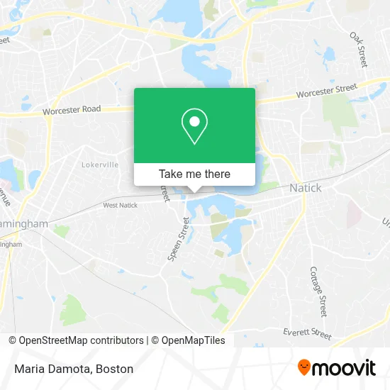
See Maria Damota, Boston, on the map
Public Transit to Maria Damota in Boston
Wondering how to get to Maria Damota in Boston? Moovit helps you find the best way to get to Maria Damota with step-by-step directions from the nearest public transit station.
Moovit provides free maps and live directions to help you navigate through your city. View schedules, routes, timetables, and find out how long does it take to get to Maria Damota in real time.
Looking for the nearest stop or station to Maria Damota? Check out this list of stops closest to your destination: Roche Bros.; Framingham; Framingham Amtrak.
Bus: 01, 10, 11.Train: FRAMINGHAM/WORCESTER, LAKE SHORE LIMITED.
Want to see if there’s another route that gets you there at an earlier time? Moovit helps you find alternative routes or times. Get directions from and directions to Maria Damota easily from the Moovit App or Website.
We make riding to Maria Damota easy, which is why over 1.7 million users, including users in Boston, trust Moovit as the best app for public transit. You don’t need to download an individual bus app or train app, Moovit is your all-in-one transit app that helps you find the best bus time or train time available.
For information on prices of bus and train, costs and ride fares to Maria Damota, please check the Moovit app.
Use the app to navigate to popular places including to the airport, hospital, stadium, grocery store, mall, coffee shop, school, college, and university.
Maria Damota Address: 127 W Central St street in Boston
- JS Dental Laberatory,
- M & Co Hair Studio and Spa,
- Minuteman Press,
- Assembleia de Deus Bethel-Natick,
- Natick You Local Roofers,
- KeyMe,
- Thrive Pet Healthcare - Natick,
- Sunshine Vision Develop,
- Adt Security Services,
- Natick Interstate Movers,
- The Whyte School of Irish Dancing,
- Brick City Masonry & Paving,
- Coinstar,
- Residential Hvac,
- BOSCH Car Service,
- The Tanning Loft,
- Versus Jiu-Jitsu Acade,
- ATM,
- Water Leak Repair Near Me,
- Ees Companies
Places Near Maria Damota (Boston)
- Isabella Stewart Gardner Museum, Boston,
- Wang Theater, Boston,
- House Of Blues, Boston,
- Cheers, Boston,
- Faneuil Hall, Boston,
- Leader Bank Pavilion (Leader Bank Pavillion), Boston,
- Td Garden, Boston,
- Castle Island, Boston,
- Massachusetts General Hospital, Boston,
- Mgm Music Hall, Boston,
- Prudential Center, Boston,
- North End, Boston,
- Museum Of Science, Boston,
- Seaport District, Boston,
- Boston Children's Hospital, Boston,
- Quincy Market, Boston,
- Boston Common, Boston,
- Boston Medical Center, Boston,
- Boston Convention & Exhibition Center, Boston,
- Wilbur Theatre, Boston
How to get to popular places in Boston with public transit
Get around Boston by public transit!
Traveling around Boston has never been so easy. See step by step directions as you travel to any attraction, street or major public transit station. View bus and train schedules, arrival times, service alerts and detailed routes on a map, so you know exactly how to get to anywhere in Boston.
When traveling to any destination around Boston use Moovit's Live Directions with Get Off Notifications to know exactly where and how far to walk, how long to wait for your line, and how many stops are left. Moovit will alert you when it's time to get off — no need to constantly re-check whether yours is the next stop.
Wondering how to use public transit in Boston or how to pay for public transit in Boston? Moovit public transit app can help you navigate your way with public transit easily, and at minimum cost. It includes public transit fees, ticket prices, and costs. Looking for a map of Boston public transit lines? Moovit public transit app shows all public transit maps in Boston with all Bus, Train, Subway and Ferry routes and stops on an interactive map.
Boston has 4 transit type(s), including: Bus, Train, Subway and Ferry, operated by several transit agencies, including MBTA, Southeastern Regional Transit Authority, MetroWest Regional Transit Authority, Rhode Island Public Transit Authority, WRTA, Lowell Regional Transit Authority, Merrimack Valley Transit, Montachusett Regional Transit Authority, Cape Cod Regional Transit Authority, Brockton Area Transit Authority, Martha's Vineyard Transit Authority, the WAVE - Nantucket Regional Transit Authority, GATRA, Cape Ann Transportation Authority and Massport