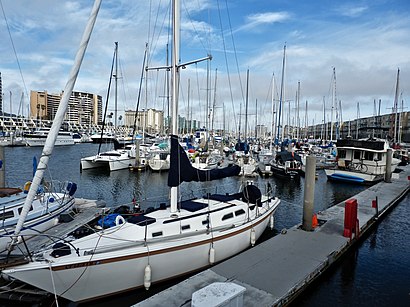
Directions to Marina del Rey (Marina Del Rey) with public transportation
The following transit lines have routes that pass near Marina del Rey
How to get to Marina del Rey by bus?
Click on the bus route to see step by step directions with maps, line arrival times and updated time schedules.
Bus stations near Marina del Rey in Marina Del Rey
- Fiji Wy/Admiralty Wy, 25 min walk,
- Fiji Way and Admiralty Way, 25 min walk,
- Lincoln SB & Fiji Ns, 29 min walk,
- Mindanao / Admiralty, 31 min walk,
- Lincoln SB & Mindanao FS, 32 min walk,
Bus lines to Marina del Rey in Marina Del Rey
- CC 7, Culver Blvd/Fisherman's Village,
- BEACH SHUTTLE, Beach Shuttle,
- 3, Downtown SM,
- 16, Playa Del Rey,
- CE437A, Westbound,
- 108, Marina Del Rey,
- R3, Aviation Sta/Lax Rapid,
What are the closest stations to Marina del Rey?
The closest stations to Marina del Rey are:
- Fiji Wy/Admiralty Wy is 2048 yards away, 25 min walk.
- Fiji Way and Admiralty Way is 2054 yards away, 25 min walk.
- Lincoln SB & Fiji Ns is 2408 yards away, 29 min walk.
- Mindanao / Admiralty is 2534 yards away, 31 min walk.
- Lincoln SB & Mindanao FS is 2631 yards away, 32 min walk.
Which bus line stops near Marina del Rey?
CC 7
What time is the first bus to Marina del Rey in Marina Del Rey?
The 108 is the first bus that goes to Marina del Rey in Marina Del Rey. It stops nearby at 4:57 AM.
What time is the last bus to Marina del Rey in Marina Del Rey?
The 3 is the last bus that goes to Marina del Rey in Marina Del Rey. It stops nearby at 11:20 PM.
See Marina del Rey, Marina Del Rey, on the map
Public Transit to Marina del Rey in Marina Del Rey
Wondering how to get to Marina del Rey in Marina Del Rey, United States? Moovit helps you find the best way to get to Marina del Rey with step-by-step directions from the nearest public transit station.
Moovit provides free maps and live directions to help you navigate through your city. View schedules, routes, timetables, and find out how long does it take to get to Marina del Rey in real time.
Looking for the nearest stop or station to Marina del Rey? Check out this list of stops closest to your destination: Fiji Wy/Admiralty Wy; Fiji Way and Admiralty Way; Lincoln SB & Fiji Ns; Mindanao / Admiralty; Lincoln SB & Mindanao FS.
Bus: CC 7, BEACH SHUTTLE, 3, 16, CE437A, 108, R3.
Want to see if there’s another route that gets you there at an earlier time? Moovit helps you find alternative routes or times. Get directions from and directions to Marina del Rey easily from the Moovit App or Website.
We make riding to Marina del Rey easy, which is why over 1.5 million users, including users in Marina Del Rey, trust Moovit as the best app for public transit. You don’t need to download an individual bus app or train app, Moovit is your all-in-one transit app that helps you find the best bus time or train time available.
For information on prices of bus, costs and ride fares to Marina del Rey, please check the Moovit app.
Use the app to navigate to popular places including to the airport, hospital, stadium, grocery store, mall, coffee shop, school, college, and university.
Marina del Rey Address: Marina del Rey street in Marina Del Rey
Attractions near Marina del Rey
Let It Go Hypnosis,Business Solution Services,Used Oil Collection Center,ATHLETA,Wolverine World Wide,Columbia,Sperry,BRIGHTON - MARINA WATERSIDE,Alyssa Rozenbaum - Highland Premiere Real Estate,Savvy Sista,Newground Pr & Marketing,Bennett Auto Glass,Kmi Inc,Miss Beauty of the Philippines,Wrapsody,Gasket Pro,Todd Soundelux Marina del Rey,Meridian Corporate Marketing Group,Higher Ground Agency,SFWHow to get to popular attractions in Marina Del Rey with public transit
Volcom Skate Park, Costa Mesa,Wilshire/Westwood Bus Stop, Westwood, La,Arroyo Valley High School, San Bernardino,Denny's, Downtown, La,St John's Pleasant Valley Hospital, Camarillo,LAX Green Line Shuttle - G Bus, Westchester, La,Amtrak Reservation Call Center, Riverside,Santa Monica And Fairfax, West Hollywood,The Vitamin Shoppe, Pasadena,Belvedere Park, East Los Angeles,Metroflex, Long Beach,Nickelodeon Studios, Hollywood, La,Clark Magnet High School, Glendale,Venice Blvd And Crenshaw Blvd., Mid-City, La,Kaiser Permanente Orange County Anaheim, Anaheim,Sideshow Collectibles, Thousand Oaks,Super King Market, Van Nuys, La,Indoor Swap Meet, Pomona,FOX Television Center, Sawtelle, La,Experian Parking Structure, Costa MesaGet around Los Angeles by public transit!
Traveling around Los Angeles has never been so easy. See step by step directions as you travel to any attraction, street or major public transit station. View bus and train schedules, arrival times, service alerts and detailed routes on a map, so you know exactly how to get to anywhere in Los Angeles.
When traveling to any destination around Los Angeles use Moovit's Live Directions with Get Off Notifications to know exactly where and how far to walk, how long to wait for your line, and how many stops are left. Moovit will alert you when it's time to get off — no need to constantly re-check whether yours is the next stop.
Wondering how to use public transit in Los Angeles or how to pay for public transit in Los Angeles? Moovit public transit app can help you navigate your way with public transit easily, and at minimum cost. It includes public transit fees, ticket prices, and costs. Looking for a map of Los Angeles public transit lines? Moovit public transit app shows all public transit maps in Los Angeles with all Bus, Train, Subway, Light Rail, Ferry and Funicular routes and stops on an interactive map.
Los Angeles has 6 transit type(s), including: Bus, Train, Subway, Light Rail, Ferry and Funicular, operated by several transit agencies, including Metro - Los Angeles, Metrolink Trains, METRO, Long Beach Transit, LADOT, OCTA, Foothill Transit, Big Blue Bus, Riverside Transit Agency, LAX FlyAway, Airporter Shuttle, Playa Vista Shuttle, Amtrak, OMNITRANS, Pasadena Transit