How to get to Marine Works Inc by bus?
Click on the bus route to see step by step directions with maps, line arrival times and updated time schedules.
From Home2 Suites-Boston South Bay (Home2 Stes by Hilton Boston S Bay), Boston
71 minFrom Franklin Park Zoo, Boston
64 minFrom Courtyard South Boston (COURTYARD by Marriott), Boston
71 minFrom South Boston, Boston
76 minFrom Home2 Suites-Boston South Bay, Boston
71 minFrom JFK Library, Boston
98 minFrom John F. Kennedy Presidential Library And Museum, Boston
98 minFrom Uphams Corner, Boston
76 minFrom Castle Island, Boston
124 minFrom Castle Island, Boston
119 min
How to get to Marine Works Inc by train?
Click on the train route to see step by step directions with maps, line arrival times and updated time schedules.
From Home2 Suites-Boston South Bay (Home2 Stes by Hilton Boston S Bay), Boston
86 minFrom Franklin Park Zoo, Boston
101 minFrom Courtyard South Boston (COURTYARD by Marriott), Boston
88 minFrom South Boston, Boston
78 minFrom Home2 Suites-Boston South Bay, Boston
86 minFrom JFK Library, Boston
87 minFrom John F. Kennedy Presidential Library And Museum, Boston
87 minFrom Uphams Corner, Boston
76 min
How to get to Marine Works Inc by subway?
Click on the subway route to see step by step directions with maps, line arrival times and updated time schedules.
From Home2 Suites-Boston South Bay (Home2 Stes by Hilton Boston S Bay), Boston
49 minFrom Franklin Park Zoo, Boston
88 minFrom Courtyard South Boston (COURTYARD by Marriott), Boston
47 minFrom South Boston, Boston
44 minFrom Home2 Suites-Boston South Bay, Boston
48 minFrom JFK Library, Boston
59 minFrom John F. Kennedy Presidential Library And Museum, Boston
59 minFrom Uphams Corner, Boston
48 min
Bus stops near Marine Works Inc in Quincy
Subway station near Marine Works Inc in Quincy
- Wollaston, 48 min walk,VIEW
Train station near Marine Works Inc in Quincy
- Weymouth Landing/East Braintree, 51 min walk,VIEW
Bus lines to Marine Works Inc in Quincy
What are the closest stations to Marine Works Inc?
The closest stations to Marine Works Inc are:
- Washington St @ Edison St is 238 yards away, 3 min walk.
- Mcgrath Hwy Opp Brackett St is 392 yards away, 5 min walk.
- Wollaston is 4047 yards away, 48 min walk.
- Weymouth Landing/East Braintree is 4319 yards away, 51 min walk.
Which bus lines stop near Marine Works Inc?
These bus lines stop near Marine Works Inc: 210, 215, 220, 222.
Which train line stops near Marine Works Inc?
GREENBUSH (#1061 | Greenbush)
Which subway line stops near Marine Works Inc?
RED LINE (Ashmont/Braintree)
What’s the nearest bus station to Marine Works Inc in Quincy?
The nearest bus station to Marine Works Inc in Quincy is Washington St @ Edison St. It’s a 3 min walk away.
What time is the first subway to Marine Works Inc in Quincy?
The RED LINE is the first subway that goes to Marine Works Inc in Quincy. It stops nearby at 5:18 AM.
What time is the last subway to Marine Works Inc in Quincy?
The RED LINE is the last subway that goes to Marine Works Inc in Quincy. It stops nearby at 1:49 AM.
What time is the first train to Marine Works Inc in Quincy?
The GREENBUSH is the first train that goes to Marine Works Inc in Quincy. It stops nearby at 5:46 AM.
What time is the last train to Marine Works Inc in Quincy?
The GREENBUSH is the last train that goes to Marine Works Inc in Quincy. It stops nearby at 12:14 AM.
What time is the first bus to Marine Works Inc in Quincy?
The 222 is the first bus that goes to Marine Works Inc in Quincy. It stops nearby at 4:57 AM.
What time is the last bus to Marine Works Inc in Quincy?
The 220 is the last bus that goes to Marine Works Inc in Quincy. It stops nearby at 1:48 AM.
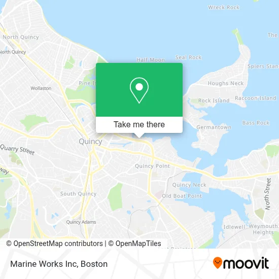
See Marine Works Inc, Quincy, on the map
Public Transit to Marine Works Inc in Quincy
Wondering how to get to Marine Works Inc in Quincy? Moovit helps you find the best way to get to Marine Works Inc with step-by-step directions from the nearest public transit station.
Moovit provides free maps and live directions to help you navigate through your city. View schedules, routes, timetables, and find out how long does it take to get to Marine Works Inc in real time.
Looking for the nearest stop or station to Marine Works Inc? Check out this list of stops closest to your destination: Washington St @ Edison St; Mcgrath Hwy Opp Brackett St; Wollaston; Weymouth Landing/East Braintree.
Bus: 210, 215, 220, 222, 216.Train: GREENBUSH.Subway: RED LINE.
Want to see if there’s another route that gets you there at an earlier time? Moovit helps you find alternative routes or times. Get directions from and directions to Marine Works Inc easily from the Moovit App or Website.
We make riding to Marine Works Inc easy, which is why over 1.7 million users, including users in Quincy, trust Moovit as the best app for public transit. You don’t need to download an individual bus app or train app, Moovit is your all-in-one transit app that helps you find the best bus time or train time available.
For information on prices of bus, subway and train, costs and ride fares to Marine Works Inc, please check the Moovit app.
Use the app to navigate to popular places including to the airport, hospital, stadium, grocery store, mall, coffee shop, school, college, and university.
Marine Works Inc Address: 666 Southern Artery street in Quincy
- The Goodwill Store (Quincy),
- Brazilian Assembly of God in Quincy,
- Popeyes Louisiana Kitchen,
- City of Quincy,
- Credit Union 1,
- Nour al Sham Market,
- Father Bill's Place (Father Bill's Shelter Clinic),
- Fix It Phil,
- Tacos & Pupusas,
- The Craic Irish Pub,
- MBTA Transit Police Academy,
- So Weymouth Community Church of the Nazarene Call,
- AM PM Locksmith Co,
- Coverall Ins,
- Waldron Contracting Services,
- Hancock Renovation South Shore,
- Arc Design Cabinetry,
- Quincy Dentists,
- DUNKIN',
- JCBT Architect
Places Near Marine Works Inc (Quincy)
- Quincy Market, Boston,
- Td Garden, Boston,
- Castle Island, Boston,
- Wilbur Theatre, Boston,
- Boston Children's Hospital, Boston,
- Isabella Stewart Gardner Museum, Boston,
- Wang Theater, Boston,
- North End, Boston,
- Boston Convention & Exhibition Center, Boston,
- Prudential Center, Boston,
- Boston Medical Center, Boston,
- Faneuil Hall, Boston,
- Boston Common, Boston,
- Seaport District, Boston,
- Massachusetts General Hospital, Boston,
- Leader Bank Pavilion (Leader Bank Pavillion), Boston,
- House Of Blues, Boston,
- Mgm Music Hall, Boston,
- Cheers, Boston,
- Museum Of Science, Boston
How to get to popular places in Boston with public transit
Get around Quincy by public transit!
Traveling around Quincy has never been so easy. See step by step directions as you travel to any attraction, street or major public transit station. View bus and train schedules, arrival times, service alerts and detailed routes on a map, so you know exactly how to get to anywhere in Quincy.
When traveling to any destination around Quincy use Moovit's Live Directions with Get Off Notifications to know exactly where and how far to walk, how long to wait for your line, and how many stops are left. Moovit will alert you when it's time to get off — no need to constantly re-check whether yours is the next stop.
Wondering how to use public transit in Quincy or how to pay for public transit in Quincy? Moovit public transit app can help you navigate your way with public transit easily, and at minimum cost. It includes public transit fees, ticket prices, and costs. Looking for a map of Quincy public transit lines? Moovit public transit app shows all public transit maps in Quincy with all Bus, Train, Subway and Ferry routes and stops on an interactive map.
Boston has 4 transit type(s), including: Bus, Train, Subway and Ferry, operated by several transit agencies, including MBTA, Southeastern Regional Transit Authority, MetroWest Regional Transit Authority, Rhode Island Public Transit Authority, WRTA, Lowell Regional Transit Authority, Merrimack Valley Transit, Montachusett Regional Transit Authority, Cape Cod Regional Transit Authority, Brockton Area Transit Authority, Martha's Vineyard Transit Authority, the WAVE - Nantucket Regional Transit Authority, GATRA, Cape Ann Transportation Authority and Massport