How to get to Mark Garbino by bus?
Click on the bus route to see step by step directions with maps, line arrival times and updated time schedules.
From Vertex Pharmaceuticals, Inc., Boston
56 minFrom Chestnut Hill, Boston
78 minFrom House Of Blues, Boston
59 minFrom Warren Tavern, Boston
58 minFrom Fenway Park (Fenway Park, Home of the Boston Red Sox), Boston
69 minFrom Fenway Park, Boston
62 minFrom Costco, Everett
85 minFrom Fenway Park-Gate C Entrance, Boston
59 minFrom Inman Sq, Cambridge
44 minFrom Watertown Mall, Watertown Town
55 min
How to get to Mark Garbino by train?
Click on the train route to see step by step directions with maps, line arrival times and updated time schedules.
How to get to Mark Garbino by subway?
Click on the subway route to see step by step directions with maps, line arrival times and updated time schedules.
From Chestnut Hill, Boston
130 minFrom House Of Blues, Boston
100 minFrom Warren Tavern, Boston
93 minFrom Fenway Park (Fenway Park, Home of the Boston Red Sox), Boston
100 minFrom Fenway Park, Boston
99 minFrom Costco, Everett
105 minFrom Fenway Park-Gate C Entrance, Boston
99 minFrom Inman Sq, Cambridge
80 min
Bus stops near Mark Garbino in Arlington
Subway station near Mark Garbino in Arlington
- Alewife, 14 min walk,VIEW
Train stations near Mark Garbino in Arlington
What are the closest stations to Mark Garbino?
The closest stations to Mark Garbino are:
- Massachusetts Ave @ Brattle St is 235 yards away, 3 min walk.
- Summer St @ Washington St is 293 yards away, 4 min walk.
- Alewife is 1137 yards away, 14 min walk.
- Waverley is 1504 yards away, 18 min walk.
- West Medford is 3130 yards away, 37 min walk.
Which bus line stops near Mark Garbino?
77 (Arlington Heights)
Which train line stops near Mark Garbino?
FITCHBURG (#409 | Wachusett)
Which subway line stops near Mark Garbino?
RED LINE (Alewife)
What’s the nearest subway station to Mark Garbino in Arlington?
The nearest subway station to Mark Garbino in Arlington is Alewife. It’s a 14 min walk away.
What’s the nearest train station to Mark Garbino in Arlington?
The nearest train station to Mark Garbino in Arlington is Waverley. It’s a 18 min walk away.
What’s the nearest bus station to Mark Garbino in Arlington?
The nearest bus station to Mark Garbino in Arlington is Massachusetts Ave @ Brattle St. It’s a 3 min walk away.
What time is the first subway to Mark Garbino in Arlington?
The RED LINE is the first subway that goes to Mark Garbino in Arlington. It stops nearby at 5:15 AM.
What time is the last subway to Mark Garbino in Arlington?
The RED LINE is the last subway that goes to Mark Garbino in Arlington. It stops nearby at 2:06 AM.
What time is the first train to Mark Garbino in Arlington?
The LOWELL is the first train that goes to Mark Garbino in Arlington. It stops nearby at 5:29 AM.
What time is the last train to Mark Garbino in Arlington?
The LOWELL is the last train that goes to Mark Garbino in Arlington. It stops nearby at 12:20 AM.
What time is the first bus to Mark Garbino in Arlington?
The 77 is the first bus that goes to Mark Garbino in Arlington. It stops nearby at 4:51 AM.
What time is the last bus to Mark Garbino in Arlington?
The 77 is the last bus that goes to Mark Garbino in Arlington. It stops nearby at 1:25 AM.
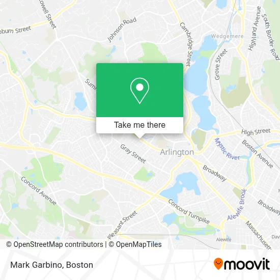
See Mark Garbino, Arlington, on the map
Public Transit to Mark Garbino in Arlington
Wondering how to get to Mark Garbino in Arlington? Moovit helps you find the best way to get to Mark Garbino with step-by-step directions from the nearest public transit station.
Moovit provides free maps and live directions to help you navigate through your city. View schedules, routes, timetables, and find out how long does it take to get to Mark Garbino in real time.
Looking for the nearest stop or station to Mark Garbino? Check out this list of stops closest to your destination: Massachusetts Ave @ Brattle St; Summer St @ Washington St; Alewife; Waverley; West Medford.
Bus: 77, 67.Train: FITCHBURG, LOWELL.Subway: RED LINE.
Want to see if there’s another route that gets you there at an earlier time? Moovit helps you find alternative routes or times. Get directions from and directions to Mark Garbino easily from the Moovit App or Website.
We make riding to Mark Garbino easy, which is why over 1.7 million users, including users in Arlington, trust Moovit as the best app for public transit. You don’t need to download an individual bus app or train app, Moovit is your all-in-one transit app that helps you find the best bus time or train time available.
For information on prices of bus, subway and train, costs and ride fares to Mark Garbino, please check the Moovit app.
Use the app to navigate to popular places including to the airport, hospital, stadium, grocery store, mall, coffee shop, school, college, and university.
Mark Garbino Address: 1010 Massachusetts Ave street in Arlington
- Mike Pallotta, Realtor,
- Artilles Locksmith,
- Robin's Nest Pet Salon (Robins Nest Pet Salon),
- Philips Electric,
- Nesf Boston,
- Mass BJJ,
- Top Notch Collision,
- Brattle,
- Astound Broadband Powered by RCN,
- Independent Dentists of Massachusetts,
- Enterprise Rent-A-Car,
- Real Motors,
- Brown & Associates,
- Provo Financial Services,
- Tech Electric,
- DWM,
- Appleseed Carpentry,
- Lexington Energy Partners,
- Arlington House,
- Locksmith Express
Places Near Mark Garbino (Arlington)
- North End, Boston,
- Boston Children's Hospital, Boston,
- Cheers, Boston,
- Leader Bank Pavilion (Leader Bank Pavillion), Boston,
- Wang Theater, Boston,
- Prudential Center, Boston,
- Wilbur Theatre, Boston,
- Td Garden, Boston,
- House Of Blues, Boston,
- Boston Medical Center, Boston,
- Boston Convention & Exhibition Center, Boston,
- Mgm Music Hall, Boston,
- Faneuil Hall, Boston,
- Massachusetts General Hospital, Boston,
- Seaport District, Boston,
- Quincy Market, Boston,
- Museum Of Science, Boston,
- Castle Island, Boston,
- Boston Common, Boston,
- Isabella Stewart Gardner Museum, Boston
How to get to popular places in Boston with public transit
Get around Arlington by public transit!
Traveling around Arlington has never been so easy. See step by step directions as you travel to any attraction, street or major public transit station. View bus and train schedules, arrival times, service alerts and detailed routes on a map, so you know exactly how to get to anywhere in Arlington.
When traveling to any destination around Arlington use Moovit's Live Directions with Get Off Notifications to know exactly where and how far to walk, how long to wait for your line, and how many stops are left. Moovit will alert you when it's time to get off — no need to constantly re-check whether yours is the next stop.
Wondering how to use public transit in Arlington or how to pay for public transit in Arlington? Moovit public transit app can help you navigate your way with public transit easily, and at minimum cost. It includes public transit fees, ticket prices, and costs. Looking for a map of Arlington public transit lines? Moovit public transit app shows all public transit maps in Arlington with all Bus, Train, Subway and Ferry routes and stops on an interactive map.
Boston has 4 transit type(s), including: Bus, Train, Subway and Ferry, operated by several transit agencies, including MBTA, Southeastern Regional Transit Authority, MetroWest Regional Transit Authority, Rhode Island Public Transit Authority, WRTA, Lowell Regional Transit Authority, Merrimack Valley Transit, Montachusett Regional Transit Authority, Cape Cod Regional Transit Authority, Brockton Area Transit Authority, Martha's Vineyard Transit Authority, the WAVE - Nantucket Regional Transit Authority, GATRA, Cape Ann Transportation Authority and Massport