Directions to Mark's Stadium (Boston) with public transportation
The following transit lines have routes that pass near Mark's Stadium
 Bus: 101.
How to get to Mark's Stadium by bus?
Click on the bus route to see step by step directions with maps, line arrival times and updated time schedules.
Bus stop near Mark's Stadium in Boston
- Shove St And Broad St, 4 min walk,VIEW
Bus lines to Mark's Stadium in Boston
- 101, Terminal,VIEW
What are the closest stations to Mark's Stadium?
The closest stations to Mark's Stadium are:
- Shove St And Broad St is 318 yards away, 4 min walk.
Which bus line stops near Mark's Stadium?
101 (South Main St)
What’s the nearest bus station to Mark's Stadium in Boston?
The nearest bus station to Mark's Stadium in Boston is Shove St And Broad St. It’s a 4 min walk away.
What time is the first bus to Mark's Stadium in Boston?
The 101 is the first bus that goes to Mark's Stadium in Boston. It stops nearby at 6:00 AM.
What time is the last bus to Mark's Stadium in Boston?
The 101 is the last bus that goes to Mark's Stadium in Boston. It stops nearby at 8:55 PM.
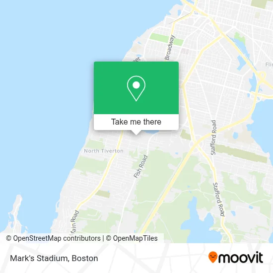
See Mark's Stadium, Boston, on the map
Public Transit to Mark's Stadium in Boston
Wondering how to get to Mark's Stadium in Boston? Moovit helps you find the best way to get to Mark's Stadium with step-by-step directions from the nearest public transit station.
Moovit provides free maps and live directions to help you navigate through your city. View schedules, routes, timetables, and find out how long does it take to get to Mark's Stadium in real time.
Looking for the nearest stop or station to Mark's Stadium? Check out this list of stops closest to your destination: Shove St And Broad St.
Bus: 101.
Want to see if there’s another route that gets you there at an earlier time? Moovit helps you find alternative routes or times. Get directions from and directions to Mark's Stadium easily from the Moovit App or Website.
We make riding to Mark's Stadium easy, which is why over 1.7 million users, including users in Boston, trust Moovit as the best app for public transit. You don’t need to download an individual bus app or train app, Moovit is your all-in-one transit app that helps you find the best bus time or train time available.
For information on prices of bus, costs and ride fares to Mark's Stadium, please check the Moovit app.
Use the app to navigate to popular places including to the airport, hospital, stadium, grocery store, mall, coffee shop, school, college, and university.
Location: Boston
- McGovern's Family Restaurant (MC Govern's Restaurant),
- Nailsbyshannon,
- China Sea,
- Beyond Menu,
- Melissa's New To You! A Thrift Shoppe,
- Atlantis Charter School,
- Sundance Woodworking,
- Hayden Property Management,
- Supreme Marketing,
- Amazon Counter-Ams Food Mart,
- Ams Food Mart,
- Liquorwicks,
- Martin's Auto Sales,
- Color-Tones Auto Body,
- Bayview Club,
- Charlton Mill,
- Baptista Doreen,
- Ryan Rebello, Realtor Re / Max Vantage,
- Storm's Cleaning,
- Ringhello
Places Near Mark's Stadium (Boston)
- Isabella Stewart Gardner Museum, Boston,
- Cheers, Boston,
- Seaport District, Boston,
- House Of Blues, Boston,
- Boston Common, Boston,
- Wilbur Theatre, Boston,
- Leader Bank Pavilion (Leader Bank Pavillion), Boston,
- Faneuil Hall, Boston,
- Boston Medical Center, Boston,
- Quincy Market, Boston,
- Boston Children's Hospital, Boston,
- Massachusetts General Hospital, Boston,
- North End, Boston,
- Boston Convention & Exhibition Center, Boston,
- Museum Of Science, Boston,
- Mgm Music Hall, Boston,
- Wang Theater, Boston,
- Castle Island, Boston,
- Prudential Center, Boston,
- Td Garden, Boston
How to get to popular places in Boston with public transit
Get around Boston by public transit!
Traveling around Boston has never been so easy. See step by step directions as you travel to any attraction, street or major public transit station. View bus and train schedules, arrival times, service alerts and detailed routes on a map, so you know exactly how to get to anywhere in Boston.
When traveling to any destination around Boston use Moovit's Live Directions with Get Off Notifications to know exactly where and how far to walk, how long to wait for your line, and how many stops are left. Moovit will alert you when it's time to get off — no need to constantly re-check whether yours is the next stop.
Wondering how to use public transit in Boston or how to pay for public transit in Boston? Moovit public transit app can help you navigate your way with public transit easily, and at minimum cost. It includes public transit fees, ticket prices, and costs. Looking for a map of Boston public transit lines? Moovit public transit app shows all public transit maps in Boston with all Bus, Train, Subway and Ferry routes and stops on an interactive map.
Boston has 4 transit type(s), including: Bus, Train, Subway and Ferry, operated by several transit agencies, including MBTA, Southeastern Regional Transit Authority, MetroWest Regional Transit Authority, Rhode Island Public Transit Authority, WRTA, Lowell Regional Transit Authority, Merrimack Valley Transit, Montachusett Regional Transit Authority, Cape Cod Regional Transit Authority, Brockton Area Transit Authority, Martha's Vineyard Transit Authority, the WAVE - Nantucket Regional Transit Authority, GATRA, Cape Ann Transportation Authority and Massport