Directions to Mark's Tech Solution (Weymouth Town) with public transportation
The following transit lines have routes that pass near Mark's Tech Solution
 Bus: 220, 222.
- Train: GREENBUSH.
- Ferry: BUMPKIN ISLAND FERRY, GEORGES ISLAND FERRY, HEWITT'S COVE FERRY, PEDDOCKS ISLAND FERRY, HINGHAM FERRY.
How to get to Mark's Tech Solution by bus?
Click on the bus route to see step by step directions with maps, line arrival times and updated time schedules.
From Best Western Adams Inn Quincy - Boston, Quincy
58 minFrom Marina Bay, Quincy
94 minFrom Wollaston Beach, Quincy
90 minFrom Encompass Health Rehabilitation Hospital of Braintree, Braintree Town
73 minFrom Marina Bay, Quincy
75 minFrom Boston Scientific, Quincy
76 minFrom Braintree, MA, Braintree Town
60 minFrom Quincy Market, Quincy
30 min
How to get to Mark's Tech Solution by train?
Click on the train route to see step by step directions with maps, line arrival times and updated time schedules.
Train station near Mark's Tech Solution in Weymouth Town
- West Hingham, 10 min walk,VIEW
Bus stop near Mark's Tech Solution in Weymouth Town
- North St @ Green St, 11 min walk,VIEW
Ferry stations near Mark's Tech Solution in Weymouth Town
Bus lines to Mark's Tech Solution in Weymouth Town
- 222, East Weymouth,VIEW
What are the closest stations to Mark's Tech Solution?
The closest stations to Mark's Tech Solution are:
- West Hingham is 819 yards away, 10 min walk.
- North St @ Green St is 891 yards away, 11 min walk.
- Hewitt's Cove is 3170 yards away, 38 min walk.
- Hingham is 3182 yards away, 38 min walk.
Which bus lines stop near Mark's Tech Solution?
These bus lines stop near Mark's Tech Solution: 220, 222.
Which train line stops near Mark's Tech Solution?
GREENBUSH (#1061 | Greenbush)
What’s the nearest train station to Mark's Tech Solution in Weymouth Town?
The nearest train station to Mark's Tech Solution in Weymouth Town is West Hingham. It’s a 10 min walk away.
What’s the nearest bus station to Mark's Tech Solution in Weymouth Town?
The nearest bus station to Mark's Tech Solution in Weymouth Town is North St @ Green St. It’s a 11 min walk away.
What time is the first train to Mark's Tech Solution in Weymouth Town?
The GREENBUSH is the first train that goes to Mark's Tech Solution in Weymouth Town. It stops nearby at 5:37 AM.
What time is the last train to Mark's Tech Solution in Weymouth Town?
The GREENBUSH is the last train that goes to Mark's Tech Solution in Weymouth Town. It stops nearby at 12:22 AM.
What time is the first bus to Mark's Tech Solution in Weymouth Town?
The 222 is the first bus that goes to Mark's Tech Solution in Weymouth Town. It stops nearby at 5:07 AM.
What time is the last bus to Mark's Tech Solution in Weymouth Town?
The 222 is the last bus that goes to Mark's Tech Solution in Weymouth Town. It stops nearby at 1:20 AM.
What time is the first ferry to Mark's Tech Solution in Weymouth Town?
The HINGHAM/HULL FERRY is the first ferry that goes to Mark's Tech Solution in Weymouth Town. It stops nearby at 5:40 AM.
What time is the last ferry to Mark's Tech Solution in Weymouth Town?
The HINGHAM/HULL FERRY is the last ferry that goes to Mark's Tech Solution in Weymouth Town. It stops nearby at 10:50 PM.
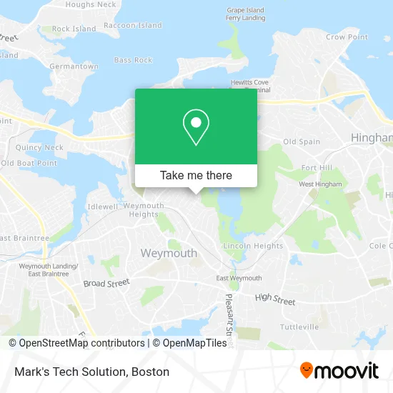
See Mark's Tech Solution, Weymouth Town, on the map
Public Transit to Mark's Tech Solution in Weymouth Town
Wondering how to get to Mark's Tech Solution in Weymouth Town? Moovit helps you find the best way to get to Mark's Tech Solution with step-by-step directions from the nearest public transit station.
Moovit provides free maps and live directions to help you navigate through your city. View schedules, routes, timetables, and find out how long does it take to get to Mark's Tech Solution in real time.
Looking for the nearest stop or station to Mark's Tech Solution? Check out this list of stops closest to your destination: West Hingham; North St @ Green St; Hewitt's Cove; Hingham.
Bus: 220, 222.Train: GREENBUSH.Ferry: BUMPKIN ISLAND FERRY, GEORGES ISLAND FERRY, HEWITT'S COVE FERRY, PEDDOCKS ISLAND FERRY, HINGHAM FERRY, HINGHAM/HULL FERRY.
Want to see if there’s another route that gets you there at an earlier time? Moovit helps you find alternative routes or times. Get directions from and directions to Mark's Tech Solution easily from the Moovit App or Website.
We make riding to Mark's Tech Solution easy, which is why over 1.7 million users, including users in Weymouth Town, trust Moovit as the best app for public transit. You don’t need to download an individual bus app or train app, Moovit is your all-in-one transit app that helps you find the best bus time or train time available.
For information on prices of bus, subway and train, costs and ride fares to Mark's Tech Solution, please check the Moovit app.
Use the app to navigate to popular places including to the airport, hospital, stadium, grocery store, mall, coffee shop, school, college, and university.
Mark's Tech Solution Address: 16 Dale Rd street in Weymouth Town
- Julia Road Park,
- Lou’S Farmstand,
- G W Construction,
- National Tow List,
- Warren Automotive,
- Details by Murphy,
- South Shore Tint And Paint Protection,
- Dicarlo Upholstery Corporation,
- Dresco Belting,
- Aaron Construction,
- Wonderly Lights of South Shore Ma,
- Greenwood Construction & Restoration LLC,
- Mosquito Joe Of Braintree-Weymouth,
- Total Construction Solutions,
- Jason J Plumbing & Heating,
- Weymouth Elder Services,
- Osprey Point Esker Park,
- Weymouth Shop for Locksmith,
- The Emery Estate,
- Emery Estate
Places Near Mark's Tech Solution (Weymouth Town)
- Seaport District, Boston,
- Cheers, Boston,
- Castle Island, Boston,
- Leader Bank Pavilion (Leader Bank Pavillion), Boston,
- Boston Convention & Exhibition Center, Boston,
- Boston Common, Boston,
- House Of Blues, Boston,
- Td Garden, Boston,
- Faneuil Hall, Boston,
- Mgm Music Hall, Boston,
- North End, Boston,
- Quincy Market, Boston,
- Isabella Stewart Gardner Museum, Boston,
- Boston Children's Hospital, Boston,
- Massachusetts General Hospital, Boston,
- Wang Theater, Boston,
- Boston Medical Center, Boston,
- Wilbur Theatre, Boston,
- Museum Of Science, Boston,
- Prudential Center, Boston
How to get to popular places in Boston with public transit
Get around Weymouth Town by public transit!
Traveling around Weymouth Town has never been so easy. See step by step directions as you travel to any attraction, street or major public transit station. View bus and train schedules, arrival times, service alerts and detailed routes on a map, so you know exactly how to get to anywhere in Weymouth Town.
When traveling to any destination around Weymouth Town use Moovit's Live Directions with Get Off Notifications to know exactly where and how far to walk, how long to wait for your line, and how many stops are left. Moovit will alert you when it's time to get off — no need to constantly re-check whether yours is the next stop.
Wondering how to use public transit in Weymouth Town or how to pay for public transit in Weymouth Town? Moovit public transit app can help you navigate your way with public transit easily, and at minimum cost. It includes public transit fees, ticket prices, and costs. Looking for a map of Weymouth Town public transit lines? Moovit public transit app shows all public transit maps in Weymouth Town with all Bus, Train, Subway and Ferry routes and stops on an interactive map.
Boston has 4 transit type(s), including: Bus, Train, Subway and Ferry, operated by several transit agencies, including MBTA, Southeastern Regional Transit Authority, MetroWest Regional Transit Authority, Rhode Island Public Transit Authority, WRTA, Lowell Regional Transit Authority, Merrimack Valley Transit, Montachusett Regional Transit Authority, Cape Cod Regional Transit Authority, Brockton Area Transit Authority, Martha's Vineyard Transit Authority, the WAVE - Nantucket Regional Transit Authority, GATRA, Cape Ann Transportation Authority and Massport