How to get to Marrakech Beach by bus?
Click on the bus route to see step by step directions with maps, line arrival times and updated time schedules.
From Bakırköy Yht, Bakirköy
47 minFrom Besiktas - Beykoz Sahil Vapuru, Ortaköy, Beşiktaş
90 minFrom SULTANGAZİ, Sultangazi
62 minFrom Ataköy Marina, Bakirköy
67 minFrom Taksim, Sultangazi
62 minFrom Kadıköy İskele, Kadıköy
138 minFrom Yahya Efendi Türbesi, Beşiktaş
85 minFrom Armoni park, Küçükçekmece
83 minFrom Yeşilköy Prof. Dr. Murat Dilmener Acil Durum Hastanesi, Bakirköy
85 min
How to get to Marrakech Beach by train?
Click on the train route to see step by step directions with maps, line arrival times and updated time schedules.
How to get to Marrakech Beach by metro?
Click on the metro route to see step by step directions with maps, line arrival times and updated time schedules.
Dolmus & Minibus station near Marrakech Beach in Zeytinburnu
- İett Blokları Yolu, 2 min walk,VIEW
Bus stops near Marrakech Beach in Zeytinburnu
- Cevizlibağ Sokak - Güngören Yönü, 3 min walk,VIEW
- Cevizlibağ Sokak - Topkapı Yönü, 5 min walk,VIEW
- Cevizlibağ - Şirinevler Yönü, 10 min walk,VIEW
- Topkapı Panorama 1453 - Topkapı Yönü, 11 min walk,VIEW
- Mevlanakapı - Topkapı Yönü, 13 min walk,VIEW
- Topkapı Zeytinburnu - Zeytinburnu Yönü, 14 min walk,VIEW
- Cevizlibağ - Topkapı Yönü, 17 min walk,VIEW
Bus lines to Marrakech Beach in Zeytinburnu
- 33B, Üçyüzlü Metro-Giyimkent,VIEW
- 92B, Aksaray Ring-Yeni Mahalle Metro,VIEW
- 92C, Haznedar - Eminönü / Ring,VIEW
- A27, Yıldıztabya,VIEW
- A27, Pazariçi,VIEW
- 41AT, Cevizlibağ-Yıldız Teknik Üniversitesi Davutpaşa Kampüsü,VIEW
- MR11, Topkapı-Kazlıçeşme Marmaray,VIEW
- 31, Kuyumcukent - Yenikapı / Ring,VIEW
- 31E, Kuyumcukent-Kuyumcukent Çarşı,VIEW
- 50B, Alibeyköy Metro-Zuhuratbaba,VIEW
- 71T, Ataköy 9.-10.Kısım-Medeni Berk İlkokulu,VIEW
- 72T, Yeşilköy-Ziya Erdem,VIEW
- 73, Yenibosna Metro-Harbiye Askeri Müze,VIEW
- 73F, Florya - Taksim / Ring,VIEW
- 76D, Bahçeşehir-Gümüşsuyu Peron,VIEW
- 82, Kuyumcukent-Eminönü,VIEW
- 89, Aksaray Peron-Kanuni Sultan Süleyman,VIEW
- 89B, Aksaray Peron-Küçükçekmece Anadolu Lisesi,VIEW
- 89K, Aksaray Peron-Kanuni Sultan Süleyman,VIEW
- 92, Eminönü-Yeni Mahalle Metro,VIEW
What are the closest stations to Marrakech Beach?
The closest stations to Marrakech Beach are:
- İett Blokları Yolu is 96 meters away, 2 min walk.
- Cevizlibağ Sokak - Güngören Yönü is 174 meters away, 3 min walk.
- Cevizlibağ Sokak - Topkapı Yönü is 316 meters away, 5 min walk.
- Cevizlibağ - Şirinevler Yönü is 718 meters away, 10 min walk.
- Topkapı Panorama 1453 - Topkapı Yönü is 842 meters away, 11 min walk.
- Mevlanakapı - Topkapı Yönü is 971 meters away, 13 min walk.
- Topkapı Zeytinburnu - Zeytinburnu Yönü is 1085 meters away, 14 min walk.
- Cevizlibağ - Topkapı Yönü is 1277 meters away, 17 min walk.
Which bus lines stop near Marrakech Beach?
These bus lines stop near Marrakech Beach: 41AT, 72T, 76D, 89K, 97A, 97T, MR11.
Which train lines stop near Marrakech Beach?
These train lines stop near Marrakech Beach: B1, U3.
Which metro line stops near Marrakech Beach?
M1A (Atatürk Havalimanı→Yenikapı)
Which tram line stops near Marrakech Beach?
T1 (Kabataş→Bağcılar)
Which Metrobus line stops near Marrakech Beach?
34BZ (Beylikdüzü > Zincirlikuyu)
Which Dolmus & Minibus line stops near Marrakech Beach?
A10 (Cevizlibağ)
What’s the nearest bus station to Marrakech Beach in Zeytinburnu?
The nearest bus station to Marrakech Beach in Zeytinburnu is Cevizlibağ Sokak - Güngören Yönü. It’s a 3 min walk away.
What’s the nearest Dolmus & Minibus station to Marrakech Beach in Zeytinburnu?
The nearest Dolmus & Minibus station to Marrakech Beach in Zeytinburnu is İett Blokları Yolu. It’s a 2 min walk away.
What time is the first bus to Marrakech Beach in Zeytinburnu?
The 500L is the first bus that goes to Marrakech Beach in Zeytinburnu. It stops nearby at 5:08 AM.
What time is the last bus to Marrakech Beach in Zeytinburnu?
The 500L is the last bus that goes to Marrakech Beach in Zeytinburnu. It stops nearby at 1:15 AM.
What time is the first Dolmus & Minibus to Marrakech Beach in Zeytinburnu?
The TAKSIM - TOPKAPI - CEVIZLIBAĞ is the first Dolmus & Minibus that goes to Marrakech Beach in Zeytinburnu. It stops nearby at 3:00 AM.
What time is the last Dolmus & Minibus to Marrakech Beach in Zeytinburnu?
The TAKSIM - ŞIRINEVLER - YENIBOSNA is the last Dolmus & Minibus that goes to Marrakech Beach in Zeytinburnu. It stops nearby at 3:05 AM.
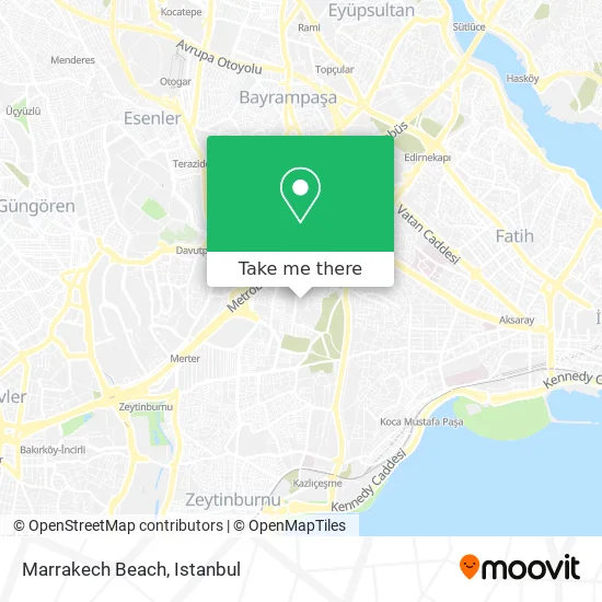
See Marrakech Beach, Zeytinburnu, on the map
Public Transit to Marrakech Beach in Zeytinburnu
Wondering how to get to Marrakech Beach in Zeytinburnu? Moovit helps you find the best way to get to Marrakech Beach with step-by-step directions from the nearest public transit station.
Moovit provides free maps and live directions to help you navigate through your city. View schedules, routes, timetables, and find out how long does it take to get to Marrakech Beach in real time.
Looking for the nearest stop or station to Marrakech Beach? Check out this list of stops closest to your destination: İett Blokları Yolu; Cevizlibağ Sokak - Güngören Yönü; Cevizlibağ Sokak - Topkapı Yönü; Cevizlibağ - Şirinevler Yönü; Topkapı Panorama 1453 - Topkapı Yönü; Mevlanakapı - Topkapı Yönü; Topkapı Zeytinburnu - Zeytinburnu Yönü; Cevizlibağ - Topkapı Yönü.
Bus: 41AT, 72T, 76D, 89K, 97A, 97T, MR11, 33B, 92B, 92C, A27, A27, 31, 31E, 50B, 71T, A10, B46, A48, 85C, 50K, 93, 93M, 93T.Train: B1, U3.Metro: M1A.Tram: T1.Metrobus: 34BZ.Dolmus & Minibus: A10.
Want to see if there’s another route that gets you there at an earlier time? Moovit helps you find alternative routes or times. Get directions from and directions to Marrakech Beach easily from the Moovit App or Website.
We make riding to Marrakech Beach easy, which is why over 1.5 million users, including users in Zeytinburnu, trust Moovit as the best app for public transit. You don’t need to download an individual bus app or train app, Moovit is your all-in-one transit app that helps you find the best bus time or train time available.
For information on prices of bus, metro, Dolmus & Minibus, train, tram and Metrobus, costs and ride fares to Marrakech Beach, please check the Moovit app.
Use the app to navigate to popular places including to the airport, hospital, stadium, grocery store, mall, coffee shop, school, college, and university.
Location: Zeytinburnu, Istanbul
- İett Blokları,
- Zeytinburnu Kız Anadolu Imam Hatip Lisesi,
- Gaziosmanpaşa - Aksaray Minibüs Durakları,
- İETT Site Yolu Sokak / G 62. Sokak,
- Bogaziçi Elektrik Kaçak Takip Merkezi,
- CLK Boğaziçi Elektrik Dağıtım Müdürlüğü Kayıp Kaçak Müdürlüğü,
- Bedaş Cevizlibağ Kaçak Takip Müdürlüğü,
- Merkezefendi Mah.,
- Damla Spor Merkezefendi Tesisleri,
- Sabri Ülker Sokak,
- Atatürk Ögrenci Yurdu Spor Salonu,
- Şeyhülislam İbn-i Kemal Camii,
- Şeyhülislam İbn-i Kemal Camii (Seyhül Islam Ibni Kemal Cami),
- Sarmasik Bufe,
- Zeytinburnu İstanbul Ticaret Odası Mesleki ve Teknik Anadolu Lisesi,
- AÖY-Yemekhane,
- Merkezefendi Taziye Evi,
- Zeytinburnu Spor Klübü Tesisleri İç Yolu,
- Merkezefendi Mahallesi,
- Zeytinburnu Taziye Evi
Places Near Marrakech Beach (Zeytinburnu)
- Topkule Kışlası 47.Komando Tugay Komutanlığı, Esenler,
- 2 Nolu Minibüss, Beylikduzu,
- Beylikdüzü - 4 Nolu Minibüs Hattı, Beylikduzu,
- İstanbul,
- Hilltown AVM, Maltepe,
- 41 Burda AVM, Kocaeli Merkezi,
- Başakşehir Çam Ve Sakura Şehir Hastanesi, Basaksehir,
- Şehit Prof. Dr. İlhan Varank Eğitim Ve Araştırma Hastanesi, Sancaktepe,
- METROPOL IsTaNBuL, Ataşehir,
- Karaköy Genelevi, Karaköy, Beyoğlu,
- Mehmet Emin Tokadî Hz. Türbesi, Fatih,
- Gebze-Harem Minibüs Hattı, Gebze,
- Bakırköy Sosyete Pazarı, Bakirköy,
- Hz. Yuşa Tepesi, Beykoz,
- 212 AVM, Bagcilar,
- Mall Of İstanbul, Basaksehir,
- VİALAND AVM, Eyüp,
- Tersane İstanbul, Beyoğlu,
- İstinye Park, Sariyer,
- Gebze Koop Durağı, Gebze
How to get to popular places in Istanbul with public transit
Get around Zeytinburnu by public transit!
Traveling around Zeytinburnu has never been so easy. See step by step directions as you travel to any attraction, street or major public transit station. View bus and train schedules, arrival times, service alerts and detailed routes on a map, so you know exactly how to get to anywhere in Zeytinburnu.
When traveling to any destination around Zeytinburnu use Moovit's Live Directions with Get Off Notifications to know exactly where and how far to walk, how long to wait for your line, and how many stops are left. Moovit will alert you when it's time to get off — no need to constantly re-check whether yours is the next stop.
Wondering how to use public transit in Zeytinburnu or how to pay for public transit in Zeytinburnu? Moovit public transit app can help you navigate your way with public transit easily, and at minimum cost. It includes public transit fees, ticket prices, and costs. Looking for a map of Zeytinburnu public transit lines? Moovit public transit app shows all public transit maps in Zeytinburnu with all Bus, Train, Metro, Tram, Ferry, Metrobus and Dolmus & Minibus routes and stops on an interactive map.
Istanbul has 7 transit type(s), including: Bus, Train, Metro, Tram, Ferry, Metrobus and Dolmus & Minibus, operated by several transit agencies, including Marmaray, Metro İstanbul, Metrobüs, UAB, İETT, İETT ÇIFT KATLI HATLAR, İETT BÖLGESEL HATLAR, TCDD, Şehir Hatları, Dentur Avrasya, Beyden, Turyol, Mavi Marmara, Havaist and Prenstur
