See Marshall Road, Lansdowne, on the map
Directions to Marshall Road (Lansdowne) with public transportation
The following transit lines have routes that pass near Marshall Road
 Bus:
Bus: - Train:
- Subway:
How to get to Marshall Road by bus?
Click on the bus route to see step by step directions with maps, line arrival times and updated time schedules.
How to get to Marshall Road by train?
Click on the train route to see step by step directions with maps, line arrival times and updated time schedules.
How to get to Marshall Road by subway?
Click on the subway route to see step by step directions with maps, line arrival times and updated time schedules.
Bus stations near Marshall Road in Lansdowne
- Lansdowne Av & Marshall Rd,1 min walk,
- Marshall Rd & Lincoln Av,2 min walk,
Bus lines to Marshall Road in Lansdowne
- 115,Airport,
- 107,Oakview,
What are the closest stations to Marshall Road?
The closest stations to Marshall Road are:
- Lansdowne Av & Marshall Rd is 44 yards away, 1 min walk.
- Marshall Rd & Lincoln Av is 89 yards away, 2 min walk.
Which bus line stops near Marshall Road?
107
Which train line stops near Marshall Road?
MEDIA/ELWYN LINE
Which subway line stops near Marshall Road?
MFL
What’s the nearest bus stop to Marshall Road in Lansdowne?
The nearest bus stop to Marshall Road in Lansdowne is Lansdowne Av & Marshall Rd. It’s a 1 min walk away.
See Marshall Road, Lansdowne, on the map
Public Transit to Marshall Road in Lansdowne
Wondering how to get to Marshall Road in Lansdowne, United States? Moovit helps you find the best way to get to Marshall Road with step-by-step directions from the nearest public transit station.
Moovit provides free maps and live directions to help you navigate through your city. View schedules, routes, timetables, and find out how long does it take to get to Marshall Road in real time.
Looking for the nearest stop or station to Marshall Road? Check out this list of stops closest to your destination: Lansdowne Av & Marshall Rd; Marshall Rd & Lincoln Av.
Bus:Train:Subway:
Want to see if there’s another route that gets you there at an earlier time? Moovit helps you find alternative routes or times. Get directions from and directions to Marshall Road easily from the Moovit App or Website.
We make riding to Marshall Road easy, which is why over 1.5 million users, including users in Lansdowne, trust Moovit as the best app for public transit. You don’t need to download an individual bus app or train app, Moovit is your all-in-one transit app that helps you find the best bus time or train time available.
For information on prices of bus, subway, train and light rail, costs and ride fares to Marshall Road, please check the Moovit app.
Use the app to navigate to popular places including to the airport, hospital, stadium, grocery store, mall, coffee shop, school, college, and university.
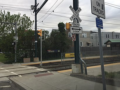
Marshall Road Address: Marshall Rd & N Lansdowne Ave, Lansdowne, PA 19050, USA street in Lansdowne
Attractions near Marshall Road
North Lansdowne Avenue,East Marshall Road,E Marshall Rd (marshall rd lansdowne),Lansdowne Av & Marshall Rd,2143 E Marshall Rd,N Lansdowne Ave,Urology Care Center,21 W Albemarle Ave,E Marshall Rd,The Little Blue Acadamy,Marshall Rd & Lincoln Av,Marshall Rd & Owen Av- FS,Lansdowne Family Dental,21 East Albemarle Avenue,W Marshall Rd,Dr Mooreville Urologist,allied medical assaciates,The O2 Bandit,Drougherty Chiroprafor,Dougherty Chiropractic CenterHow to get to popular attractions in Lansdowne with public transit
West Oak Lane, Philadelphia,Plainsboro, NJ, Plainsboro Center,SEPTA Forest Hills Station, Philadelphia,Honey's Sit 'n Eat, Philadelphia,Hatfield, PA, Hatfield,NJT - Princeton Junction Station (NEC), Princeton Junction,Morimoto, Philadelphia,Mount Airy, Philadelphia,Sampan, Philadelphia,Moriarty's Restaurant & Irish Pub, Philadelphia,NJT - Hamilton Station (NEC),Spring Valley YMCA, Limerick,Geno's Steaks, Philadelphia,Aloft Philadelphia Airport, Philadelphia,Doylestown, PA, Doylestown,Talula's Garden, Philadelphia,Pottstown, PA, Pottstown,The Cheesecake Factory, Willow Grove,Iron Hill Brewery & Restaurant, West Chester,Vedge, PhiladelphiaGet around Lansdowne by public transit!
Traveling around Lansdowne has never been so easy. See step by step directions as you travel to any attraction, street or major public transit station. View bus and train schedules, arrival times, service alerts and detailed routes on a map, so you know exactly how to get to anywhere in Lansdowne.
When traveling to any destination around Lansdowne use Moovit's Live Directions with Get Off Notifications to know exactly where and how far to walk, how long to wait for your line, and how many stops are left. Moovit will alert you when it's time to get off — no need to constantly re-check whether yours is the next stop.
Wondering how to use public transit in Lansdowne or how to pay for public transit in Lansdowne? Moovit public transit app can help you navigate your way with public transit easily, and at minimum cost. It includes public transit fees, ticket prices, and costs. Looking for a map of Lansdowne public transit lines? Moovit public transit app shows all public transit maps in Lansdowne with all bus, subway, train or light rail routes and stops on an interactive map.
Lansdowne has 4 transit type(s), including: bus, subway, train or light rail, operated by several transit agencies, including SEPTA Subway, SEPTA Trolley, SEPTA Rail, SEPTA, SEPTA, NJ TRANSIT RAIL-Rail, NJ TRANSIT RAIL-Tram, NJ TRANSIT BUS, Port Authority Transit Corporation, Navy Yard, Penn Transit, Drexel University, Pottstown Area Rapid Transit (PART), Fullington Tours and Chescobus