See Martin Goodman Trail, Toronto, on the map
Directions to Martin Goodman Trail (Toronto) with public transportation
The following transit lines have routes that pass near Martin Goodman Trail
 Bus:
Bus: - Train:
- Subway:
- Streetcar:
How to get to Martin Goodman Trail by bus?
Click on the bus route to see step by step directions with maps, line arrival times and updated time schedules.
How to get to Martin Goodman Trail by train?
Click on the train route to see step by step directions with maps, line arrival times and updated time schedules.
How to get to Martin Goodman Trail by subway?
Click on the subway route to see step by step directions with maps, line arrival times and updated time schedules.
Bus stations near Martin Goodman Trail in Toronto
- Exhibition Place At Cne West Entrance (Dufferin Gate),11 min walk,
Bus lines to Martin Goodman Trail in Toronto
- 29,Wilson Ave at Billy Bishop Way,
- 329,Steeles Ave West at Dufferin St,
- 501,Mccaul St at Stephanie St,
- 929,Dufferin Gate Loop,
What are the closest stations to Martin Goodman Trail?
The closest stations to Martin Goodman Trail are:
- Exhibition Place At Cne West Entrance (Dufferin Gate) is 770 meters away, 11 min walk.
Which bus lines stop near Martin Goodman Trail?
These bus lines stop near Martin Goodman Trail: 29, 80.
Which train line stops near Martin Goodman Trail?
LW
Which subway line stops near Martin Goodman Trail?
2
Which Streetcar line stops near Martin Goodman Trail?
504
What’s the nearest bus stop to Martin Goodman Trail in Toronto?
The nearest bus stop to Martin Goodman Trail in Toronto is Exhibition Place At Cne West Entrance (Dufferin Gate). It’s a 11 min walk away.
See Martin Goodman Trail, Toronto, on the map
Public Transit to Martin Goodman Trail in Toronto
Wondering how to get to Martin Goodman Trail in Toronto, Canada? Moovit helps you find the best way to get to Martin Goodman Trail with step-by-step directions from the nearest public transit station.
Moovit provides free maps and live directions to help you navigate through your city. View schedules, routes, timetables, and find out how long does it take to get to Martin Goodman Trail in real time.
Looking for the nearest stop or station to Martin Goodman Trail? Check out this list of stops closest to your destination: Exhibition Place At Cne West Entrance (Dufferin Gate).
Bus:Train:Subway:Streetcar:
Want to see if there’s another route that gets you there at an earlier time? Moovit helps you find alternative routes or times. Get directions from and directions to Martin Goodman Trail easily from the Moovit App or Website.
We make riding to Martin Goodman Trail easy, which is why over 1.5 million users, including users in Toronto, trust Moovit as the best app for public transit. You don’t need to download an individual bus app or train app, Moovit is your all-in-one transit app that helps you find the best bus time or train time available.
For information on prices of bus, subway, train and Streetcar, costs and ride fares to Martin Goodman Trail, please check the Moovit app.
Use the app to navigate to popular places including to the airport, hospital, stadium, grocery store, mall, coffee shop, school, college, and university.
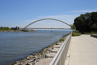
Martin Goodman Trail Address: Martin Goodman Trail, Toronto, ON, Canada street in Toronto
Attractions near Martin Goodman Trail
South Parkdale,Maritz Holiday Party - Winter Wonderland: A Frosted Affair,Lake Shore & Ontario Drive,Corus Entertainment,818 Lake Shore Blvd W,Colonel Samuel Smith Park,CIAS VIP Flight Deck,TD Echo Beach,Junction Flea Market,Digital Dreams Music Festival,Lot 6,Biosteel Centre,Jamz Bistro & Bar,Carnival Food Fair,Toronto Oktoberfest,Biosteel,Alberta Drive,Exhibition Baseball Field,Exit 149/Dunn Ave/W,Liberty GrandHow to get to popular attractions in Toronto with public transit
The Junction, Toronto,Sheppard West Subway Station, Toronto,Starbucks, Toronto,Mcmaster University, Hamilton,Union Station (YBZ), Toronto,Yorkdale Subway Station, Toronto,Wayne Gretzky's Toronto, Toronto,St Joseph's Healthcare (Charlton Campus), Hamilton,Orangeville, Ontario, Orangeville,RioCan Georgian Mall, Barrie,Starbucks, Toronto,Toronto Pearson International Airport (Yyz), Mississauga,McMaster University, Hamilton,Rogers Centre, Toronto,Starbucks, Toronto,Appleby GO Station, Burlington,Brampton ON, Brampton,Landmark Theatres Whitby 24, Whitby,Costco Wholesale, Hamilton,Canadian Tire Home Office, TorontoGet around Toronto by public transit!
Traveling around Toronto has never been so easy. See step by step directions as you travel to any attraction, street or major public transit station. View bus and train schedules, arrival times, service alerts and detailed routes on a map, so you know exactly how to get to anywhere in Toronto.
When traveling to any destination around Toronto use Moovit's Live Directions with Get Off Notifications to know exactly where and how far to walk, how long to wait for your line, and how many stops are left. Moovit will alert you when it's time to get off — no need to constantly re-check whether yours is the next stop.
Wondering how to use public transit in Toronto or how to pay for public transit in Toronto? Moovit public transit app can help you navigate your way with public transit easily, and at minimum cost. It includes public transit fees, ticket prices, and costs. Looking for a map of Toronto public transit lines? Moovit public transit app shows all public transit maps in Toronto with all bus, subway, train or Streetcar routes and stops on an interactive map.
Toronto has 4 transit type(s), including: bus, subway, train or Streetcar, operated by several transit agencies, including TTC, TTC Streetcar, Toronto Subway, GO Transit Bus, GO Transit, Amtrak, York Region Transit, Grand River Transit, Guelph Transit, grt, Hamilton Street Railway, MiWay, Brampton Transit, Burlington Transit and Oakville Transit