Directions to Mary Bemis (Boston) with public transportation
The following transit lines have routes that pass near Mary Bemis
 Bus: 11, 9, 10.
- Train: PROVIDENCE/STOUGHTON, FALL RIVER/NEW BEDFORD, GREENBUSH, KINGSTON.
- Subway: RED LINE.
- Ferry: LOVEJOY - FAN PIER - PIER 10.
How to get to Mary Bemis by bus?
Click on the bus route to see step by step directions with maps, line arrival times and updated time schedules.
From Takeda Pharmaceuticals, Cambridge
61 minFrom Massachusetts College Of Pharmacy And Health Science, Boston
48 minFrom The Burren, Somerville
95 minFrom Davis Sq, Somerville
93 minFrom Sommerville Theatre, Somerville
94 minFrom Brighton, Boston
71 minFrom Roxbury Community College, Boston
57 minFrom Encore Boston Harbor, Everett
80 minFrom Brighton, Boston
84 minFrom Brigham and Women's Hospital, Boston
55 min
How to get to Mary Bemis by train?
Click on the train route to see step by step directions with maps, line arrival times and updated time schedules.
How to get to Mary Bemis by subway?
Click on the subway route to see step by step directions with maps, line arrival times and updated time schedules.
From Takeda Pharmaceuticals, Cambridge
47 minFrom Massachusetts College Of Pharmacy And Health Science, Boston
63 minFrom The Burren, Somerville
52 minFrom Davis Sq, Somerville
51 minFrom Sommerville Theatre, Somerville
50 minFrom Brighton, Boston
89 minFrom Roxbury Community College, Boston
49 minFrom Encore Boston Harbor, Everett
68 minFrom Brighton, Boston
81 minFrom Brigham and Women's Hospital, Boston
63 min
Bus stops near Mary Bemis in Boston
Subway station near Mary Bemis in Boston
- Andrew, 11 min walk,VIEW
Train station near Mary Bemis in Boston
- Jfk/Umass, 16 min walk,VIEW
Ferry station near Mary Bemis in Boston
- Pier 10, 27 min walk,VIEW
Bus lines to Mary Bemis in Boston
What are the closest stations to Mary Bemis?
The closest stations to Mary Bemis are:
- E Broadway @ L St is 46 yards away, 1 min walk.
- E 8th St @ I St is 128 yards away, 2 min walk.
- Andrew is 918 yards away, 11 min walk.
- Jfk/Umass is 1341 yards away, 16 min walk.
- Pier 10 is 2238 yards away, 27 min walk.
Which bus lines stop near Mary Bemis?
These bus lines stop near Mary Bemis: 11, 9.
Which train line stops near Mary Bemis?
PROVIDENCE/STOUGHTON (#820 | South Station)
Which subway line stops near Mary Bemis?
RED LINE (Ashmont/Braintree)
What’s the nearest subway station to Mary Bemis in Boston?
The nearest subway station to Mary Bemis in Boston is Andrew. It’s a 11 min walk away.
What’s the nearest train station to Mary Bemis in Boston?
The nearest train station to Mary Bemis in Boston is Jfk/Umass. It’s a 16 min walk away.
What’s the nearest bus station to Mary Bemis in Boston?
The nearest bus station to Mary Bemis in Boston is E Broadway @ L St. It’s a 1 min walk away.
What’s the nearest ferry station to Mary Bemis in Boston?
The nearest ferry station to Mary Bemis in Boston is Pier 10. It’s a 27 min walk away.
What time is the first subway to Mary Bemis in Boston?
The RED LINE is the first subway that goes to Mary Bemis in Boston. It stops nearby at 5:23 AM.
What time is the last subway to Mary Bemis in Boston?
The RED LINE is the last subway that goes to Mary Bemis in Boston. It stops nearby at 1:55 AM.
What time is the first train to Mary Bemis in Boston?
The KINGSTON is the first train that goes to Mary Bemis in Boston. It stops nearby at 5:50 AM.
What time is the last train to Mary Bemis in Boston?
The KINGSTON is the last train that goes to Mary Bemis in Boston. It stops nearby at 8:02 PM.
What time is the first bus to Mary Bemis in Boston?
The 10 is the first bus that goes to Mary Bemis in Boston. It stops nearby at 4:53 AM.
What time is the last bus to Mary Bemis in Boston?
The 10 is the last bus that goes to Mary Bemis in Boston. It stops nearby at 1:38 AM.
What time is the first ferry to Mary Bemis in Boston?
The LOVEJOY - FAN PIER - PIER 10 is the first ferry that goes to Mary Bemis in Boston. It stops nearby at 6:45 AM.
What time is the last ferry to Mary Bemis in Boston?
The LOVEJOY - FAN PIER - PIER 10 is the last ferry that goes to Mary Bemis in Boston. It stops nearby at 7:10 PM.
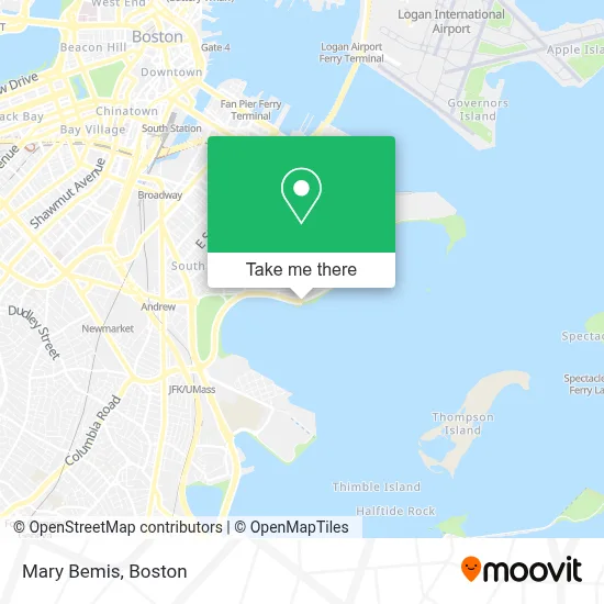
See Mary Bemis, Boston, on the map
Public Transit to Mary Bemis in Boston
Wondering how to get to Mary Bemis in Boston? Moovit helps you find the best way to get to Mary Bemis with step-by-step directions from the nearest public transit station.
Moovit provides free maps and live directions to help you navigate through your city. View schedules, routes, timetables, and find out how long does it take to get to Mary Bemis in real time.
Looking for the nearest stop or station to Mary Bemis? Check out this list of stops closest to your destination: E Broadway @ L St; E 8th St @ I St; Andrew; Jfk/Umass; Pier 10.
Bus: 11, 9, 10.Train: PROVIDENCE/STOUGHTON, FALL RIVER/NEW BEDFORD, GREENBUSH, KINGSTON.Subway: RED LINE.Ferry: LOVEJOY - FAN PIER - PIER 10.
Want to see if there’s another route that gets you there at an earlier time? Moovit helps you find alternative routes or times. Get directions from and directions to Mary Bemis easily from the Moovit App or Website.
We make riding to Mary Bemis easy, which is why over 1.7 million users, including users in Boston, trust Moovit as the best app for public transit. You don’t need to download an individual bus app or train app, Moovit is your all-in-one transit app that helps you find the best bus time or train time available.
For information on prices of bus, subway and train, costs and ride fares to Mary Bemis, please check the Moovit app.
Use the app to navigate to popular places including to the airport, hospital, stadium, grocery store, mall, coffee shop, school, college, and university.
Mary Bemis Address: 3666 Rainy Day Drive street in Boston
- BCYF- Curley Community Center,
- M Street Beach,
- ATM,
- L Street Tavern,
- L Street Tavern (L Street Lounge),
- Kiki Beach,
- Liquor & Wine Emporium,
- Round The Clock Locksmith,
- M Street Beach,
- John J. Alcorn Square,
- Glynn Advisory,
- South Boston, Massachusetts,
- Government Offices City,
- Flaherty Demolition,
- CM Masonry and Construction,
- Kindred Nursing and Rehabilitation - Harborlights (Kindred Healthcare Operating),
- C Ma CGM American Boston Office (Cma CGM America Boston Office),
- South Boston Yacht Club,
- Babe Cave,
- Southie Beach
Places Near Mary Bemis (Boston)
- Boston Common, Boston,
- Boston Medical Center, Boston,
- Td Garden, Boston,
- Seaport District, Boston,
- Massachusetts General Hospital, Boston,
- Castle Island, Boston,
- Museum Of Science, Boston,
- Boston Children's Hospital, Boston,
- Wilbur Theatre, Boston,
- Quincy Market, Boston,
- Cheers, Boston,
- House Of Blues, Boston,
- Wang Theater, Boston,
- Leader Bank Pavilion (Leader Bank Pavillion), Boston,
- Mgm Music Hall, Boston,
- Prudential Center, Boston,
- Isabella Stewart Gardner Museum, Boston,
- North End, Boston,
- Faneuil Hall, Boston,
- Boston Convention & Exhibition Center, Boston
How to get to popular places in Boston with public transit
Get around Boston by public transit!
Traveling around Boston has never been so easy. See step by step directions as you travel to any attraction, street or major public transit station. View bus and train schedules, arrival times, service alerts and detailed routes on a map, so you know exactly how to get to anywhere in Boston.
When traveling to any destination around Boston use Moovit's Live Directions with Get Off Notifications to know exactly where and how far to walk, how long to wait for your line, and how many stops are left. Moovit will alert you when it's time to get off — no need to constantly re-check whether yours is the next stop.
Wondering how to use public transit in Boston or how to pay for public transit in Boston? Moovit public transit app can help you navigate your way with public transit easily, and at minimum cost. It includes public transit fees, ticket prices, and costs. Looking for a map of Boston public transit lines? Moovit public transit app shows all public transit maps in Boston with all Bus, Train, Subway and Ferry routes and stops on an interactive map.
Boston has 4 transit type(s), including: Bus, Train, Subway and Ferry, operated by several transit agencies, including MBTA, Southeastern Regional Transit Authority, MetroWest Regional Transit Authority, Rhode Island Public Transit Authority, WRTA, Lowell Regional Transit Authority, Merrimack Valley Transit, Montachusett Regional Transit Authority, Cape Cod Regional Transit Authority, Brockton Area Transit Authority, Martha's Vineyard Transit Authority, the WAVE - Nantucket Regional Transit Authority, GATRA, Cape Ann Transportation Authority and Massport