Directions to Masheen Charters (Boston) with public transportation
The following transit lines have routes that pass near Masheen Charters
 Bus: 14.
How to get to Masheen Charters by bus?
Click on the bus route to see step by step directions with maps, line arrival times and updated time schedules.
Bus stop near Masheen Charters in Boston
- Post Before Island View, 3 min walk,VIEW
Bus lines to Masheen Charters in Boston
- 14, Newport Via Jamestown,VIEW
What are the closest stations to Masheen Charters?
The closest stations to Masheen Charters are:
- Post Before Island View is 252 yards away, 3 min walk.
Which bus line stops near Masheen Charters?
14 (Newport Via Jamestown)
What’s the nearest bus station to Masheen Charters in Boston?
The nearest bus station to Masheen Charters in Boston is Post Before Island View. It’s a 3 min walk away.
What time is the first bus to Masheen Charters in Boston?
The 14 is the first bus that goes to Masheen Charters in Boston. It stops nearby at 5:24 AM.
What time is the last bus to Masheen Charters in Boston?
The 14 is the last bus that goes to Masheen Charters in Boston. It stops nearby at 9:12 PM.
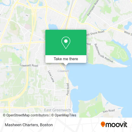
See Masheen Charters, Boston, on the map
Public Transit to Masheen Charters in Boston
Wondering how to get to Masheen Charters in Boston? Moovit helps you find the best way to get to Masheen Charters with step-by-step directions from the nearest public transit station.
Moovit provides free maps and live directions to help you navigate through your city. View schedules, routes, timetables, and find out how long does it take to get to Masheen Charters in real time.
Looking for the nearest stop or station to Masheen Charters? Check out this list of stops closest to your destination: Post Before Island View.
Bus: 14.
Want to see if there’s another route that gets you there at an earlier time? Moovit helps you find alternative routes or times. Get directions from and directions to Masheen Charters easily from the Moovit App or Website.
We make riding to Masheen Charters easy, which is why over 1.7 million users, including users in Boston, trust Moovit as the best app for public transit. You don’t need to download an individual bus app or train app, Moovit is your all-in-one transit app that helps you find the best bus time or train time available.
For information on prices of bus, costs and ride fares to Masheen Charters, please check the Moovit app.
Use the app to navigate to popular places including to the airport, hospital, stadium, grocery store, mall, coffee shop, school, college, and university.
Masheen Charters Address: 1 Masthead Dr street in Boston
- USCG Auxiliary North Star Flotilla 013-07-06,
- Bassett Boat,
- Petzold's Yacht Sales Rhode Island,
- Amazon Locker-Memories,
- Harborview Apartments,
- Sumo's Nails & Spa,
- Waxing by Dawn Marie,
- Single Sourced,
- Sericum Pellis,
- The Corner House,
- Greenwich Cove Kitchen,
- American Express,
- Jubilee Legal Services,
- The Resolution Collaborative,
- Youth Pride,
- Air Tech Pro Hvac,
- Wellnami,
- Zested Pharmacy,
- Royal Crustacean Charters,
- BC Marine Canvas
Places Near Masheen Charters (Boston)
- Prudential Center, Boston,
- Castle Island, Boston,
- North End, Boston,
- Seaport District, Boston,
- House Of Blues, Boston,
- Boston Convention & Exhibition Center, Boston,
- Quincy Market, Boston,
- Td Garden, Boston,
- Faneuil Hall, Boston,
- Boston Medical Center, Boston,
- Mgm Music Hall, Boston,
- Museum Of Science, Boston,
- Cheers, Boston,
- Leader Bank Pavilion (Leader Bank Pavillion), Boston,
- Wang Theater, Boston,
- Massachusetts General Hospital, Boston,
- Wilbur Theatre, Boston,
- Boston Children's Hospital, Boston,
- Boston Common, Boston,
- Isabella Stewart Gardner Museum, Boston
How to get to popular places in Boston with public transit
Get around Boston by public transit!
Traveling around Boston has never been so easy. See step by step directions as you travel to any attraction, street or major public transit station. View bus and train schedules, arrival times, service alerts and detailed routes on a map, so you know exactly how to get to anywhere in Boston.
When traveling to any destination around Boston use Moovit's Live Directions with Get Off Notifications to know exactly where and how far to walk, how long to wait for your line, and how many stops are left. Moovit will alert you when it's time to get off — no need to constantly re-check whether yours is the next stop.
Wondering how to use public transit in Boston or how to pay for public transit in Boston? Moovit public transit app can help you navigate your way with public transit easily, and at minimum cost. It includes public transit fees, ticket prices, and costs. Looking for a map of Boston public transit lines? Moovit public transit app shows all public transit maps in Boston with all Bus, Train, Subway and Ferry routes and stops on an interactive map.
Boston has 4 transit type(s), including: Bus, Train, Subway and Ferry, operated by several transit agencies, including MBTA, Southeastern Regional Transit Authority, MetroWest Regional Transit Authority, Rhode Island Public Transit Authority, WRTA, Lowell Regional Transit Authority, Merrimack Valley Transit, Montachusett Regional Transit Authority, Cape Cod Regional Transit Authority, Brockton Area Transit Authority, Martha's Vineyard Transit Authority, the WAVE - Nantucket Regional Transit Authority, GATRA, Cape Ann Transportation Authority and Massport