How to get to Mass Energy Rates by bus?
Click on the bus route to see step by step directions with maps, line arrival times and updated time schedules.
From Children's Hospital, Boston
113 minFrom John F. Kennedy Presidential Library And Museum, Boston
95 minFrom Milton, MA, Milton
68 minFrom Ramada by Wyndham Boston, Boston
74 minFrom Doubletree-Boston Bayside, Boston
91 minFrom The Banshee Bar, Boston
101 minFrom The Strand Theater, Boston
88 minFrom Dorchester, Boston
96 minFrom Dorchester District Court, Boston
71 minFrom Uphams Corner, Boston
104 min
How to get to Mass Energy Rates by subway?
Click on the subway route to see step by step directions with maps, line arrival times and updated time schedules.
Bus stop near Mass Energy Rates in Quincy
- Granite St @ Braintree Hill Pk, 10 min walk,VIEW
Train station near Mass Energy Rates in Quincy
- Braintree, 59 min walk,VIEW
Subway station near Mass Energy Rates in Quincy
- Braintree, 61 min walk,VIEW
Bus lines to Mass Energy Rates in Quincy
- 238, Quincy Center,VIEW
What are the closest stations to Mass Energy Rates?
The closest stations to Mass Energy Rates are:
- Granite St @ Braintree Hill Pk is 755 yards away, 10 min walk.
- Braintree is 5025 yards away, 59 min walk.
Which bus lines stop near Mass Energy Rates?
These bus lines stop near Mass Energy Rates: 215, 238.
Which subway line stops near Mass Energy Rates?
RED LINE (Ashmont/Braintree)
What’s the nearest bus station to Mass Energy Rates in Quincy?
The nearest bus station to Mass Energy Rates in Quincy is Granite St @ Braintree Hill Pk. It’s a 10 min walk away.
What time is the first subway to Mass Energy Rates in Quincy?
The RED LINE is the first subway that goes to Mass Energy Rates in Quincy. It stops nearby at 5:09 AM.
What time is the last subway to Mass Energy Rates in Quincy?
The RED LINE is the last subway that goes to Mass Energy Rates in Quincy. It stops nearby at 2:00 AM.
What time is the first train to Mass Energy Rates in Quincy?
The FALL RIVER/NEW BEDFORD is the first train that goes to Mass Energy Rates in Quincy. It stops nearby at 5:27 AM.
What time is the last train to Mass Energy Rates in Quincy?
The KINGSTON is the last train that goes to Mass Energy Rates in Quincy. It stops nearby at 12:25 AM.
What time is the first bus to Mass Energy Rates in Quincy?
The 238 is the first bus that goes to Mass Energy Rates in Quincy. It stops nearby at 5:20 AM.
What time is the last bus to Mass Energy Rates in Quincy?
The 238 is the last bus that goes to Mass Energy Rates in Quincy. It stops nearby at 11:25 PM.
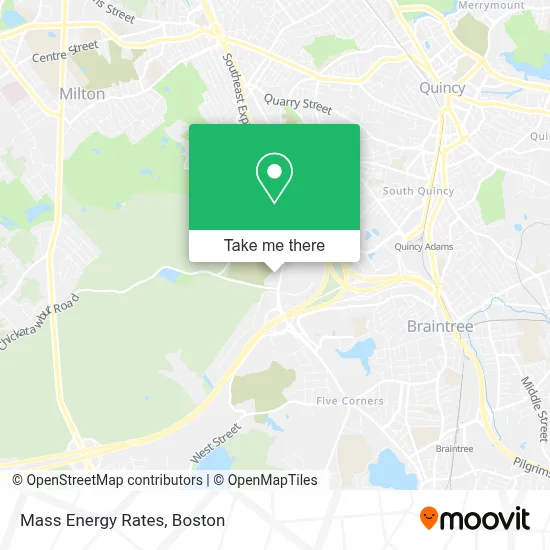
See Mass Energy Rates, Quincy, on the map
Public Transit to Mass Energy Rates in Quincy
Wondering how to get to Mass Energy Rates in Quincy? Moovit helps you find the best way to get to Mass Energy Rates with step-by-step directions from the nearest public transit station.
Moovit provides free maps and live directions to help you navigate through your city. View schedules, routes, timetables, and find out how long does it take to get to Mass Energy Rates in real time.
Looking for the nearest stop or station to Mass Energy Rates? Check out this list of stops closest to your destination: Granite St @ Braintree Hill Pk; Braintree.
Bus: 215, 238.Train: CAPEFLYER, FALL RIVER/NEW BEDFORD, KINGSTON.Subway: RED LINE.
Want to see if there’s another route that gets you there at an earlier time? Moovit helps you find alternative routes or times. Get directions from and directions to Mass Energy Rates easily from the Moovit App or Website.
We make riding to Mass Energy Rates easy, which is why over 1.7 million users, including users in Quincy, trust Moovit as the best app for public transit. You don’t need to download an individual bus app or train app, Moovit is your all-in-one transit app that helps you find the best bus time or train time available.
For information on prices of bus and subway, costs and ride fares to Mass Energy Rates, please check the Moovit app.
Use the app to navigate to popular places including to the airport, hospital, stadium, grocery store, mall, coffee shop, school, college, and university.
Mass Energy Rates Address: 859 Willard St street in Quincy
- Computer Arithmetic,
- Custom Ink,
- Law Offices of Morgan & Murphy,
- Bulens Law,
- South Shore Homecare, Inc,
- Comparequotesonline,
- Jay Shak,
- Joanne MC Kenna,
- Loyalty To Royalty,
- Attorney Houlihan & Muldoon,
- DLB Insurance,
- Conquest Funds,
- Caru International,
- It's Aparentiy Time,
- Regus - Massachusetts, Quincy - Braintree Quincy Center,
- Plumbing Repair Pros,
- Top Mark Masonry & Construction,
- Kings & Queens Consulting,
- Import & Export BCS Construction Services,
- John Fossetti
Places Near Mass Energy Rates (Quincy)
- Faneuil Hall, Boston,
- Boston Medical Center, Boston,
- Quincy Market, Boston,
- Boston Convention & Exhibition Center, Boston,
- Seaport District, Boston,
- North End, Boston,
- Prudential Center, Boston,
- Castle Island, Boston,
- Wang Theater, Boston,
- Mgm Music Hall, Boston,
- Boston Common, Boston,
- Cheers, Boston,
- Wilbur Theatre, Boston,
- Isabella Stewart Gardner Museum, Boston,
- House Of Blues, Boston,
- Massachusetts General Hospital, Boston,
- Boston Children's Hospital, Boston,
- Museum Of Science, Boston,
- Leader Bank Pavilion (Leader Bank Pavillion), Boston,
- Td Garden, Boston
How to get to popular places in Boston with public transit
Get around Quincy by public transit!
Traveling around Quincy has never been so easy. See step by step directions as you travel to any attraction, street or major public transit station. View bus and train schedules, arrival times, service alerts and detailed routes on a map, so you know exactly how to get to anywhere in Quincy.
When traveling to any destination around Quincy use Moovit's Live Directions with Get Off Notifications to know exactly where and how far to walk, how long to wait for your line, and how many stops are left. Moovit will alert you when it's time to get off — no need to constantly re-check whether yours is the next stop.
Wondering how to use public transit in Quincy or how to pay for public transit in Quincy? Moovit public transit app can help you navigate your way with public transit easily, and at minimum cost. It includes public transit fees, ticket prices, and costs. Looking for a map of Quincy public transit lines? Moovit public transit app shows all public transit maps in Quincy with all Bus, Train, Subway and Ferry routes and stops on an interactive map.
Boston has 4 transit type(s), including: Bus, Train, Subway and Ferry, operated by several transit agencies, including MBTA, Southeastern Regional Transit Authority, MetroWest Regional Transit Authority, Rhode Island Public Transit Authority, WRTA, Lowell Regional Transit Authority, Merrimack Valley Transit, Montachusett Regional Transit Authority, Cape Cod Regional Transit Authority, Brockton Area Transit Authority, Martha's Vineyard Transit Authority, the WAVE - Nantucket Regional Transit Authority, GATRA, Cape Ann Transportation Authority and Massport