Directions to Mass. Eye And Ear (Quincy) with public transportation
The following transit lines have routes that pass near Mass. Eye And Ear
 Bus: 215, 238, 210, RED LINE SHUTTLE, RED LINE SHUTTLE.
- Train: FALL RIVER/NEW BEDFORD, GREENBUSH.
- Subway: RED LINE.
How to get to Mass. Eye And Ear by bus?
Click on the bus route to see step by step directions with maps, line arrival times and updated time schedules.
From Milton, MA, Milton
64 minFrom Boston Latin Academy, Boston
63 minFrom South Shore Hospital Outpatient Center, Weymouth Town
61 minFrom John F. Kennedy Presidential Library And Museum, Boston
86 minFrom Lemuel Shattuck Hospital, Boston
53 minFrom The Wilbur, Boston
77 minFrom Carson Beach, Boston
84 minFrom Ramada by Wyndham Boston, Boston
52 minFrom Georgetown, Massachusetts, Boston
100 minFrom Best Western Adams Inn Quincy - Boston, Quincy
64 min
How to get to Mass. Eye And Ear by train?
Click on the train route to see step by step directions with maps, line arrival times and updated time schedules.
How to get to Mass. Eye And Ear by subway?
Click on the subway route to see step by step directions with maps, line arrival times and updated time schedules.
From Milton, MA, Milton
83 minFrom Boston Latin Academy, Boston
76 minFrom John F. Kennedy Presidential Library And Museum, Boston
53 minFrom Lemuel Shattuck Hospital, Boston
73 minFrom The Wilbur, Boston
47 minFrom Carson Beach, Boston
43 minFrom Ramada by Wyndham Boston, Boston
60 minFrom Best Western Adams Inn Quincy - Boston, Quincy
38 min
Bus stops near Mass. Eye And Ear in Quincy
Subway station near Mass. Eye And Ear in Quincy
- Wollaston, 5 min walk,VIEW
Bus lines to Mass. Eye And Ear in Quincy
- 238, Quincy Center,VIEW
- 210, Fields Corner - Quincy Center,VIEW
- RED LINE SHUTTLE, Ashmont - Braintree,VIEW
- RED LINE SHUTTLE, Braintree - Broadway,VIEW
- RED LINE SHUTTLE, Braintree - Quincy Center,VIEW
- RED LINE SHUTTLE, Braintree - JFK/UMass (Shuttle),VIEW
- RED LINE SHUTTLE, Braintree - North Quincy (Shuttle),VIEW
- 230, Montello,VIEW
What are the closest stations to Mass. Eye And Ear?
The closest stations to Mass. Eye And Ear are:
- Centre St @ Mcdonald St is 80 yards away, 1 min walk.
- Wollaston is 334 yards away, 5 min walk.
- Quincy Adams is 501 yards away, 6 min walk.
- Independence Ave @ Federal Ave is 1818 yards away, 22 min walk.
Which bus lines stop near Mass. Eye And Ear?
These bus lines stop near Mass. Eye And Ear: 215, 238.
Which train lines stop near Mass. Eye And Ear?
These train lines stop near Mass. Eye And Ear: FALL RIVER/NEW BEDFORD, GREENBUSH.
Which subway line stops near Mass. Eye And Ear?
RED LINE (Ashmont/Braintree)
What’s the nearest subway station to Mass. Eye And Ear in Quincy?
The nearest subway station to Mass. Eye And Ear in Quincy is Wollaston. It’s a 5 min walk away.
What’s the nearest bus station to Mass. Eye And Ear in Quincy?
The nearest bus station to Mass. Eye And Ear in Quincy is Centre St @ Mcdonald St. It’s a 1 min walk away.
What time is the first subway to Mass. Eye And Ear in Quincy?
The RED LINE is the first subway that goes to Mass. Eye And Ear in Quincy. It stops nearby at 5:12 AM.
What time is the last subway to Mass. Eye And Ear in Quincy?
The RED LINE is the last subway that goes to Mass. Eye And Ear in Quincy. It stops nearby at 1:55 AM.
What time is the first bus to Mass. Eye And Ear in Quincy?
The 230 is the first bus that goes to Mass. Eye And Ear in Quincy. It stops nearby at 4:56 AM.
What time is the last bus to Mass. Eye And Ear in Quincy?
The 210 is the last bus that goes to Mass. Eye And Ear in Quincy. It stops nearby at 1:24 AM.
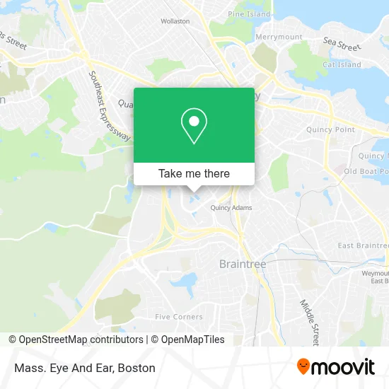
See Mass. Eye And Ear, Quincy, on the map
Public Transit to Mass. Eye And Ear in Quincy
Wondering how to get to Mass. Eye And Ear in Quincy? Moovit helps you find the best way to get to Mass. Eye And Ear with step-by-step directions from the nearest public transit station.
Moovit provides free maps and live directions to help you navigate through your city. View schedules, routes, timetables, and find out how long does it take to get to Mass. Eye And Ear in real time.
Looking for the nearest stop or station to Mass. Eye And Ear? Check out this list of stops closest to your destination: Centre St @ Mcdonald St; Wollaston; Quincy Adams; Independence Ave @ Federal Ave.
Bus: 215, 238, 210, RED LINE SHUTTLE, RED LINE SHUTTLE, RED LINE SHUTTLE, RED LINE SHUTTLE, 230.Train: FALL RIVER/NEW BEDFORD, GREENBUSH.Subway: RED LINE.
Want to see if there’s another route that gets you there at an earlier time? Moovit helps you find alternative routes or times. Get directions from and directions to Mass. Eye And Ear easily from the Moovit App or Website.
We make riding to Mass. Eye And Ear easy, which is why over 1.7 million users, including users in Quincy, trust Moovit as the best app for public transit. You don’t need to download an individual bus app or train app, Moovit is your all-in-one transit app that helps you find the best bus time or train time available.
For information on prices of bus, subway and train, costs and ride fares to Mass. Eye And Ear, please check the Moovit app.
Use the app to navigate to popular places including to the airport, hospital, stadium, grocery store, mall, coffee shop, school, college, and university.
Mass. Eye And Ear Address: 500 Congress St #2b & #1c street in Quincy
- Priority Std Testing Quincy,
- Care Access,
- Excel Garage Door Experts,
- Mouchati Rizkalla Md,
- Best Quincy Carpet Cleaning,
- Crown Colony Medical Center,
- Advantage Imaging Solutions,
- Ccrm Fertility Of Quincy,
- Mandana R. Namiranian, MD,
- Massoms,
- Massachusetts Oral & Maxillofacial Surgery - Quincy,
- Devin M Ruiz, MD,
- Integrated Derm Mass,
- Yuna Larrabee, MD,
- Same Day STD Testing,
- Dennis Goldin MD,
- Natalia Kyriazidis, MD,
- Quincy Spine & Orthopedic Center,
- Hand & Upper Extremity Center Of New England,
- Deschrijver Antoin Pa
Places Near Mass. Eye And Ear (Quincy)
- Wilbur Theatre, Boston,
- Boston Common, Boston,
- Mgm Music Hall, Boston,
- Massachusetts General Hospital, Boston,
- North End, Boston,
- Isabella Stewart Gardner Museum, Boston,
- Museum Of Science, Boston,
- Td Garden, Boston,
- Castle Island, Boston,
- Faneuil Hall, Boston,
- Boston Children's Hospital, Boston,
- House Of Blues, Boston,
- Quincy Market, Boston,
- Leader Bank Pavilion (Leader Bank Pavillion), Boston,
- Wang Theater, Boston,
- Seaport District, Boston,
- Boston Medical Center, Boston,
- Prudential Center, Boston,
- Boston Convention & Exhibition Center, Boston,
- Cheers, Boston
How to get to popular places in Boston with public transit
Get around Quincy by public transit!
Traveling around Quincy has never been so easy. See step by step directions as you travel to any attraction, street or major public transit station. View bus and train schedules, arrival times, service alerts and detailed routes on a map, so you know exactly how to get to anywhere in Quincy.
When traveling to any destination around Quincy use Moovit's Live Directions with Get Off Notifications to know exactly where and how far to walk, how long to wait for your line, and how many stops are left. Moovit will alert you when it's time to get off — no need to constantly re-check whether yours is the next stop.
Wondering how to use public transit in Quincy or how to pay for public transit in Quincy? Moovit public transit app can help you navigate your way with public transit easily, and at minimum cost. It includes public transit fees, ticket prices, and costs. Looking for a map of Quincy public transit lines? Moovit public transit app shows all public transit maps in Quincy with all Bus, Train, Subway and Ferry routes and stops on an interactive map.
Boston has 4 transit type(s), including: Bus, Train, Subway and Ferry, operated by several transit agencies, including MBTA, Southeastern Regional Transit Authority, MetroWest Regional Transit Authority, Rhode Island Public Transit Authority, WRTA, Lowell Regional Transit Authority, Merrimack Valley Transit, Montachusett Regional Transit Authority, Cape Cod Regional Transit Authority, Brockton Area Transit Authority, Martha's Vineyard Transit Authority, the WAVE - Nantucket Regional Transit Authority, GATRA, Cape Ann Transportation Authority and Massport