Directions to Mass General Brigham Pain Research Lab (Brookline) with public transportation
The following transit lines have routes that pass near Mass General Brigham Pain Research Lab
 Bus: 51, 60, 86.
- Subway: GREEN LINE D, GREEN LINE C.
How to get to Mass General Brigham Pain Research Lab by bus?
Click on the bus route to see step by step directions with maps, line arrival times and updated time schedules.
From Target, Boston
73 minFrom Harvard University, Cambridge
52 minFrom Black Falcon Cruise Terminal, Boston
93 minFrom House Of Blues, Boston
28 minFrom Medford, MA, Medford
89 minFrom Sowa, Boston
65 minFrom Spaulding Rehabilitation Hospital, Boston
108 minFrom Beth Israel Deaconess Hospital-Milton, Milton
74 minFrom 31 St. James Street, Boston
41 minFrom Reelhouse, Boston
127 min
How to get to Mass General Brigham Pain Research Lab by subway?
Click on the subway route to see step by step directions with maps, line arrival times and updated time schedules.
Bus stops near Mass General Brigham Pain Research Lab in Brookline
Subway stations near Mass General Brigham Pain Research Lab in Brookline
Bus lines to Mass General Brigham Pain Research Lab in Brookline
What are the closest stations to Mass General Brigham Pain Research Lab?
The closest stations to Mass General Brigham Pain Research Lab are:
- Boylston St @ Heath St is 479 yards away, 6 min walk.
- Lee St @ Boylston St is 696 yards away, 9 min walk.
- Chestnut Hill is 1136 yards away, 14 min walk.
- Cleveland Circle is 1562 yards away, 19 min walk.
Which bus lines stop near Mass General Brigham Pain Research Lab?
These bus lines stop near Mass General Brigham Pain Research Lab: 51, 60, 86.
Which subway line stops near Mass General Brigham Pain Research Lab?
GREEN LINE D (Riverside)
What’s the nearest subway station to Mass General Brigham Pain Research Lab in Brookline?
The nearest subway station to Mass General Brigham Pain Research Lab in Brookline is Chestnut Hill. It’s a 14 min walk away.
What’s the nearest bus station to Mass General Brigham Pain Research Lab in Brookline?
The nearest bus station to Mass General Brigham Pain Research Lab in Brookline is Boylston St @ Heath St. It’s a 6 min walk away.
What time is the first subway to Mass General Brigham Pain Research Lab in Brookline?
The GREEN LINE D is the first subway that goes to Mass General Brigham Pain Research Lab in Brookline. It stops nearby at 4:45 AM.
What time is the last subway to Mass General Brigham Pain Research Lab in Brookline?
The GREEN LINE D is the last subway that goes to Mass General Brigham Pain Research Lab in Brookline. It stops nearby at 2:34 AM.
What time is the first bus to Mass General Brigham Pain Research Lab in Brookline?
The 60 is the first bus that goes to Mass General Brigham Pain Research Lab in Brookline. It stops nearby at 4:58 AM.
What time is the last bus to Mass General Brigham Pain Research Lab in Brookline?
The 60 is the last bus that goes to Mass General Brigham Pain Research Lab in Brookline. It stops nearby at 12:22 AM.
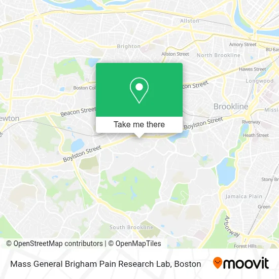
See Mass General Brigham Pain Research Lab, Brookline, on the map
Public Transit to Mass General Brigham Pain Research Lab in Brookline
Wondering how to get to Mass General Brigham Pain Research Lab in Brookline? Moovit helps you find the best way to get to Mass General Brigham Pain Research Lab with step-by-step directions from the nearest public transit station.
Moovit provides free maps and live directions to help you navigate through your city. View schedules, routes, timetables, and find out how long does it take to get to Mass General Brigham Pain Research Lab in real time.
Looking for the nearest stop or station to Mass General Brigham Pain Research Lab? Check out this list of stops closest to your destination: Boylston St @ Heath St; Lee St @ Boylston St; Chestnut Hill; Cleveland Circle.
Bus: 51, 60, 86.Subway: GREEN LINE D, GREEN LINE C.
Want to see if there’s another route that gets you there at an earlier time? Moovit helps you find alternative routes or times. Get directions from and directions to Mass General Brigham Pain Research Lab easily from the Moovit App or Website.
We make riding to Mass General Brigham Pain Research Lab easy, which is why over 1.7 million users, including users in Brookline, trust Moovit as the best app for public transit. You don’t need to download an individual bus app or train app, Moovit is your all-in-one transit app that helps you find the best bus time or train time available.
For information on prices of bus and subway, costs and ride fares to Mass General Brigham Pain Research Lab, please check the Moovit app.
Use the app to navigate to popular places including to the airport, hospital, stadium, grocery store, mall, coffee shop, school, college, and university.
Mass General Brigham Pain Research Lab Address: 850 Boylston St street in Brookline
- Patti A Colevas MD,
- Farnan, Lori - Fish Center Womens Health,
- BWH Allergy and Asthma at Chestnut Hill,
- Brigham and Women's Ambulatory Care Center at Chestnut Hill,
- Brigham and Womens Pain Management Center,
- New England Baptist Hospital,
- Neoss,
- Koh Young America Inc,
- Lanova Aesthetics,
- Brookline Fire Department Station 4,
- Carpet Cleaners Unlimited,
- Hammond Heritage,
- Unnamed,
- Top of the Hub,
- Boston Private Bank,
- Weles,
- Franklin Covey,
- Air Conditioning Company,
- Dr Marshall Wolf MD,
- Chestnut Hill Benevolent Association
Places Near Mass General Brigham Pain Research Lab (Brookline)
- Mgm Music Hall, Boston,
- Td Garden, Boston,
- Prudential Center, Boston,
- Castle Island, Boston,
- Seaport District, Boston,
- Boston Common, Boston,
- Cheers, Boston,
- House Of Blues, Boston,
- Wang Theater, Boston,
- Leader Bank Pavilion (Leader Bank Pavillion), Boston,
- Boston Children's Hospital, Boston,
- Museum Of Science, Boston,
- Massachusetts General Hospital, Boston,
- Wilbur Theatre, Boston,
- Faneuil Hall, Boston,
- Boston Convention & Exhibition Center, Boston,
- Quincy Market, Boston,
- Isabella Stewart Gardner Museum, Boston,
- Boston Medical Center, Boston,
- North End, Boston
How to get to popular places in Boston with public transit
Get around Brookline by public transit!
Traveling around Brookline has never been so easy. See step by step directions as you travel to any attraction, street or major public transit station. View bus and train schedules, arrival times, service alerts and detailed routes on a map, so you know exactly how to get to anywhere in Brookline.
When traveling to any destination around Brookline use Moovit's Live Directions with Get Off Notifications to know exactly where and how far to walk, how long to wait for your line, and how many stops are left. Moovit will alert you when it's time to get off — no need to constantly re-check whether yours is the next stop.
Wondering how to use public transit in Brookline or how to pay for public transit in Brookline? Moovit public transit app can help you navigate your way with public transit easily, and at minimum cost. It includes public transit fees, ticket prices, and costs. Looking for a map of Brookline public transit lines? Moovit public transit app shows all public transit maps in Brookline with all Bus, Train, Subway and Ferry routes and stops on an interactive map.
Boston has 4 transit type(s), including: Bus, Train, Subway and Ferry, operated by several transit agencies, including MBTA, Southeastern Regional Transit Authority, MetroWest Regional Transit Authority, Rhode Island Public Transit Authority, WRTA, Lowell Regional Transit Authority, Merrimack Valley Transit, Montachusett Regional Transit Authority, Cape Cod Regional Transit Authority, Brockton Area Transit Authority, Martha's Vineyard Transit Authority, the WAVE - Nantucket Regional Transit Authority, GATRA, Cape Ann Transportation Authority and Massport