Directions to Mass Mayhem Cheer & Tumble (Bliss Corner) with public transportation
The following transit lines have routes that pass near Mass Mayhem Cheer & Tumble
 Bus: 203.
- Ferry: SEASTREAK, SEASTREAK, CUTTYHUNK FERRY.
How to get to Mass Mayhem Cheer & Tumble by bus?
Click on the bus route to see step by step directions with maps, line arrival times and updated time schedules.
From Lizzy Borden House, Fall River
75 minFrom RMV New Bedford, New Bedford
109 minFrom Walmart Fall River Supercenter, Fall River
111 minFrom B.M.C. Durfee High School, Fall River
96 minFrom Bedford Industrial Park, New Bedford
111 minFrom Bristol Community College, Fall River
98 minFrom Charlton Memorial Hospital, Fall River
116 minFrom Amazon Fulfillment Bos7, Fall River
132 minFrom Falmouth MA USA, Falmouth
114 min
Bus stop near Mass Mayhem Cheer & Tumble in Bliss Corner
- Dartmouth St And Rogers St, 5 min walk,VIEW
Ferry stations near Mass Mayhem Cheer & Tumble in Bliss Corner
Bus lines to Mass Mayhem Cheer & Tumble in Bliss Corner
- 203, Terminal,VIEW
What are the closest stations to Mass Mayhem Cheer & Tumble?
The closest stations to Mass Mayhem Cheer & Tumble are:
- Dartmouth St And Rogers St is 383 yards away, 5 min walk.
- New Bedford, MA is 803 yards away, 10 min walk.
- Cuttyhunk Ferry Pier, New Bedford, MA is 962 yards away, 12 min walk.
Which bus line stops near Mass Mayhem Cheer & Tumble?
203 (Dartmouth St)
What’s the nearest bus station to Mass Mayhem Cheer & Tumble in Bliss Corner?
The nearest bus station to Mass Mayhem Cheer & Tumble in Bliss Corner is Dartmouth St And Rogers St. It’s a 5 min walk away.
What’s the nearest ferry station to Mass Mayhem Cheer & Tumble in Bliss Corner?
The nearest ferry station to Mass Mayhem Cheer & Tumble in Bliss Corner is New Bedford, MA. It’s a 10 min walk away.
What time is the first bus to Mass Mayhem Cheer & Tumble in Bliss Corner?
The 203 is the first bus that goes to Mass Mayhem Cheer & Tumble in Bliss Corner. It stops nearby at 6:51 AM.
What time is the last bus to Mass Mayhem Cheer & Tumble in Bliss Corner?
The 203 is the last bus that goes to Mass Mayhem Cheer & Tumble in Bliss Corner. It stops nearby at 8:53 PM.
What time is the first ferry to Mass Mayhem Cheer & Tumble in Bliss Corner?
The SEASTREAK is the first ferry that goes to Mass Mayhem Cheer & Tumble in Bliss Corner. It stops nearby at 8:20 AM.
What time is the last ferry to Mass Mayhem Cheer & Tumble in Bliss Corner?
The SEASTREAK is the last ferry that goes to Mass Mayhem Cheer & Tumble in Bliss Corner. It stops nearby at 8:40 PM.
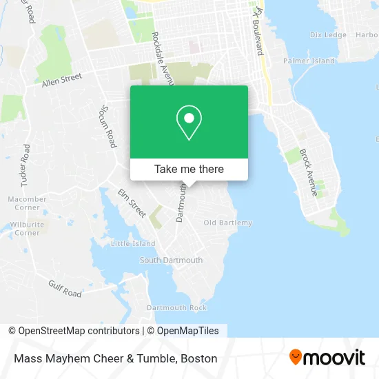
See Mass Mayhem Cheer & Tumble, Bliss Corner, on the map
Public Transit to Mass Mayhem Cheer & Tumble in Bliss Corner
Wondering how to get to Mass Mayhem Cheer & Tumble in Bliss Corner? Moovit helps you find the best way to get to Mass Mayhem Cheer & Tumble with step-by-step directions from the nearest public transit station.
Moovit provides free maps and live directions to help you navigate through your city. View schedules, routes, timetables, and find out how long does it take to get to Mass Mayhem Cheer & Tumble in real time.
Looking for the nearest stop or station to Mass Mayhem Cheer & Tumble? Check out this list of stops closest to your destination: Dartmouth St And Rogers St; New Bedford; Cuttyhunk Ferry Pier.
Bus: 203.Ferry: SEASTREAK, SEASTREAK, CUTTYHUNK FERRY.
Want to see if there’s another route that gets you there at an earlier time? Moovit helps you find alternative routes or times. Get directions from and directions to Mass Mayhem Cheer & Tumble easily from the Moovit App or Website.
We make riding to Mass Mayhem Cheer & Tumble easy, which is why over 1.7 million users, including users in Bliss Corner, trust Moovit as the best app for public transit. You don’t need to download an individual bus app or train app, Moovit is your all-in-one transit app that helps you find the best bus time or train time available.
For information on prices of bus, costs and ride fares to Mass Mayhem Cheer & Tumble, please check the Moovit app.
Use the app to navigate to popular places including to the airport, hospital, stadium, grocery store, mall, coffee shop, school, college, and university.
Mass Mayhem Cheer & Tumble Address: 718 Dartmouth St street in Bliss Corner
- Pickleball And More,
- Master Lee's Us Taekwondo Dartmouth,
- Killer B's,
- Delken,
- Ying Dynasty Of Dartmouth,
- Tangles Hair,
- Dartmouth Housing Authority,
- Hidden Brook Veterinary Services,
- ADT A T Alarm & Home Security,
- Playground,
- Ace Junk Removal,
- DG Auto,
- Kids Ink Too,
- Libertyx Bitcoin Atm,
- Two Sisters Catering,
- The Boujee Bean,
- Atm Walgreens,
- German American Bank Itm,
- Amelia Apartments,
- Walgreens #17925
Places Near Mass Mayhem Cheer & Tumble (Bliss Corner)
- Museum Of Science, Boston,
- Quincy Market, Boston,
- Faneuil Hall, Boston,
- Td Garden, Boston,
- Mgm Music Hall, Boston,
- Prudential Center, Boston,
- Seaport District, Boston,
- North End, Boston,
- Cheers, Boston,
- Boston Medical Center, Boston,
- Isabella Stewart Gardner Museum, Boston,
- Boston Common, Boston,
- Boston Children's Hospital, Boston,
- Leader Bank Pavilion (Leader Bank Pavillion), Boston,
- Castle Island, Boston,
- Boston Convention & Exhibition Center, Boston,
- Wilbur Theatre, Boston,
- Massachusetts General Hospital, Boston,
- Wang Theater, Boston,
- House Of Blues, Boston
How to get to popular places in Boston with public transit
Get around Bliss Corner by public transit!
Traveling around Bliss Corner has never been so easy. See step by step directions as you travel to any attraction, street or major public transit station. View bus and train schedules, arrival times, service alerts and detailed routes on a map, so you know exactly how to get to anywhere in Bliss Corner.
When traveling to any destination around Bliss Corner use Moovit's Live Directions with Get Off Notifications to know exactly where and how far to walk, how long to wait for your line, and how many stops are left. Moovit will alert you when it's time to get off — no need to constantly re-check whether yours is the next stop.
Wondering how to use public transit in Bliss Corner or how to pay for public transit in Bliss Corner? Moovit public transit app can help you navigate your way with public transit easily, and at minimum cost. It includes public transit fees, ticket prices, and costs. Looking for a map of Bliss Corner public transit lines? Moovit public transit app shows all public transit maps in Bliss Corner with all Bus, Train, Subway and Ferry routes and stops on an interactive map.
Boston has 4 transit type(s), including: Bus, Train, Subway and Ferry, operated by several transit agencies, including MBTA, Southeastern Regional Transit Authority, MetroWest Regional Transit Authority, Rhode Island Public Transit Authority, WRTA, Lowell Regional Transit Authority, Merrimack Valley Transit, Montachusett Regional Transit Authority, Cape Cod Regional Transit Authority, Brockton Area Transit Authority, Martha's Vineyard Transit Authority, the WAVE - Nantucket Regional Transit Authority, GATRA, Cape Ann Transportation Authority and Massport