Directions to Massachusett General Hospital (Somerville) with public transportation
The following transit lines have routes that pass near Massachusett General Hospital
 Bus: 109, 85, 90, ORANGE LINE SHUTTLE, ORANGE LINE SHUTTLE.
- Subway: ORANGE LINE, GREEN LINE B, GREEN LINE C, GREEN LINE E.
How to get to Massachusett General Hospital by bus?
Click on the bus route to see step by step directions with maps, line arrival times and updated time schedules.
From Revere Beach, Revere
87 minFrom Forest Hills Station MBTA, Boston
77 minFrom Sowa, Boston
65 minFrom Brigham and Women's Hospital, Boston
52 minFrom Walmart, Saugus
80 minFrom Isabella Stewart Gardner Museum, Boston
49 minFrom Dorchester, Boston
96 minFrom Showa Boston Institute, Boston
105 minFrom Lemuel Shattuck Hospital, Boston
88 minFrom Simmons College, Boston
45 min
How to get to Massachusett General Hospital by subway?
Click on the subway route to see step by step directions with maps, line arrival times and updated time schedules.
From Revere Beach, Revere
53 minFrom Forest Hills Station MBTA, Boston
31 minFrom Sowa, Boston
32 minFrom Brigham and Women's Hospital, Boston
46 minFrom Isabella Stewart Gardner Museum, Boston
40 minFrom Dorchester, Boston
50 minFrom Lemuel Shattuck Hospital, Boston
46 minFrom Simmons College, Boston
48 min
Bus stops near Massachusett General Hospital in Somerville
Subway stations near Massachusett General Hospital in Somerville
Bus lines to Massachusett General Hospital in Somerville
What are the closest stations to Massachusett General Hospital?
The closest stations to Massachusett General Hospital are:
- Grand Union Blvd @ Canal St is 202 yards away, 3 min walk.
- Grand Union Blvd @ Foley St is 255 yards away, 4 min walk.
- Broadway @ Mt Vernon St is 568 yards away, 7 min walk.
- East Somerville Station is 1027 yards away, 13 min walk.
- Sullivan Square is 2046 yards away, 25 min walk.
Which bus lines stop near Massachusett General Hospital?
These bus lines stop near Massachusett General Hospital: 109, 85.
Which subway line stops near Massachusett General Hospital?
ORANGE LINE (Oak Grove)
What’s the nearest subway station to Massachusett General Hospital in Somerville?
The nearest subway station to Massachusett General Hospital in Somerville is East Somerville Station. It’s a 13 min walk away.
What’s the nearest bus station to Massachusett General Hospital in Somerville?
The nearest bus station to Massachusett General Hospital in Somerville is Grand Union Blvd @ Canal St. It’s a 3 min walk away.
What time is the first subway to Massachusett General Hospital in Somerville?
The GREEN LINE E is the first subway that goes to Massachusett General Hospital in Somerville. It stops nearby at 4:49 AM.
What time is the last subway to Massachusett General Hospital in Somerville?
The GREEN LINE E is the last subway that goes to Massachusett General Hospital in Somerville. It stops nearby at 2:36 AM.
What time is the first bus to Massachusett General Hospital in Somerville?
The 89/93 is the first bus that goes to Massachusett General Hospital in Somerville. It stops nearby at 4:42 AM.
What time is the last bus to Massachusett General Hospital in Somerville?
The 89 is the last bus that goes to Massachusett General Hospital in Somerville. It stops nearby at 1:51 AM.
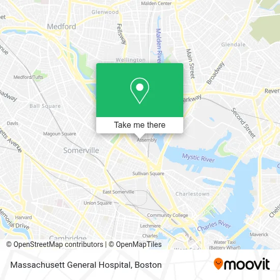
See Massachusett General Hospital, Somerville, on the map
Public Transit to Massachusett General Hospital in Somerville
Wondering how to get to Massachusett General Hospital in Somerville? Moovit helps you find the best way to get to Massachusett General Hospital with step-by-step directions from the nearest public transit station.
Moovit provides free maps and live directions to help you navigate through your city. View schedules, routes, timetables, and find out how long does it take to get to Massachusett General Hospital in real time.
Looking for the nearest stop or station to Massachusett General Hospital? Check out this list of stops closest to your destination: Grand Union Blvd @ Canal St; Grand Union Blvd @ Foley St; Broadway @ Mt Vernon St; East Somerville Station; Sullivan Square.
Bus: 109, 85, 90, ORANGE LINE SHUTTLE, ORANGE LINE SHUTTLE, 89, 95, 101, 89/93.Subway: ORANGE LINE, GREEN LINE B, GREEN LINE C, GREEN LINE E.
Want to see if there’s another route that gets you there at an earlier time? Moovit helps you find alternative routes or times. Get directions from and directions to Massachusett General Hospital easily from the Moovit App or Website.
We make riding to Massachusett General Hospital easy, which is why over 1.7 million users, including users in Somerville, trust Moovit as the best app for public transit. You don’t need to download an individual bus app or train app, Moovit is your all-in-one transit app that helps you find the best bus time or train time available.
For information on prices of bus and subway, costs and ride fares to Massachusett General Hospital, please check the Moovit app.
Use the app to navigate to popular places including to the airport, hospital, stadium, grocery store, mall, coffee shop, school, college, and university.
Location: Somerville, Boston
- Lucky Strike Somerville,
- Bright Horizons,
- PKL,
- Rumble Boxing,
- Revolution at Assembly Row,
- Fitrow,
- Mass General Brigham,
- Allways Health Partners,
- The Home Depot,
- Home Depot,
- Arow Express (A Row Express Grab and Go),
- Mike's Pastry,
- Legal Sea Foods- Somerville,
- CHA Assembly Square,
- 3D Cowboys,
- Papersource,
- A. Sasha Oxnard, MD,
- T Frank Law,
- Perac,
- Miriam Segura-Harrison, MD
Places Near Massachusett General Hospital (Somerville)
- Castle Island, Boston,
- Boston Common, Boston,
- North End, Boston,
- Massachusetts General Hospital, Boston,
- Seaport District, Boston,
- Leader Bank Pavilion (Leader Bank Pavillion), Boston,
- House Of Blues, Boston,
- Isabella Stewart Gardner Museum, Boston,
- Wang Theater, Boston,
- Museum Of Science, Boston,
- Boston Children's Hospital, Boston,
- Quincy Market, Boston,
- Cheers, Boston,
- Faneuil Hall, Boston,
- Wilbur Theatre, Boston,
- Mgm Music Hall, Boston,
- Boston Convention & Exhibition Center, Boston,
- Boston Medical Center, Boston,
- Prudential Center, Boston,
- Td Garden, Boston
How to get to popular places in Boston with public transit
Get around Somerville by public transit!
Traveling around Somerville has never been so easy. See step by step directions as you travel to any attraction, street or major public transit station. View bus and train schedules, arrival times, service alerts and detailed routes on a map, so you know exactly how to get to anywhere in Somerville.
When traveling to any destination around Somerville use Moovit's Live Directions with Get Off Notifications to know exactly where and how far to walk, how long to wait for your line, and how many stops are left. Moovit will alert you when it's time to get off — no need to constantly re-check whether yours is the next stop.
Wondering how to use public transit in Somerville or how to pay for public transit in Somerville? Moovit public transit app can help you navigate your way with public transit easily, and at minimum cost. It includes public transit fees, ticket prices, and costs. Looking for a map of Somerville public transit lines? Moovit public transit app shows all public transit maps in Somerville with all Bus, Train, Subway and Ferry routes and stops on an interactive map.
Boston has 4 transit type(s), including: Bus, Train, Subway and Ferry, operated by several transit agencies, including MBTA, Southeastern Regional Transit Authority, MetroWest Regional Transit Authority, Rhode Island Public Transit Authority, WRTA, Lowell Regional Transit Authority, Merrimack Valley Transit, Montachusett Regional Transit Authority, Cape Cod Regional Transit Authority, Brockton Area Transit Authority, Martha's Vineyard Transit Authority, the WAVE - Nantucket Regional Transit Authority, GATRA, Cape Ann Transportation Authority and Massport