Directions to Massachusetts Bay Cc Bookstore (Wellesley) with public transportation
The following transit lines have routes that pass near Massachusetts Bay Cc Bookstore
 Bus: 59, MBRS, 01, MBCS.
- Train: FRAMINGHAM/WORCESTER.
- Subway: GREEN LINE D.
How to get to Massachusetts Bay Cc Bookstore by bus?
Click on the bus route to see step by step directions with maps, line arrival times and updated time schedules.
From Watertown Mall, Watertown Town
107 minFrom Brighton District Court, Boston
95 minFrom The Westin Waltham Boston, Waltham
85 minFrom St. Elizabeth's, Boston
106 minFrom Hampton Inn & Suites-Hampton Watertown Boston (Hampton Inn & Suites Watertown Boston), Watertown Town
105 minFrom Dedham District Court, Dedham
180 minFrom Embassy Suites by Hilton Boston Waltham, Waltham
86 minFrom St. Elizabeth's Medical Center, Boston
95 minFrom The Mall At Chestnut Hill, Newton
109 min
How to get to Massachusetts Bay Cc Bookstore by train?
Click on the train route to see step by step directions with maps, line arrival times and updated time schedules.
How to get to Massachusetts Bay Cc Bookstore by subway?
Click on the subway route to see step by step directions with maps, line arrival times and updated time schedules.
Subway station near Massachusetts Bay Cc Bookstore in Wellesley
- Riverside, 21 min walk,VIEW
Train station near Massachusetts Bay Cc Bookstore in Wellesley
- Wellesley Farms, 23 min walk,VIEW
Bus stop near Massachusetts Bay Cc Bookstore in Wellesley
- Massbay Wellesley, 28 min walk,VIEW
Bus lines to Massachusetts Bay Cc Bookstore in Wellesley
What are the closest stations to Massachusetts Bay Cc Bookstore?
The closest stations to Massachusetts Bay Cc Bookstore are:
- Riverside is 1739 yards away, 21 min walk.
- Wellesley Farms is 1891 yards away, 23 min walk.
- Massbay Wellesley is 2388 yards away, 28 min walk.
Which bus lines stop near Massachusetts Bay Cc Bookstore?
These bus lines stop near Massachusetts Bay Cc Bookstore: 59, MBRS.
Which train line stops near Massachusetts Bay Cc Bookstore?
FRAMINGHAM/WORCESTER (#525 | Worcester)
Which subway line stops near Massachusetts Bay Cc Bookstore?
GREEN LINE D (Riverside)
What’s the nearest subway station to Massachusetts Bay Cc Bookstore in Wellesley?
The nearest subway station to Massachusetts Bay Cc Bookstore in Wellesley is Riverside. It’s a 21 min walk away.
What’s the nearest train station to Massachusetts Bay Cc Bookstore in Wellesley?
The nearest train station to Massachusetts Bay Cc Bookstore in Wellesley is Wellesley Farms. It’s a 23 min walk away.
What time is the first subway to Massachusetts Bay Cc Bookstore in Wellesley?
The GREEN LINE D is the first subway that goes to Massachusetts Bay Cc Bookstore in Wellesley. It stops nearby at 4:45 AM.
What time is the last subway to Massachusetts Bay Cc Bookstore in Wellesley?
The GREEN LINE D is the last subway that goes to Massachusetts Bay Cc Bookstore in Wellesley. It stops nearby at 2:48 AM.
What time is the first train to Massachusetts Bay Cc Bookstore in Wellesley?
The FRAMINGHAM/WORCESTER is the first train that goes to Massachusetts Bay Cc Bookstore in Wellesley. It stops nearby at 5:09 AM.
What time is the last train to Massachusetts Bay Cc Bookstore in Wellesley?
The FRAMINGHAM/WORCESTER is the last train that goes to Massachusetts Bay Cc Bookstore in Wellesley. It stops nearby at 12:32 AM.
What time is the first bus to Massachusetts Bay Cc Bookstore in Wellesley?
The 01 is the first bus that goes to Massachusetts Bay Cc Bookstore in Wellesley. It stops nearby at 6:07 AM.
What time is the last bus to Massachusetts Bay Cc Bookstore in Wellesley?
The 01 is the last bus that goes to Massachusetts Bay Cc Bookstore in Wellesley. It stops nearby at 8:44 PM.
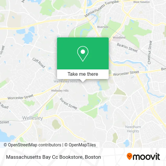
See Massachusetts Bay Cc Bookstore, Wellesley, on the map
Public Transit to Massachusetts Bay Cc Bookstore in Wellesley
Wondering how to get to Massachusetts Bay Cc Bookstore in Wellesley? Moovit helps you find the best way to get to Massachusetts Bay Cc Bookstore with step-by-step directions from the nearest public transit station.
Moovit provides free maps and live directions to help you navigate through your city. View schedules, routes, timetables, and find out how long does it take to get to Massachusetts Bay Cc Bookstore in real time.
Looking for the nearest stop or station to Massachusetts Bay Cc Bookstore? Check out this list of stops closest to your destination: Riverside; Wellesley Farms; Massbay Wellesley.
Bus: 59, MBRS, 01, MBCS.Train: FRAMINGHAM/WORCESTER.Subway: GREEN LINE D.
Want to see if there’s another route that gets you there at an earlier time? Moovit helps you find alternative routes or times. Get directions from and directions to Massachusetts Bay Cc Bookstore easily from the Moovit App or Website.
We make riding to Massachusetts Bay Cc Bookstore easy, which is why over 1.7 million users, including users in Wellesley, trust Moovit as the best app for public transit. You don’t need to download an individual bus app or train app, Moovit is your all-in-one transit app that helps you find the best bus time or train time available.
For information on prices of bus, subway and train, costs and ride fares to Massachusetts Bay Cc Bookstore, please check the Moovit app.
Use the app to navigate to popular places including to the airport, hospital, stadium, grocery store, mall, coffee shop, school, college, and university.
Massachusetts Bay Cc Bookstore Address: 50 Oakland St street in Wellesley
- Massbay Auditorium,
- MassBay Community College,
- Wellesley Symphony Orchestra,
- School,
- Save Massbay Forest,
- Sisters Of Charity / Mount St. Vincent,
- Paul Esposito Construction,
- Castles Unlimited,
- Wellesley Community Children Center After School Progrm,
- Frank M. Prall Electric,
- The Wilson Group,
- Scalliwags Infant Toddler Childcare,
- Peet's Coffee Wellesley,
- Video Games For Homeless Children,
- Association-Wellesley Family,
- New Beginnings,
- Alibaba Locksmith,
- New England Breast And Wellness,
- Pappas Karen DMD,
- Lois S Goodman MD
Places Near Massachusetts Bay Cc Bookstore (Wellesley)
- Boston Convention & Exhibition Center, Boston,
- Leader Bank Pavilion (Leader Bank Pavillion), Boston,
- Prudential Center, Boston,
- House Of Blues, Boston,
- Mgm Music Hall, Boston,
- Boston Children's Hospital, Boston,
- Boston Medical Center, Boston,
- Wang Theater, Boston,
- Faneuil Hall, Boston,
- Massachusetts General Hospital, Boston,
- Td Garden, Boston,
- Boston Common, Boston,
- Cheers, Boston,
- Museum Of Science, Boston,
- Quincy Market, Boston,
- North End, Boston,
- Isabella Stewart Gardner Museum, Boston,
- Wilbur Theatre, Boston,
- Castle Island, Boston,
- Seaport District, Boston
How to get to popular places in Boston with public transit
Get around Wellesley by public transit!
Traveling around Wellesley has never been so easy. See step by step directions as you travel to any attraction, street or major public transit station. View bus and train schedules, arrival times, service alerts and detailed routes on a map, so you know exactly how to get to anywhere in Wellesley.
When traveling to any destination around Wellesley use Moovit's Live Directions with Get Off Notifications to know exactly where and how far to walk, how long to wait for your line, and how many stops are left. Moovit will alert you when it's time to get off — no need to constantly re-check whether yours is the next stop.
Wondering how to use public transit in Wellesley or how to pay for public transit in Wellesley? Moovit public transit app can help you navigate your way with public transit easily, and at minimum cost. It includes public transit fees, ticket prices, and costs. Looking for a map of Wellesley public transit lines? Moovit public transit app shows all public transit maps in Wellesley with all Bus, Train, Subway and Ferry routes and stops on an interactive map.
Boston has 4 transit type(s), including: Bus, Train, Subway and Ferry, operated by several transit agencies, including MBTA, Southeastern Regional Transit Authority, MetroWest Regional Transit Authority, Rhode Island Public Transit Authority, WRTA, Lowell Regional Transit Authority, Merrimack Valley Transit, Montachusett Regional Transit Authority, Cape Cod Regional Transit Authority, Brockton Area Transit Authority, Martha's Vineyard Transit Authority, the WAVE - Nantucket Regional Transit Authority, GATRA, Cape Ann Transportation Authority and Massport