Directions to Massachusetts Fields School (Quincy) with public transportation
The following transit lines have routes that pass near Massachusetts Fields School
 Bus: 210, 217.
- Train: FALL RIVER/NEW BEDFORD, GREENBUSH.
- Subway: RED LINE, MATTAPAN LINE.
- Ferry: QUINCY FERRY, WINTHROP/QUINCY FERRY.
How to get to Massachusetts Fields School by bus?
Click on the bus route to see step by step directions with maps, line arrival times and updated time schedules.
From 245 Summer St, Boston
90 minFrom Spaulding Rehab, Boston
84 minFrom Renaissance Boston Waterfront Hotel (Renaissance Waterfront Conference Center), Boston
96 minFrom Earls Kitchen + Bar, Boston
85 minFrom MCPHS University-Boston, Boston
75 minFrom Park Plaza Hotel Boston, Boston
105 minFrom Astrazeneca Hope Lodge, Boston
87 minFrom Westin Copley Place Hotel Boston, Boston
102 minFrom Harvard T.H. Chan School of Public Health, Boston
74 minFrom Hilton Boston Back Bay, Boston
87 min
How to get to Massachusetts Fields School by train?
Click on the train route to see step by step directions with maps, line arrival times and updated time schedules.
From 245 Summer St, Boston
56 minFrom Spaulding Rehab, Boston
102 minFrom Renaissance Boston Waterfront Hotel (Renaissance Waterfront Conference Center), Boston
74 minFrom Earls Kitchen + Bar, Boston
76 minFrom MCPHS University-Boston, Boston
87 minFrom Park Plaza Hotel Boston, Boston
74 minFrom Westin Copley Place Hotel Boston, Boston
71 minFrom Harvard T.H. Chan School of Public Health, Boston
88 minFrom Hilton Boston Back Bay, Boston
80 min
How to get to Massachusetts Fields School by subway?
Click on the subway route to see step by step directions with maps, line arrival times and updated time schedules.
From 245 Summer St, Boston
29 minFrom Spaulding Rehab, Boston
76 minFrom Renaissance Boston Waterfront Hotel (Renaissance Waterfront Conference Center), Boston
47 minFrom Earls Kitchen + Bar, Boston
45 minFrom MCPHS University-Boston, Boston
57 minFrom Park Plaza Hotel Boston, Boston
43 minFrom Astrazeneca Hope Lodge, Boston
67 minFrom Westin Copley Place Hotel Boston, Boston
40 minFrom Harvard T.H. Chan School of Public Health, Boston
58 minFrom Hilton Boston Back Bay, Boston
50 min
Bus stops near Massachusetts Fields School in Quincy
Subway stations near Massachusetts Fields School in Quincy
Ferry station near Massachusetts Fields School in Quincy
- Quincy, 52 min walk,VIEW
Bus lines to Massachusetts Fields School in Quincy
What are the closest stations to Massachusetts Fields School?
The closest stations to Massachusetts Fields School are:
- Hancock St @ Chester St is 54 yards away, 1 min walk.
- W Elm Ave @ Gould St is 442 yards away, 6 min walk.
- Wollaston is 2931 yards away, 35 min walk.
- Quincy is 4425 yards away, 52 min walk.
- Cedar Grove is 5037 yards away, 59 min walk.
Which bus line stops near Massachusetts Fields School?
210 (Quincy Center)
Which train lines stop near Massachusetts Fields School?
These train lines stop near Massachusetts Fields School: FALL RIVER/NEW BEDFORD, GREENBUSH.
Which subway line stops near Massachusetts Fields School?
RED LINE (Ashmont/Braintree)
What’s the nearest bus station to Massachusetts Fields School in Quincy?
The nearest bus station to Massachusetts Fields School in Quincy is Hancock St @ Chester St. It’s a 1 min walk away.
What time is the first subway to Massachusetts Fields School in Quincy?
The MATTAPAN LINE is the first subway that goes to Massachusetts Fields School in Quincy. It stops nearby at 5:10 AM.
What time is the last subway to Massachusetts Fields School in Quincy?
The MATTAPAN LINE is the last subway that goes to Massachusetts Fields School in Quincy. It stops nearby at 2:31 AM.
What time is the first bus to Massachusetts Fields School in Quincy?
The 210 is the first bus that goes to Massachusetts Fields School in Quincy. It stops nearby at 5:04 AM.
What time is the last bus to Massachusetts Fields School in Quincy?
The 210 is the last bus that goes to Massachusetts Fields School in Quincy. It stops nearby at 1:12 AM.
What time is the first ferry to Massachusetts Fields School in Quincy?
The QUINCY FERRY is the first ferry that goes to Massachusetts Fields School in Quincy. It stops nearby at 6:15 AM.
What time is the last ferry to Massachusetts Fields School in Quincy?
The QUINCY FERRY is the last ferry that goes to Massachusetts Fields School in Quincy. It stops nearby at 8:55 PM.
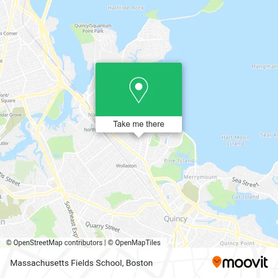
See Massachusetts Fields School, Quincy, on the map
Public Transit to Massachusetts Fields School in Quincy
Wondering how to get to Massachusetts Fields School in Quincy? Moovit helps you find the best way to get to Massachusetts Fields School with step-by-step directions from the nearest public transit station.
Moovit provides free maps and live directions to help you navigate through your city. View schedules, routes, timetables, and find out how long does it take to get to Massachusetts Fields School in real time.
Looking for the nearest stop or station to Massachusetts Fields School? Check out this list of stops closest to your destination: Hancock St @ Chester St; W Elm Ave @ Gould St; Wollaston; Quincy; Cedar Grove.
Bus: 210, 217.Train: FALL RIVER/NEW BEDFORD, GREENBUSH.Subway: RED LINE, MATTAPAN LINE.Ferry: QUINCY FERRY, WINTHROP/QUINCY FERRY.
Want to see if there’s another route that gets you there at an earlier time? Moovit helps you find alternative routes or times. Get directions from and directions to Massachusetts Fields School easily from the Moovit App or Website.
We make riding to Massachusetts Fields School easy, which is why over 1.7 million users, including users in Quincy, trust Moovit as the best app for public transit. You don’t need to download an individual bus app or train app, Moovit is your all-in-one transit app that helps you find the best bus time or train time available.
For information on prices of subway, bus and train, costs and ride fares to Massachusetts Fields School, please check the Moovit app.
Use the app to navigate to popular places including to the airport, hospital, stadium, grocery store, mall, coffee shop, school, college, and university.
Location: Quincy, Boston
- Angellash,
- Emergency A Locksmith,
- Extreme Locksmith of Quincy,
- Premier Masonry,
- Lianxing Corporation,
- Star Five Oil,
- Emily's Dog Care,
- Jimmys Five Star Painting,
- TLC Details,
- Ace Waterproofing,
- Cotter Paul F,
- We Fix Roofs,
- Gamma Locksmith,
- Qea,
- Brewster Ambulance Service,
- Brewster Ambulance,
- Christian Mana Church,
- Five J's Convenient & Lottery,
- Canterbury Hall,
- Edith Cove Fine Arts Center
Places Near Massachusetts Fields School (Quincy)
- Quincy Market, Boston,
- Museum Of Science, Boston,
- Cheers, Boston,
- North End, Boston,
- Castle Island, Boston,
- Seaport District, Boston,
- Wilbur Theatre, Boston,
- Td Garden, Boston,
- Mgm Music Hall, Boston,
- Isabella Stewart Gardner Museum, Boston,
- Boston Children's Hospital, Boston,
- Boston Medical Center, Boston,
- Wang Theater, Boston,
- House Of Blues, Boston,
- Prudential Center, Boston,
- Faneuil Hall, Boston,
- Leader Bank Pavilion (Leader Bank Pavillion), Boston,
- Boston Common, Boston,
- Massachusetts General Hospital, Boston,
- Boston Convention & Exhibition Center, Boston
How to get to popular places in Boston with public transit
Get around Quincy by public transit!
Traveling around Quincy has never been so easy. See step by step directions as you travel to any attraction, street or major public transit station. View bus and train schedules, arrival times, service alerts and detailed routes on a map, so you know exactly how to get to anywhere in Quincy.
When traveling to any destination around Quincy use Moovit's Live Directions with Get Off Notifications to know exactly where and how far to walk, how long to wait for your line, and how many stops are left. Moovit will alert you when it's time to get off — no need to constantly re-check whether yours is the next stop.
Wondering how to use public transit in Quincy or how to pay for public transit in Quincy? Moovit public transit app can help you navigate your way with public transit easily, and at minimum cost. It includes public transit fees, ticket prices, and costs. Looking for a map of Quincy public transit lines? Moovit public transit app shows all public transit maps in Quincy with all Bus, Train, Subway and Ferry routes and stops on an interactive map.
Boston has 4 transit type(s), including: Bus, Train, Subway and Ferry, operated by several transit agencies, including MBTA, Southeastern Regional Transit Authority, MetroWest Regional Transit Authority, Rhode Island Public Transit Authority, WRTA, Lowell Regional Transit Authority, Merrimack Valley Transit, Montachusett Regional Transit Authority, Cape Cod Regional Transit Authority, Brockton Area Transit Authority, Martha's Vineyard Transit Authority, the WAVE - Nantucket Regional Transit Authority, GATRA, Cape Ann Transportation Authority and Massport