Directions to Massachusetts House Of Representatives (Boston) with public transportation
The following transit lines have routes that pass near Massachusetts House Of Representatives
 Bus: 354, 43, 504, EZRIDE, SL5.
- Train: FAIRMOUNT, FRAMINGHAM/WORCESTER, HAVERHILL, NEEDHAM.
- Subway: GREEN LINE D, GREEN LINE E, ORANGE LINE, RED LINE, GREEN LINE B.
How to get to Massachusetts House Of Representatives by bus?
Click on the bus route to see step by step directions with maps, line arrival times and updated time schedules.
From Mount Auburn Hospital, Cambridge
73 minFrom Mspca, Boston
54 minFrom Arlington, MA, Arlington
71 minFrom Melrose, MA, Melrose
71 minFrom Qea, Quincy
116 minFrom FOUR POINTS BY SHERATON Boston Newton, Newton
34 minFrom Washington St, Boston
80 minFrom Arsenal Yards, Watertown Town
70 minFrom Sam Adams Boston Brewery Tour, Boston
51 minFrom The Mall At Chestnut Hill, Newton
85 min
How to get to Massachusetts House Of Representatives by train?
Click on the train route to see step by step directions with maps, line arrival times and updated time schedules.
How to get to Massachusetts House Of Representatives by subway?
Click on the subway route to see step by step directions with maps, line arrival times and updated time schedules.
Bus stops near Massachusetts House Of Representatives in Boston
- Temple Pl @ Washington St, 1 min walk,VIEW
- Tremont St Opp Temple Pl, 2 min walk,VIEW
- Park Street - Tremont St @ Winter St, 2 min walk,VIEW
- Park Street - Tremont St Opp Hamilton Pl, 4 min walk,VIEW
- Devonshire St @ Water St, 4 min walk,VIEW
- State St @ Washington Mall - State St Sta, 6 min walk,VIEW
- Cambridge St @ Government Ctr Sta, 7 min walk,VIEW
Subway stations near Massachusetts House Of Representatives in Boston
Bus lines to Massachusetts House Of Representatives in Boston
- SL5, Downtown,VIEW
- 15, Ruggles - Fields Corner,VIEW
- 39, Back Bay - Forest Hills,VIEW
- 43, Park St & Tremont St - Ruggles,VIEW
- 57, Kenmore - Watertown Yard,VIEW
- GREEN LINE E SHUTTLE, Heath Street - Park Street,VIEW
- GREEN LINE SHUTTLE, Boston University East - Park Street,VIEW
- RED LINE SHUTTLE, Harvard - South Station,VIEW
- RED LINE SHUTTLE, Ashmont - Park Street via Post Office,VIEW
- RED LINE SHUTTLE, JFK/UMass - Park Street via Post Office,VIEW
- RED LINE SHUTTLE, Park Street (Shuttle),VIEW
- RED LINE SHUTTLE, Kendall/MIT (Shuttle),VIEW
- RED LINE SHUTTLE, Broadway (Shuttle),VIEW
- RED LINE SHUTTLE, Alewife - Park Street,VIEW
- RED LINE SHUTTLE, JFK/UMass - Park Street,VIEW
- RED LINE SHUTTLE, Harvard - Park Street,VIEW
- 4, Design Center,VIEW
- 92, Downtown,VIEW
- 93, Downtown Via Navy Yard,VIEW
- 116, Wonderland Via Maverick,VIEW
What are the closest stations to Massachusetts House Of Representatives?
The closest stations to Massachusetts House Of Representatives are:
- Temple Pl @ Washington St is 10 yards away, 1 min walk.
- Tremont St Opp Temple Pl is 87 yards away, 2 min walk.
- Park Street is 115 yards away, 2 min walk.
- Park Street - Tremont St @ Winter St is 153 yards away, 2 min walk.
- Park Street - Tremont St Opp Hamilton Pl is 262 yards away, 4 min walk.
- Devonshire St @ Water St is 301 yards away, 4 min walk.
- State St @ Washington Mall - State St Sta is 404 yards away, 6 min walk.
- Bowdoin is 440 yards away, 6 min walk.
- State Street is 476 yards away, 6 min walk.
- Cambridge St @ Government Ctr Sta is 535 yards away, 7 min walk.
Which bus lines stop near Massachusetts House Of Representatives?
These bus lines stop near Massachusetts House Of Representatives: 354, 43, 504, EZRIDE, SL5.
Which train lines stop near Massachusetts House Of Representatives?
These train lines stop near Massachusetts House Of Representatives: FAIRMOUNT, FRAMINGHAM/WORCESTER, HAVERHILL, NEEDHAM.
Which subway lines stop near Massachusetts House Of Representatives?
These subway lines stop near Massachusetts House Of Representatives: GREEN LINE D, GREEN LINE E, ORANGE LINE, RED LINE.
What’s the nearest subway station to Massachusetts House Of Representatives in Boston?
The nearest subway station to Massachusetts House Of Representatives in Boston is Park Street. It’s a 2 min walk away.
What’s the nearest bus station to Massachusetts House Of Representatives in Boston?
The nearest bus station to Massachusetts House Of Representatives in Boston is Temple Pl @ Washington St. It’s a 1 min walk away.
What time is the first subway to Massachusetts House Of Representatives in Boston?
The GREEN LINE E is the first subway that goes to Massachusetts House Of Representatives in Boston. It stops nearby at 5:05 AM.
What time is the last subway to Massachusetts House Of Representatives in Boston?
The GREEN LINE E is the last subway that goes to Massachusetts House Of Representatives in Boston. It stops nearby at 2:20 AM.
What time is the first bus to Massachusetts House Of Representatives in Boston?
The 57 is the first bus that goes to Massachusetts House Of Representatives in Boston. It stops nearby at 5:02 AM.
What time is the last bus to Massachusetts House Of Representatives in Boston?
The 116 is the last bus that goes to Massachusetts House Of Representatives in Boston. It stops nearby at 1:58 AM.
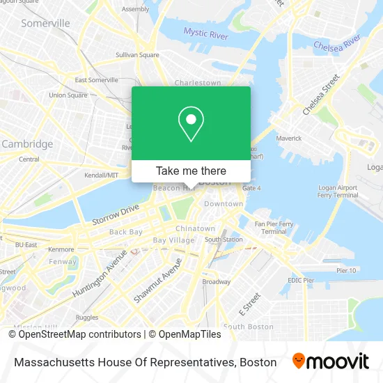
See Massachusetts House Of Representatives, Boston, on the map
Public Transit to Massachusetts House Of Representatives in Boston
Wondering how to get to Massachusetts House Of Representatives in Boston? Moovit helps you find the best way to get to Massachusetts House Of Representatives with step-by-step directions from the nearest public transit station.
Moovit provides free maps and live directions to help you navigate through your city. View schedules, routes, timetables, and find out how long does it take to get to Massachusetts House Of Representatives in real time.
Looking for the nearest stop or station to Massachusetts House Of Representatives? Check out this list of stops closest to your destination: Temple Pl @ Washington St; Tremont St Opp Temple Pl; Park Street; Park Street - Tremont St @ Winter St; Park Street - Tremont St Opp Hamilton Pl; Devonshire St @ Water St; State St @ Washington Mall - State St Sta; Bowdoin; State Street; Cambridge St @ Government Ctr Sta.
Bus: 354, 43, 504, EZRIDE, SL5, 15, 39, 57, GREEN LINE E SHUTTLE, RED LINE SHUTTLE, RED LINE SHUTTLE, RED LINE SHUTTLE.Train: FAIRMOUNT, FRAMINGHAM/WORCESTER, HAVERHILL, NEEDHAM.Subway: GREEN LINE D, GREEN LINE E, ORANGE LINE, RED LINE, GREEN LINE B, GREEN LINE C, BLUE LINE.
Want to see if there’s another route that gets you there at an earlier time? Moovit helps you find alternative routes or times. Get directions from and directions to Massachusetts House Of Representatives easily from the Moovit App or Website.
We make riding to Massachusetts House Of Representatives easy, which is why over 1.7 million users, including users in Boston, trust Moovit as the best app for public transit. You don’t need to download an individual bus app or train app, Moovit is your all-in-one transit app that helps you find the best bus time or train time available.
For information on prices of bus, subway and train, costs and ride fares to Massachusetts House Of Representatives, please check the Moovit app.
Use the app to navigate to popular places including to the airport, hospital, stadium, grocery store, mall, coffee shop, school, college, and university.
Massachusetts House Of Representatives Address: 24 Beacon St street in Boston
- Massachusetts State House,
- Back Bay,
- John F. Kennedy Statue,
- Beacon Hill,
- Paradise Travel,
- Owen Rooney Square,
- 21st Amendment,
- Michael J. Delhanty Square,
- Sutton Corner,
- Joy St & Mount Vernon St,
- Boston Athenaeum Library,
- Massachusetts Law Enforcement Memorial,
- Maid in Boston,
- Delightful Pleasures,
- XV Beacon Hotel,
- Mooo,
- Xv Beacon Hotel Boston,
- Massachusetts Office Of The Attorney General,
- Masonry Guys Boston,
- Hub Town Tours
Places Near Massachusetts House Of Representatives (Boston)
- House Of Blues, Boston,
- Prudential Center, Boston,
- Wang Theater, Boston,
- Boston Convention & Exhibition Center, Boston,
- Wilbur Theatre, Boston,
- Boston Children's Hospital, Boston,
- North End, Boston,
- Boston Medical Center, Boston,
- Boston Common, Boston,
- Museum Of Science, Boston,
- Td Garden, Boston,
- Mgm Music Hall, Boston,
- Massachusetts General Hospital, Boston,
- Faneuil Hall, Boston,
- Seaport District, Boston,
- Quincy Market, Boston,
- Isabella Stewart Gardner Museum, Boston,
- Cheers, Boston,
- Leader Bank Pavilion (Leader Bank Pavillion), Boston,
- Castle Island, Boston
How to get to popular places in Boston with public transit
Get around Boston by public transit!
Traveling around Boston has never been so easy. See step by step directions as you travel to any attraction, street or major public transit station. View bus and train schedules, arrival times, service alerts and detailed routes on a map, so you know exactly how to get to anywhere in Boston.
When traveling to any destination around Boston use Moovit's Live Directions with Get Off Notifications to know exactly where and how far to walk, how long to wait for your line, and how many stops are left. Moovit will alert you when it's time to get off — no need to constantly re-check whether yours is the next stop.
Wondering how to use public transit in Boston or how to pay for public transit in Boston? Moovit public transit app can help you navigate your way with public transit easily, and at minimum cost. It includes public transit fees, ticket prices, and costs. Looking for a map of Boston public transit lines? Moovit public transit app shows all public transit maps in Boston with all Bus, Train, Subway and Ferry routes and stops on an interactive map.
Boston has 4 transit type(s), including: Bus, Train, Subway and Ferry, operated by several transit agencies, including MBTA, Southeastern Regional Transit Authority, MetroWest Regional Transit Authority, Rhode Island Public Transit Authority, WRTA, Lowell Regional Transit Authority, Merrimack Valley Transit, Montachusett Regional Transit Authority, Cape Cod Regional Transit Authority, Brockton Area Transit Authority, Martha's Vineyard Transit Authority, the WAVE - Nantucket Regional Transit Authority, GATRA, Cape Ann Transportation Authority and Massport