How to get to Massasoit Community College by bus?
Click on the bus route to see step by step directions with maps, line arrival times and updated time schedules.
From davio's, Boston
60 minFrom New England Conservatory of Music, Boston
87 minFrom Dana Farber Cancer Institute, Boston
50 minFrom YMCA of Greater Boston, Boston
88 minFrom Target, Boston
94 minFrom new hampshire!, Boston
65 minFrom Yotel Boston, Boston
45 minFrom Fenway Park (Fenway Park, Home of the Boston Red Sox), Boston
76 minFrom Sunrise Shuttle Pick Up, Boston
31 minFrom Lechmere Station, Cambridge
64 min
How to get to Massasoit Community College by train?
Click on the train route to see step by step directions with maps, line arrival times and updated time schedules.
How to get to Massasoit Community College by subway?
Click on the subway route to see step by step directions with maps, line arrival times and updated time schedules.
From davio's, Boston
56 minFrom New England Conservatory of Music, Boston
58 minFrom YMCA of Greater Boston, Boston
59 minFrom Target, Boston
71 minFrom new hampshire!, Boston
67 minFrom Yotel Boston, Boston
59 minFrom Fenway Park (Fenway Park, Home of the Boston Red Sox), Boston
72 minFrom Sunrise Shuttle Pick Up, Boston
46 minFrom Lechmere Station, Cambridge
61 min
Bus stops near Massasoit Community College in Revere
Subway station near Massasoit Community College in Revere
- Orient Heights, 9 min walk,VIEW
Bus lines to Massasoit Community College in Revere
What are the closest stations to Massasoit Community College?
The closest stations to Massasoit Community College are:
- Broadway Opp Fernwood Ave is 65 yards away, 1 min walk.
- Broadway @ Central Ave is 174 yards away, 3 min walk.
- Orient Heights is 684 yards away, 9 min walk.
Which bus lines stop near Massasoit Community College?
These bus lines stop near Massasoit Community College: 110, 116, 119.
Which train line stops near Massasoit Community College?
NEWBURYPORT/ROCKPORT (#125 | Newburyport)
Which subway line stops near Massasoit Community College?
BLUE LINE (Wonderland)
What’s the nearest subway station to Massasoit Community College in Revere?
The nearest subway station to Massasoit Community College in Revere is Orient Heights. It’s a 9 min walk away.
What’s the nearest bus station to Massasoit Community College in Revere?
The nearest bus station to Massasoit Community College in Revere is Broadway Opp Fernwood Ave. It’s a 1 min walk away.
What time is the first subway to Massasoit Community College in Revere?
The BLUE LINE is the first subway that goes to Massasoit Community College in Revere. It stops nearby at 5:08 AM.
What time is the last subway to Massasoit Community College in Revere?
The BLUE LINE is the last subway that goes to Massasoit Community College in Revere. It stops nearby at 2:10 AM.
What time is the first bus to Massasoit Community College in Revere?
The 116 is the first bus that goes to Massasoit Community College in Revere. It stops nearby at 4:27 AM.
What time is the last bus to Massasoit Community College in Revere?
The 116 is the last bus that goes to Massasoit Community College in Revere. It stops nearby at 2:25 AM.
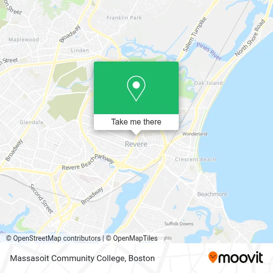
See Massasoit Community College, Revere, on the map
Public Transit to Massasoit Community College in Revere
Wondering how to get to Massasoit Community College in Revere? Moovit helps you find the best way to get to Massasoit Community College with step-by-step directions from the nearest public transit station.
Moovit provides free maps and live directions to help you navigate through your city. View schedules, routes, timetables, and find out how long does it take to get to Massasoit Community College in real time.
Looking for the nearest stop or station to Massasoit Community College? Check out this list of stops closest to your destination: Broadway Opp Fernwood Ave; Broadway @ Central Ave; Orient Heights.
Bus: 110, 116, 119, 411.Train: NEWBURYPORT/ROCKPORT.Subway: BLUE LINE.
Want to see if there’s another route that gets you there at an earlier time? Moovit helps you find alternative routes or times. Get directions from and directions to Massasoit Community College easily from the Moovit App or Website.
We make riding to Massasoit Community College easy, which is why over 1.7 million users, including users in Revere, trust Moovit as the best app for public transit. You don’t need to download an individual bus app or train app, Moovit is your all-in-one transit app that helps you find the best bus time or train time available.
For information on prices of bus, subway and train, costs and ride fares to Massasoit Community College, please check the Moovit app.
Use the app to navigate to popular places including to the airport, hospital, stadium, grocery store, mall, coffee shop, school, college, and university.
Massasoit Community College Address: 454 Broadway street in Revere
- Rite Aid,
- MBTA Bus 116 119 411,
- Atm Walgreens,
- TD Bank ATM,
- TD Bank,
- Staff Sergeant James J. Hill Elementary School,
- Sprint Store by Imobile,
- Harry Della Russo Memorial Stadium,
- Northeastern University,
- Fardad Mobed DMD,
- Revere, MA,
- Revere Pet Clinic (Boston Pet Clinics),
- Dinner Church,
- Lady Grace Intimate Apparel,
- American Legion Revere Post 61,
- Revere Beach,
- Oxigeno Beauty Salon,
- Revere Cab,
- Lenny's Barber Shop,
- Waugh's
Places Near Massasoit Community College (Revere)
- Boston Common, Boston,
- Quincy Market, Boston,
- Seaport District, Boston,
- Wang Theater, Boston,
- North End, Boston,
- House Of Blues, Boston,
- Boston Children's Hospital, Boston,
- Prudential Center, Boston,
- Boston Medical Center, Boston,
- Museum Of Science, Boston,
- Boston Convention & Exhibition Center, Boston,
- Wilbur Theatre, Boston,
- Td Garden, Boston,
- Cheers, Boston,
- Massachusetts General Hospital, Boston,
- Mgm Music Hall, Boston,
- Faneuil Hall, Boston,
- Leader Bank Pavilion (Leader Bank Pavillion), Boston,
- Isabella Stewart Gardner Museum, Boston,
- Castle Island, Boston
How to get to popular places in Boston with public transit
Get around Revere by public transit!
Traveling around Revere has never been so easy. See step by step directions as you travel to any attraction, street or major public transit station. View bus and train schedules, arrival times, service alerts and detailed routes on a map, so you know exactly how to get to anywhere in Revere.
When traveling to any destination around Revere use Moovit's Live Directions with Get Off Notifications to know exactly where and how far to walk, how long to wait for your line, and how many stops are left. Moovit will alert you when it's time to get off — no need to constantly re-check whether yours is the next stop.
Wondering how to use public transit in Revere or how to pay for public transit in Revere? Moovit public transit app can help you navigate your way with public transit easily, and at minimum cost. It includes public transit fees, ticket prices, and costs. Looking for a map of Revere public transit lines? Moovit public transit app shows all public transit maps in Revere with all Bus, Train, Subway and Ferry routes and stops on an interactive map.
Boston has 4 transit type(s), including: Bus, Train, Subway and Ferry, operated by several transit agencies, including MBTA, Southeastern Regional Transit Authority, MetroWest Regional Transit Authority, Rhode Island Public Transit Authority, WRTA, Lowell Regional Transit Authority, Merrimack Valley Transit, Montachusett Regional Transit Authority, Cape Cod Regional Transit Authority, Brockton Area Transit Authority, Martha's Vineyard Transit Authority, the WAVE - Nantucket Regional Transit Authority, GATRA, Cape Ann Transportation Authority and Massport