How to get to Master Fire Protection by bus?
Click on the bus route to see step by step directions with maps, line arrival times and updated time schedules.
Bus stops near Master Fire Protection in Worcester
What are the closest stations to Master Fire Protection?
The closest stations to Master Fire Protection are:
- Lovell St at Maywood is 8 yards away, 1 min walk.
- Park Ave + Beaver Brook Pkway is 732 yards away, 9 min walk.
Which bus lines stop near Master Fire Protection?
These bus lines stop near Master Fire Protection: 7, PETER PAN.
What’s the nearest bus station to Master Fire Protection in Worcester?
The nearest bus station to Master Fire Protection in Worcester is Lovell St at Maywood. It’s a 1 min walk away.
What time is the first bus to Master Fire Protection in Worcester?
The 7 is the first bus that goes to Master Fire Protection in Worcester. It stops nearby at 5:11 AM.
What time is the last bus to Master Fire Protection in Worcester?
The 825 is the last bus that goes to Master Fire Protection in Worcester. It stops nearby at 9:12 PM.
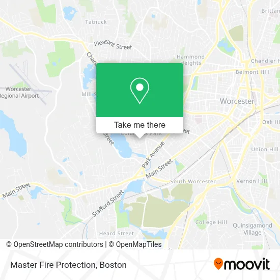
See Master Fire Protection, Worcester, on the map
Public Transit to Master Fire Protection in Worcester
Wondering how to get to Master Fire Protection in Worcester? Moovit helps you find the best way to get to Master Fire Protection with step-by-step directions from the nearest public transit station.
Moovit provides free maps and live directions to help you navigate through your city. View schedules, routes, timetables, and find out how long does it take to get to Master Fire Protection in real time.
Looking for the nearest stop or station to Master Fire Protection? Check out this list of stops closest to your destination: Lovell St at Maywood; Park Ave + Beaver Brook Pkway.
Bus: 7, PETER PAN, 825.
Want to see if there’s another route that gets you there at an earlier time? Moovit helps you find alternative routes or times. Get directions from and directions to Master Fire Protection easily from the Moovit App or Website.
We make riding to Master Fire Protection easy, which is why over 1.7 million users, including users in Worcester, trust Moovit as the best app for public transit. You don’t need to download an individual bus app or train app, Moovit is your all-in-one transit app that helps you find the best bus time or train time available.
For information on prices of bus and train, costs and ride fares to Master Fire Protection, please check the Moovit app.
Use the app to navigate to popular places including to the airport, hospital, stadium, grocery store, mall, coffee shop, school, college, and university.
Master Fire Protection Address: 18 Ferdinand St street in Worcester
- Rayito de Luz Family Day Care,
- Columbus Park School,
- Empire General Home Services,
- Samuel Hirst Three-Decker,
- Coes Knife Dam,
- High Quality Tile,
- Anokye Krom,
- Shalom Prayer Deliverance Musalla,
- Morning Star Christian Book & Music Stores,
- Hadwen Community Garden,
- Effective Waterproofing,
- Hak's Home PC Repair,
- Park Ave + Coes St,
- Society of Saint Vincents,
- Domitek,
- Mint Kitchen & Bar,
- Central Mass Window Cleaning,
- Coes Pond Parks,
- Quest Archery,
- Hadwen Arboretum at Clark University
Places Near Master Fire Protection (Worcester)
- Cheers, Boston,
- Wilbur Theatre, Boston,
- Mgm Music Hall, Boston,
- Boston Children's Hospital, Boston,
- Wang Theater, Boston,
- Isabella Stewart Gardner Museum, Boston,
- Td Garden, Boston,
- Massachusetts General Hospital, Boston,
- Boston Medical Center, Boston,
- Castle Island, Boston,
- Faneuil Hall, Boston,
- Boston Common, Boston,
- Seaport District, Boston,
- Museum Of Science, Boston,
- House Of Blues, Boston,
- Boston Convention & Exhibition Center, Boston,
- North End, Boston,
- Leader Bank Pavilion (Leader Bank Pavillion), Boston,
- Prudential Center, Boston,
- Quincy Market, Boston
How to get to popular places in Boston with public transit
Get around Worcester by public transit!
Traveling around Worcester has never been so easy. See step by step directions as you travel to any attraction, street or major public transit station. View bus and train schedules, arrival times, service alerts and detailed routes on a map, so you know exactly how to get to anywhere in Worcester.
When traveling to any destination around Worcester use Moovit's Live Directions with Get Off Notifications to know exactly where and how far to walk, how long to wait for your line, and how many stops are left. Moovit will alert you when it's time to get off — no need to constantly re-check whether yours is the next stop.
Wondering how to use public transit in Worcester or how to pay for public transit in Worcester? Moovit public transit app can help you navigate your way with public transit easily, and at minimum cost. It includes public transit fees, ticket prices, and costs. Looking for a map of Worcester public transit lines? Moovit public transit app shows all public transit maps in Worcester with all Bus, Train, Subway and Ferry routes and stops on an interactive map.
Boston has 4 transit type(s), including: Bus, Train, Subway and Ferry, operated by several transit agencies, including MBTA, Southeastern Regional Transit Authority, MetroWest Regional Transit Authority, Rhode Island Public Transit Authority, WRTA, Lowell Regional Transit Authority, Merrimack Valley Transit, Montachusett Regional Transit Authority, Cape Cod Regional Transit Authority, Brockton Area Transit Authority, Martha's Vineyard Transit Authority, the WAVE - Nantucket Regional Transit Authority, GATRA, Cape Ann Transportation Authority and Massport