How to get to Master Trapper by bus?
Click on the bus route to see step by step directions with maps, line arrival times and updated time schedules.
From Quarterdeck Restaurant, Arlington County
74 minFrom Inova Fairfax Hospital North Tower Building, Fairfax County
52 minFrom Hampton Inn & Suites Alexandria Old Town Area South, Fairfax County
55 minFrom The Westin Crystal City Hotel, Arlington County
44 minFrom Quarterdeck, Arlington County
73 minFrom US Marine Corps War Memorial (Iwo Jima), Arlington County
80 minFrom Inova Fairfax Hospital, Fairfax County
53 minFrom I-295 Exit 1 - Naval Research Lab, Washington
84 minFrom Arlington Central Library, Arlington County
60 min
How to get to Master Trapper by metro?
Click on the metro route to see step by step directions with maps, line arrival times and updated time schedules.
From Quarterdeck Restaurant, Arlington County
71 minFrom Hampton Inn & Suites Alexandria Old Town Area South, Fairfax County
72 minFrom The Westin Crystal City Hotel, Arlington County
51 minFrom Quarterdeck, Arlington County
71 minFrom US Marine Corps War Memorial (Iwo Jima), Arlington County
67 minFrom Arlington Central Library, Arlington County
74 min
Bus stops near Master Trapper in Alexandria
Metro station near Master Trapper in Alexandria
- Van Dorn Street Metro Station, 63 min walk,VIEW
Bus lines to Master Trapper in Alexandria
What are the closest stations to Master Trapper?
The closest stations to Master Trapper are:
- S Reynolds St+Duke St is 155 yards away, 3 min walk.
- West End Village is 340 yards away, 5 min walk.
- Duke St And N Ripley St is 354 yards away, 5 min walk.
- Rt 236 Duke St & Paxton St is 423 yards away, 6 min walk.
- Van Dorn Street Metro Station is 5396 yards away, 63 min walk.
Which bus lines stop near Master Trapper?
These bus lines stop near Master Trapper: 30, A27, F23.
Which metro line stops near Master Trapper?
BLUE (Franconia-Springfield)
What’s the nearest bus station to Master Trapper in Alexandria?
The nearest bus station to Master Trapper in Alexandria is S Reynolds St+Duke St. It’s a 3 min walk away.
What time is the first metro to Master Trapper in Alexandria?
The BLUE is the first metro that goes to Master Trapper in Alexandria. It stops nearby at 5:05 AM.
What time is the last metro to Master Trapper in Alexandria?
The BLUE is the last metro that goes to Master Trapper in Alexandria. It stops nearby at 12:39 AM.
What time is the first bus to Master Trapper in Alexandria?
The A27 is the first bus that goes to Master Trapper in Alexandria. It stops nearby at 4:46 AM.
What time is the last bus to Master Trapper in Alexandria?
The 30 is the last bus that goes to Master Trapper in Alexandria. It stops nearby at 1:22 AM.
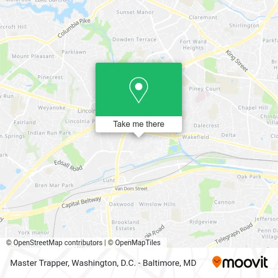
See Master Trapper, Alexandria, on the map
Public Transit to Master Trapper in Alexandria
Wondering how to get to Master Trapper in Alexandria? Moovit helps you find the best way to get to Master Trapper with step-by-step directions from the nearest public transit station.
Moovit provides free maps and live directions to help you navigate through your city. View schedules, routes, timetables, and find out how long does it take to get to Master Trapper in real time.
Looking for the nearest stop or station to Master Trapper? Check out this list of stops closest to your destination: S Reynolds St+Duke St; West End Village; Duke St And N Ripley St; Rt 236 Duke St & Paxton St; Van Dorn Street Metro Station.
Bus: 30, A27, F23, A28, 32, F24.Metro: BLUE.
Want to see if there’s another route that gets you there at an earlier time? Moovit helps you find alternative routes or times. Get directions from and directions to Master Trapper easily from the Moovit App or Website.
We make riding to Master Trapper easy, which is why over 1.5 million users, including users in Alexandria, trust Moovit as the best app for public transit. You don’t need to download an individual bus app or train app, Moovit is your all-in-one transit app that helps you find the best bus time or train time available.
For information on prices of bus and metro, costs and ride fares to Master Trapper, please check the Moovit app.
Use the app to navigate to popular places including to the airport, hospital, stadium, grocery store, mall, coffee shop, school, college, and university.
Master Trapper Address: 240 S Reynolds St Alexandria, VA 22304 street in Alexandria
- Equal Housing Opportunity,
- Credit Union 1,
- Amazon Locker-Cruz,
- WESTERN UNION,
- Ajs Pizza Cheesesteak,
- Reynolds St &,
- Sargsyan, Naira,
- S Reynolds St VA-236,
- Capital Lighting,
- Entrata, Inc.,
- Mason at van Dorn Apartments,
- The Tardis,
- Repair Rheem Furnaces Hvac,
- DHMS,
- F45 Training Landmark,
- Onekick Martial Arts of Alexandria,
- Wiggley Field Dog Park,
- LENS CRAFTERS,
- ChargePoint BMW,
- Pipe Maintenance Plumbers
Places Near Master Trapper (Alexandria)
- National Museum of African American History and Culture, Washington,
- Capital One Arena, Washington,
- National Mall, Washington,
- Washington DC VA Medical Center, Washington,
- Westfield Montgomery Mall, Montgomery County,
- Warner Theatre, Washington,
- Washington National Cathedral, Washington,
- Georgetown, Washington,
- Pennsylvania Ave NW (3rd st and pennsylvania), Washington,
- Amazon Hq2, Arlington County,
- Basilica of the National Shrine, Washington,
- M&T Bank Stadium, Baltimore,
- Camden Yards, Baltimore,
- Marriott Marquis Washington, DC, Washington,
- The Anthem, Washington,
- Rock Creek Tennis Center, Washington,
- Sibley Memorial Hospital, Washington,
- National Zoo, Washington,
- PG Mall, Prince George's County,
- Museum Of The Bible, Washington
How to get to popular places in Washington, D.C. - Baltimore, MD with public transit
Get around Alexandria by public transit!
Traveling around Alexandria has never been so easy. See step by step directions as you travel to any attraction, street or major public transit station. View bus and train schedules, arrival times, service alerts and detailed routes on a map, so you know exactly how to get to anywhere in Alexandria.
When traveling to any destination around Alexandria use Moovit's Live Directions with Get Off Notifications to know exactly where and how far to walk, how long to wait for your line, and how many stops are left. Moovit will alert you when it's time to get off — no need to constantly re-check whether yours is the next stop.
Wondering how to use public transit in Alexandria or how to pay for public transit in Alexandria? Moovit public transit app can help you navigate your way with public transit easily, and at minimum cost. It includes public transit fees, ticket prices, and costs. Looking for a map of Alexandria public transit lines? Moovit public transit app shows all public transit maps in Alexandria with all Bus, Train, Metro, Light Rail and Ferry routes and stops on an interactive map.
Washington, D.C. - Baltimore, MD has 5 transit type(s), including: Bus, Train, Metro, Light Rail and Ferry, operated by several transit agencies, including WMATA, Montgomery County Ride On, Fairfax Connector, TheBus, PRTC, DASH - Alexandria, Arlington Transit (ART), RTA of Central Maryland, MDOT MTA, MDOT MTA Light RailLink, MDOT MTA Commuter Bus, MDOT MTA Local Bus, FXBGO!, Virginia Railway Express (VRE) and MARC