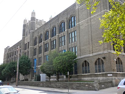
Directions to Mastery Charter Schools Shoemaker Campus (Philadelphia) with public transportation
The following transit lines have routes that pass near Mastery Charter Schools Shoemaker Campus
How to get to Mastery Charter Schools Shoemaker Campus by bus?
Click on the bus route to see step by step directions with maps, line arrival times and updated time schedules.
How to get to Mastery Charter Schools Shoemaker Campus by train?
Click on the train route to see step by step directions with maps, line arrival times and updated time schedules.
How to get to Mastery Charter Schools Shoemaker Campus by subway?
Click on the subway route to see step by step directions with maps, line arrival times and updated time schedules.
Bus stops near Mastery Charter Schools Shoemaker Campus in Philadelphia
- 52nd St & Warren St, 2 min walk,
Light Rail stations near Mastery Charter Schools Shoemaker Campus in Philadelphia
- Lansdowne Av & Lancaster Av, 2 min walk,
Bus lines to Mastery Charter Schools Shoemaker Campus in Philadelphia
- 52, Gladwyne Via 54th-City,
What are the closest stations to Mastery Charter Schools Shoemaker Campus?
The closest stations to Mastery Charter Schools Shoemaker Campus are:
- 52nd St & Warren St is 156 yards away, 2 min walk.
- Lansdowne Av & Lancaster Av is 163 yards away, 2 min walk.
Which bus lines stop near Mastery Charter Schools Shoemaker Campus?
These bus lines stop near Mastery Charter Schools Shoemaker Campus: 40, 52.
Which train line stops near Mastery Charter Schools Shoemaker Campus?
PAOLI/THORNDALE LINE
Which subway line stops near Mastery Charter Schools Shoemaker Campus?
MFL
Which light rail line stops near Mastery Charter Schools Shoemaker Campus?
10
What’s the nearest light rail station to Mastery Charter Schools Shoemaker Campus in Philadelphia?
The nearest light rail station to Mastery Charter Schools Shoemaker Campus in Philadelphia is Lansdowne Av & Lancaster Av. It’s a 2 min walk away.
What’s the nearest bus stop to Mastery Charter Schools Shoemaker Campus in Philadelphia?
The nearest bus stop to Mastery Charter Schools Shoemaker Campus in Philadelphia is 52nd St & Warren St. It’s a 2 min walk away.
See Mastery Charter Schools Shoemaker Campus, Philadelphia, on the map
Public Transit to Mastery Charter Schools Shoemaker Campus in Philadelphia
Wondering how to get to Mastery Charter Schools Shoemaker Campus in Philadelphia, United States? Moovit helps you find the best way to get to Mastery Charter Schools Shoemaker Campus with step-by-step directions from the nearest public transit station.
Moovit provides free maps and live directions to help you navigate through your city. View schedules, routes, timetables, and find out how long does it take to get to Mastery Charter Schools Shoemaker Campus in real time.
Looking for the nearest stop or station to Mastery Charter Schools Shoemaker Campus? Check out this list of stops closest to your destination: 52nd St & Warren St; Lansdowne Av & Lancaster Av.
Bus: 40, 52.Train: PAOLI/THORNDALE LINE.Subway: MFL.Light Rail: 10.
Want to see if there’s another route that gets you there at an earlier time? Moovit helps you find alternative routes or times. Get directions from and directions to Mastery Charter Schools Shoemaker Campus easily from the Moovit App or Website.
We make riding to Mastery Charter Schools Shoemaker Campus easy, which is why over 1.5 million users, including users in Philadelphia, trust Moovit as the best app for public transit. You don’t need to download an individual bus app or train app, Moovit is your all-in-one transit app that helps you find the best bus time or train time available.
For information on prices of bus, light rail, train and subway, costs and ride fares to Mastery Charter Schools Shoemaker Campus, please check the Moovit app.
Use the app to navigate to popular places including to the airport, hospital, stadium, grocery store, mall, coffee shop, school, college, and university.
Location: Philadelphia
Attractions near Mastery Charter Schools Shoemaker Campus
It's A Small World Daycare & Preschool,First Home Option Inc.,Mastery Charter School,Susan G Komen -Day 2 - Pit Stop 2,Soulful D'lite,Gain Ground Auto Sales Inc,Carribean Star & Grill,Opportunity Senior Apt,Septa Trolley - 10 (52nd St. & Lansdowne Ave),New Star Pizza,Penn Deli,Next Door,52 Bus Stop 52nd & Media,LR Food Market AKA Papi's,7-Eleven,Bible Way & Lancaster Ave 10 Stop,5215 Harlan Street,Honeybush Hair Studio,Truth Memorial baptist church,Heston Middle SchoolHow to get to popular attractions in Philadelphia with public transit
PA Turnpike Route 1 Exit, Bensalem,Broad Street & Packer Avenue, Philadelphia,SEPTA Bus Route 4, Philadelphia,12th & Callowhill, Philadelphia,SEPTA: 15 Trolley Line: 5th & Girard, Philadelphia,Exit 9A - North–South Freeway (Route 42),Cambria County Prison North Philly, Philadelphia,peco, Philadelphia,NJ Transit Train 3848 To NY, Princeton Junction,Sumneytown Pike & DeKalb Pike, Lower Gwynedd,Ghost Bus Parking Lot, Philadelphia,General Motors, Falls,HUP Pharmacy - Ravdin, Philadelphia,63rd & Callowhill street, Philadelphia,SEPTA 17 At 19th And JFK, Philadelphia,NJ Transit Washington Township Garage,Philadelphia International Airport Terminal C, Philadelphia,Broad & Tasker Street, Philadelphia,FedEx Cargo City, Tinicum,MacDade Blvd, WoodlynGet around Philadelphia by public transit!
Traveling around Philadelphia has never been so easy. See step by step directions as you travel to any attraction, street or major public transit station. View bus and train schedules, arrival times, service alerts and detailed routes on a map, so you know exactly how to get to anywhere in Philadelphia.
When traveling to any destination around Philadelphia use Moovit's Live Directions with Get Off Notifications to know exactly where and how far to walk, how long to wait for your line, and how many stops are left. Moovit will alert you when it's time to get off — no need to constantly re-check whether yours is the next stop.
Wondering how to use public transit in Philadelphia or how to pay for public transit in Philadelphia? Moovit public transit app can help you navigate your way with public transit easily, and at minimum cost. It includes public transit fees, ticket prices, and costs. Looking for a map of Philadelphia public transit lines? Moovit public transit app shows all public transit maps in Philadelphia with all Bus, Train, Subway, Light Rail and Cable Car routes and stops on an interactive map.
Philadelphia has 5 transit type(s), including: Bus, Train, Subway, Light Rail and Cable Car, operated by several transit agencies, including SEPTA Subway, SEPTA Trolley, SEPTA Rail, SEPTA, NJ TRANSIT RAIL-Rail, NJ TRANSIT RAIL-Tram, NJ TRANSIT BUS, Port Authority Transit Corporation, Navy Yard, Penn Transit, Drexel University, Pottstown Area Rapid Transit (PART), Fullington Tours, Chescobus, Amtrak