How to get to Materiales by bus?
Click on the bus route to see step by step directions with maps, line arrival times and updated time schedules.
From Templo De Guadalupe, Aguascalientes
55 minFrom Calle Privada Norberto Gómez Hornedo, Aguascalientes
48 minFrom Hospital de Psiquiatria Gustavo Leon Mojica Ga Dr, Aguascalientes
47 minFrom Jardín Del Mariachi, Aguascalientes
46 minFrom Avenida Eugenio Garza Sada, Aguascalientes
38 minFrom Avenida de la Convención de 1914 Norte, Aguascalientes
41 minFrom Valentin Gomez Farias, Aguascalientes
55 minFrom Av.Federico Méndez, Aguascalientes
53 minFrom Universidad Santa Fe, Aguascalientes
85 min
Bus stop near Materiales in Aguascalientes
- Hernández, 99, 4 min walk,VIEW
Bus lines to Materiales in Aguascalientes
What are the closest stations to Materiales?
The closest stations to Materiales are:
- Hernández, 99 is 234 meters away, 4 min walk.
Which bus lines stop near Materiales?
These bus lines stop near Materiales: RUTA 04, RUTA 06, RUTA 11, RUTA 28, RUTA 33.
What’s the nearest bus station to Materiales in Aguascalientes?
The nearest bus station to Materiales in Aguascalientes is Hernández, 99. It’s a 4 min walk away.
What time is the first bus to Materiales in Aguascalientes?
The RUTA 04 is the first bus that goes to Materiales in Aguascalientes. It stops nearby at 5:56 AM.
What time is the last bus to Materiales in Aguascalientes?
The RUTA 33 is the last bus that goes to Materiales in Aguascalientes. It stops nearby at 10:18 PM.
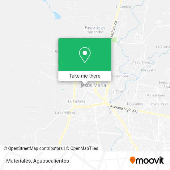
See Materiales, Aguascalientes, on the map
Public Transit to Materiales in Aguascalientes
Wondering how to get to Materiales in Aguascalientes? Moovit helps you find the best way to get to Materiales with step-by-step directions from the nearest public transit station.
Moovit provides free maps and live directions to help you navigate through your city. View schedules, routes, timetables, and find out how long does it take to get to Materiales in real time.
Looking for the nearest stop or station to Materiales? Check out this list of stops closest to your destination: Hernández.
Bus: RUTA 04, RUTA 06, RUTA 11, RUTA 28, RUTA 33.
Want to see if there’s another route that gets you there at an earlier time? Moovit helps you find alternative routes or times. Get directions from and directions to Materiales easily from the Moovit App or Website.
We make riding to Materiales easy, which is why over 1.5 million users, including users in Aguascalientes, trust Moovit as the best app for public transit. You don’t need to download an individual bus app or train app, Moovit is your all-in-one transit app that helps you find the best bus time or train time available.
For information on prices of bus, costs and ride fares to Materiales, please check the Moovit app.
Use the app to navigate to popular places including to the airport, hospital, stadium, grocery store, mall, coffee shop, school, college, and university.
Materiales Address: Materiales, Calle Ignacio Allende, Jesús María Centro, 20920 Jesús María, Aguascalientes street in Aguascalientes
- Tortas y Gorditas Lupita,
- Escuela Primaria Cuauhtémoc,
- Casa de la Cultura de Jesús María,
- Bancoppel,
- Tacos de Tripas Jessy,
- Geovani de la Cruz Flores,
- Centros Crecer Jesus Maria,
- Ferreteria Lopez,
- Fraccionamiento Ayuntamiento,
- Unidad Deportiva Jesús María,
- Panteon Jesus Maria,
- Ropa y Lenceria D Gladis,
- Inmobiliaria Lomeli Salas,
- Venta de Tortas,
- Mathy Papotas,
- Jardín de Eventos Los Pirules,
- Plasticos Loza de Barro,
- Abarrotes-Avenida San Lorenzo,
- Abarrotes Vinos y Licores Ojo de Agua,
- Distribuidora Leo
Places Near Materiales (Aguascalientes)
- Centro, Aguascalientes,
- Centro Comercial Altaria, Aguascalientes,
- Central De Autobuses, Aguascalientes,
- Villasuncion, Aguascalientes,
- Imss Clinica 1, Aguascalientes,
- clinica 3 uaa, Aguascalientes,
- Villas de Nuestra Señora de la Asunción, Aguascalientes,
- Parque Las Tres Centurias, Aguascalientes,
- Nuevo Hospital Hidalgo, Aguascalientes,
- Isla San Marcos, Aguascalientes,
- Hospital Imss No. 3, Aguascalientes,
- Agropecuario, Aguascalientes,
- Universidad Autónoma de Aguascalientes, Aguascalientes,
- ESPACIOS, Aguascalientes,
- Blvd. Luis Donaldo Colosio, Aguascalientes,
- La Isla San Marcos, Aguascalientes,
- Aeropuerto de Aguascalientes S.A. de C.V., Aguascalientes,
- Terminal De Combis, Aguascalientes,
- Ciudad industrial, Aguascalientes,
- Jesús María, Aguascalientes
How to get to popular places in Aguascalientes with public transit
Get around Aguascalientes by public transit!
Traveling around Aguascalientes has never been so easy. See step by step directions as you travel to any attraction, street or major public transit station. View bus and train schedules, arrival times, service alerts and detailed routes on a map, so you know exactly how to get to anywhere in Aguascalientes.
When traveling to any destination around Aguascalientes use Moovit's Live Directions with Get Off Notifications to know exactly where and how far to walk, how long to wait for your line, and how many stops are left. Moovit will alert you when it's time to get off — no need to constantly re-check whether yours is the next stop.
Wondering how to use public transit in Aguascalientes or how to pay for public transit in Aguascalientes? Moovit public transit app can help you navigate your way with public transit easily, and at minimum cost. It includes public transit fees, ticket prices, and costs. Looking for a map of Aguascalientes public transit lines? Moovit public transit app shows all public transit maps in Aguascalientes with all bus routes and stops on an interactive map.
Aguascalientes has 1 transit type(s), including: bus, operated by several transit agencies, including Coordinación General de Movilidad