Directions to Materials Science And Engineering (Worcester) with public transportation
The following transit lines have routes that pass near Materials Science And Engineering
 Bus: 3, 30, 31, CLINTON-WORCESTER COMMUTER SHUTTLE, GREYHOUND US0230.
- Train: FRAMINGHAM/WORCESTER.
How to get to Materials Science And Engineering by bus?
Click on the bus route to see step by step directions with maps, line arrival times and updated time schedules.
Bus stops near Materials Science And Engineering in Worcester
Bus lines to Materials Science And Engineering in Worcester
What are the closest stations to Materials Science And Engineering?
The closest stations to Materials Science And Engineering are:
- Grove St at Faraday is 77 yards away, 1 min walk.
- Highland St + Harvard St is 272 yards away, 4 min walk.
- Park Ave + Salisbury St is 925 yards away, 11 min walk.
Which bus lines stop near Materials Science And Engineering?
These bus lines stop near Materials Science And Engineering: 3, 30, 31, CLINTON-WORCESTER COMMUTER SHUTTLE, GREYHOUND US0230.
Which train line stops near Materials Science And Engineering?
FRAMINGHAM/WORCESTER (#525 | Worcester)
What’s the nearest bus station to Materials Science And Engineering in Worcester?
The nearest bus station to Materials Science And Engineering in Worcester is Grove St at Faraday. It’s a 1 min walk away.
What time is the first bus to Materials Science And Engineering in Worcester?
The 3 is the first bus that goes to Materials Science And Engineering in Worcester. It stops nearby at 5:13 AM.
What time is the last bus to Materials Science And Engineering in Worcester?
The 30 is the last bus that goes to Materials Science And Engineering in Worcester. It stops nearby at 10:39 PM.
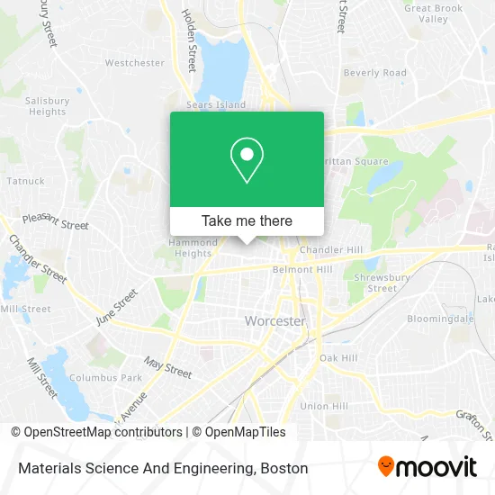
See Materials Science And Engineering, Worcester, on the map
Public Transit to Materials Science And Engineering in Worcester
Wondering how to get to Materials Science And Engineering in Worcester? Moovit helps you find the best way to get to Materials Science And Engineering with step-by-step directions from the nearest public transit station.
Moovit provides free maps and live directions to help you navigate through your city. View schedules, routes, timetables, and find out how long does it take to get to Materials Science And Engineering in real time.
Looking for the nearest stop or station to Materials Science And Engineering? Check out this list of stops closest to your destination: Grove St at Faraday; Highland St + Harvard St; Park Ave + Salisbury St.
Bus: 3, 30, 31, CLINTON-WORCESTER COMMUTER SHUTTLE, GREYHOUND US0230, 825.Train: FRAMINGHAM/WORCESTER.
Want to see if there’s another route that gets you there at an earlier time? Moovit helps you find alternative routes or times. Get directions from and directions to Materials Science And Engineering easily from the Moovit App or Website.
We make riding to Materials Science And Engineering easy, which is why over 1.7 million users, including users in Worcester, trust Moovit as the best app for public transit. You don’t need to download an individual bus app or train app, Moovit is your all-in-one transit app that helps you find the best bus time or train time available.
For information on prices of bus and train, costs and ride fares to Materials Science And Engineering, please check the Moovit app.
Use the app to navigate to popular places including to the airport, hospital, stadium, grocery store, mall, coffee shop, school, college, and university.
Materials Science And Engineering Address: Washburn Shops, 100 Institute Rd Rm 246A street in Worcester
- Wpi,
- Wpi Police,
- Wpi Pulse on Dining Marketplace,
- Worcester Polytechnic Institute - Summer Session,
- Vera Bradley,
- Wpi Beech Tree Circle,
- Vox Musical Theatre,
- Oodle,
- Alumni Field,
- Barnes & Noble Booksellers,
- Higgins Cafe,
- Boynton Hall,
- Logically Unique,
- Worcester Polytechnic Institute (WPI),
- Wpi Campus Center,
- STARBUCKS,
- TD Bank,
- Armenian Church of Our Savior the Parish House,
- CDC Systems,
- Theta Chi (Epsilon Chapter)
Places Near Materials Science And Engineering (Worcester)
- Museum Of Science, Boston,
- Td Garden, Boston,
- Leader Bank Pavilion (Leader Bank Pavillion), Boston,
- Massachusetts General Hospital, Boston,
- Boston Convention & Exhibition Center, Boston,
- Isabella Stewart Gardner Museum, Boston,
- House Of Blues, Boston,
- Seaport District, Boston,
- Wilbur Theatre, Boston,
- Quincy Market, Boston,
- Boston Medical Center, Boston,
- Prudential Center, Boston,
- North End, Boston,
- Cheers, Boston,
- Boston Common, Boston,
- Castle Island, Boston,
- Faneuil Hall, Boston,
- Boston Children's Hospital, Boston,
- Mgm Music Hall, Boston,
- Wang Theater, Boston
How to get to popular places in Boston with public transit
Get around Worcester by public transit!
Traveling around Worcester has never been so easy. See step by step directions as you travel to any attraction, street or major public transit station. View bus and train schedules, arrival times, service alerts and detailed routes on a map, so you know exactly how to get to anywhere in Worcester.
When traveling to any destination around Worcester use Moovit's Live Directions with Get Off Notifications to know exactly where and how far to walk, how long to wait for your line, and how many stops are left. Moovit will alert you when it's time to get off — no need to constantly re-check whether yours is the next stop.
Wondering how to use public transit in Worcester or how to pay for public transit in Worcester? Moovit public transit app can help you navigate your way with public transit easily, and at minimum cost. It includes public transit fees, ticket prices, and costs. Looking for a map of Worcester public transit lines? Moovit public transit app shows all public transit maps in Worcester with all Bus, Train, Subway and Ferry routes and stops on an interactive map.
Boston has 4 transit type(s), including: Bus, Train, Subway and Ferry, operated by several transit agencies, including MBTA, Southeastern Regional Transit Authority, MetroWest Regional Transit Authority, Rhode Island Public Transit Authority, WRTA, Lowell Regional Transit Authority, Merrimack Valley Transit, Montachusett Regional Transit Authority, Cape Cod Regional Transit Authority, Brockton Area Transit Authority, Martha's Vineyard Transit Authority, the WAVE - Nantucket Regional Transit Authority, GATRA, Cape Ann Transportation Authority and Massport