Directions to Matrix Usa (Newton) with public transportation
The following transit lines have routes that pass near Matrix Usa
 Bus: 52, 59.
- Train: NEEDHAM.
- Subway: GREEN LINE D.
How to get to Matrix Usa by bus?
Click on the bus route to see step by step directions with maps, line arrival times and updated time schedules.
From Arsenal Yards, Watertown Town
41 minFrom Dedham, MA, Dedham
125 minFrom Verb Hotel, Boston
70 minFrom Isabella Stewart Gardner Museum, Boston
69 minFrom Brigham & Women's Hospital, Boston
70 minFrom Beth Israel Hospital, Boston
69 minFrom Harvard Vanguard - Kenmore, Boston
69 minFrom Sweet Cheeks Q, Boston
84 minFrom Mspca, Boston
94 minFrom Boston University, Boston
63 min
How to get to Matrix Usa by train?
Click on the train route to see step by step directions with maps, line arrival times and updated time schedules.
From Dedham, MA, Dedham
102 minFrom Verb Hotel, Boston
108 minFrom Isabella Stewart Gardner Museum, Boston
82 minFrom Brigham & Women's Hospital, Boston
89 minFrom Beth Israel Hospital, Boston
89 minFrom Harvard Vanguard - Kenmore, Boston
106 minFrom Sweet Cheeks Q, Boston
109 minFrom Boston University, Boston
114 min
How to get to Matrix Usa by subway?
Click on the subway route to see step by step directions with maps, line arrival times and updated time schedules.
From Verb Hotel, Boston
51 minFrom Isabella Stewart Gardner Museum, Boston
59 minFrom Brigham & Women's Hospital, Boston
73 minFrom Beth Israel Hospital, Boston
51 minFrom Harvard Vanguard - Kenmore, Boston
50 minFrom Sweet Cheeks Q, Boston
52 minFrom Mspca, Boston
65 minFrom Boston University, Boston
66 min
Subway station near Matrix Usa in Newton
- Newton Centre, 1 min walk,VIEW
Bus stop near Matrix Usa in Newton
- Oak St @ Chestnut St, 2 min walk,VIEW
Train station near Matrix Usa in Newton
- Needham Heights, 23 min walk,VIEW
Bus lines to Matrix Usa in Newton
- 59, Needham Junction Via Needham St,VIEW
What are the closest stations to Matrix Usa?
The closest stations to Matrix Usa are:
- Newton Centre is 16 yards away, 1 min walk.
- Oak St @ Chestnut St is 148 yards away, 2 min walk.
- Needham Heights is 1935 yards away, 23 min walk.
Which bus lines stop near Matrix Usa?
These bus lines stop near Matrix Usa: 52, 59.
Which train line stops near Matrix Usa?
NEEDHAM (#617 | Needham Heights)
Which subway line stops near Matrix Usa?
GREEN LINE D (Riverside)
What’s the nearest subway station to Matrix Usa in Newton?
The nearest subway station to Matrix Usa in Newton is Newton Centre. It’s a 1 min walk away.
What’s the nearest train station to Matrix Usa in Newton?
The nearest train station to Matrix Usa in Newton is Needham Heights. It’s a 23 min walk away.
What’s the nearest bus station to Matrix Usa in Newton?
The nearest bus station to Matrix Usa in Newton is Oak St @ Chestnut St. It’s a 2 min walk away.
What time is the first subway to Matrix Usa in Newton?
The GREEN LINE D is the first subway that goes to Matrix Usa in Newton. It stops nearby at 4:48 AM.
What time is the last subway to Matrix Usa in Newton?
The GREEN LINE D is the last subway that goes to Matrix Usa in Newton. It stops nearby at 2:44 AM.
What time is the first train to Matrix Usa in Newton?
The NEEDHAM is the first train that goes to Matrix Usa in Newton. It stops nearby at 7:05 AM.
What time is the last train to Matrix Usa in Newton?
The NEEDHAM is the last train that goes to Matrix Usa in Newton. It stops nearby at 6:38 PM.
What time is the first bus to Matrix Usa in Newton?
The 59 is the first bus that goes to Matrix Usa in Newton. It stops nearby at 6:22 AM.
What time is the last bus to Matrix Usa in Newton?
The 59 is the last bus that goes to Matrix Usa in Newton. It stops nearby at 8:03 PM.
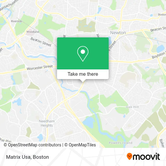
See Matrix Usa, Newton, on the map
Public Transit to Matrix Usa in Newton
Wondering how to get to Matrix Usa in Newton? Moovit helps you find the best way to get to Matrix Usa with step-by-step directions from the nearest public transit station.
Moovit provides free maps and live directions to help you navigate through your city. View schedules, routes, timetables, and find out how long does it take to get to Matrix Usa in real time.
Looking for the nearest stop or station to Matrix Usa? Check out this list of stops closest to your destination: Newton Centre; Oak St @ Chestnut St; Needham Heights.
Bus: 52, 59.Train: NEEDHAM.Subway: GREEN LINE D.
Want to see if there’s another route that gets you there at an earlier time? Moovit helps you find alternative routes or times. Get directions from and directions to Matrix Usa easily from the Moovit App or Website.
We make riding to Matrix Usa easy, which is why over 1.7 million users, including users in Newton, trust Moovit as the best app for public transit. You don’t need to download an individual bus app or train app, Moovit is your all-in-one transit app that helps you find the best bus time or train time available.
For information on prices of bus, subway and train, costs and ride fares to Matrix Usa, please check the Moovit app.
Use the app to navigate to popular places including to the airport, hospital, stadium, grocery store, mall, coffee shop, school, college, and university.
Matrix Usa Address: 233 Needham St street in Newton
- FedEx,
- Boston Psychiatric Care,
- Findbestquote,
- Carpe Diem Realty,
- Berkshire Wilton Partners,
- Kline and Gordon,
- rentometerpro,
- STARBUCKS,
- Lazzoni Furniture - Newton,
- Lifestyle Place,
- Newton Warehouse W,
- Marshalls,
- T.J. Maxx,
- Newton Upper Falls Lockman,
- Northland Investment,
- Adt Security Services,
- Antique Restoring Stud,
- Countryside School,
- Pressed,
- Nerds To Go
Places Near Matrix Usa (Newton)
- Massachusetts General Hospital, Boston,
- Boston Children's Hospital, Boston,
- Mgm Music Hall, Boston,
- Isabella Stewart Gardner Museum, Boston,
- Boston Common, Boston,
- Castle Island, Boston,
- Leader Bank Pavilion (Leader Bank Pavillion), Boston,
- Wilbur Theatre, Boston,
- Seaport District, Boston,
- Quincy Market, Boston,
- Boston Convention & Exhibition Center, Boston,
- House Of Blues, Boston,
- Td Garden, Boston,
- Prudential Center, Boston,
- Museum Of Science, Boston,
- Boston Medical Center, Boston,
- Wang Theater, Boston,
- Cheers, Boston,
- Faneuil Hall, Boston,
- North End, Boston
How to get to popular places in Boston with public transit
Get around Newton by public transit!
Traveling around Newton has never been so easy. See step by step directions as you travel to any attraction, street or major public transit station. View bus and train schedules, arrival times, service alerts and detailed routes on a map, so you know exactly how to get to anywhere in Newton.
When traveling to any destination around Newton use Moovit's Live Directions with Get Off Notifications to know exactly where and how far to walk, how long to wait for your line, and how many stops are left. Moovit will alert you when it's time to get off — no need to constantly re-check whether yours is the next stop.
Wondering how to use public transit in Newton or how to pay for public transit in Newton? Moovit public transit app can help you navigate your way with public transit easily, and at minimum cost. It includes public transit fees, ticket prices, and costs. Looking for a map of Newton public transit lines? Moovit public transit app shows all public transit maps in Newton with all Bus, Train, Subway and Ferry routes and stops on an interactive map.
Boston has 4 transit type(s), including: Bus, Train, Subway and Ferry, operated by several transit agencies, including MBTA, Southeastern Regional Transit Authority, MetroWest Regional Transit Authority, Rhode Island Public Transit Authority, WRTA, Lowell Regional Transit Authority, Merrimack Valley Transit, Montachusett Regional Transit Authority, Cape Cod Regional Transit Authority, Brockton Area Transit Authority, Martha's Vineyard Transit Authority, the WAVE - Nantucket Regional Transit Authority, GATRA, Cape Ann Transportation Authority and Massport