Directions to Matt Woods Coldwell Banker (Arlington) with public transportation
The following transit lines have routes that pass near Matt Woods Coldwell Banker
 Bus: 67, 77, 80, 95.
- Train: FITCHBURG, LOWELL.
- Subway: RED LINE, GREEN LINE B, GREEN LINE C, GREEN LINE E.
How to get to Matt Woods Coldwell Banker by bus?
Click on the bus route to see step by step directions with maps, line arrival times and updated time schedules.
From Coolidge Corner Theatre, Brookline
60 minFrom Canopy by Hilton Boston Downtown, Boston
56 minFrom Brigham & Women's Hospital, Boston
68 minFrom Hynes Convention Center, Boston
49 minFrom Inman Square, Cambridge
41 minFrom Kkkk, Boston
49 minFrom New England Conservatory of Music, Boston
52 minFrom Melrose Wakefield Hospital, Malden
75 minFrom The Freedom Trail, Boston
74 minFrom Orpheum Theatre (Orpheum Theatre Boston), Boston
73 min
How to get to Matt Woods Coldwell Banker by train?
Click on the train route to see step by step directions with maps, line arrival times and updated time schedules.
How to get to Matt Woods Coldwell Banker by subway?
Click on the subway route to see step by step directions with maps, line arrival times and updated time schedules.
From Coolidge Corner Theatre, Brookline
87 minFrom Canopy by Hilton Boston Downtown, Boston
67 minFrom Brigham & Women's Hospital, Boston
85 minFrom Hynes Convention Center, Boston
76 minFrom Inman Square, Cambridge
65 minFrom Kkkk, Boston
83 minFrom New England Conservatory of Music, Boston
72 minFrom Melrose Wakefield Hospital, Malden
86 minFrom The Freedom Trail, Boston
58 minFrom Orpheum Theatre (Orpheum Theatre Boston), Boston
57 min
Bus stops near Matt Woods Coldwell Banker in Arlington
Train stations near Matt Woods Coldwell Banker in Arlington
Subway stations near Matt Woods Coldwell Banker in Arlington
Bus lines to Matt Woods Coldwell Banker in Arlington
What are the closest stations to Matt Woods Coldwell Banker?
The closest stations to Matt Woods Coldwell Banker are:
- Pleasant St @ Wellington St is 20 yards away, 1 min walk.
- Massachusetts Ave @ Mystic St is 363 yards away, 5 min walk.
- Massachusetts Ave @ Medford St is 519 yards away, 7 min walk.
- Medford St @ Massachusetts Ave is 579 yards away, 7 min walk.
- Broadway @ Massachusetts Ave is 640 yards away, 8 min walk.
- Belmont is 2400 yards away, 28 min walk.
- Davis Sq. is 3336 yards away, 40 min walk.
- Medford/Tufts Station is 4421 yards away, 52 min walk.
- West Medford is 4640 yards away, 55 min walk.
Which bus lines stop near Matt Woods Coldwell Banker?
These bus lines stop near Matt Woods Coldwell Banker: 67, 77, 80, 95.
Which train lines stop near Matt Woods Coldwell Banker?
These train lines stop near Matt Woods Coldwell Banker: FITCHBURG, LOWELL.
Which subway line stops near Matt Woods Coldwell Banker?
RED LINE (Alewife)
What’s the nearest train station to Matt Woods Coldwell Banker in Arlington?
The nearest train station to Matt Woods Coldwell Banker in Arlington is Belmont. It’s a 28 min walk away.
What’s the nearest bus station to Matt Woods Coldwell Banker in Arlington?
The nearest bus station to Matt Woods Coldwell Banker in Arlington is Pleasant St @ Wellington St. It’s a 1 min walk away.
What time is the first subway to Matt Woods Coldwell Banker in Arlington?
The GREEN LINE E is the first subway that goes to Matt Woods Coldwell Banker in Arlington. It stops nearby at 4:57 AM.
What time is the last subway to Matt Woods Coldwell Banker in Arlington?
The GREEN LINE E is the last subway that goes to Matt Woods Coldwell Banker in Arlington. It stops nearby at 2:41 AM.
What time is the first train to Matt Woods Coldwell Banker in Arlington?
The LOWELL is the first train that goes to Matt Woods Coldwell Banker in Arlington. It stops nearby at 5:31 AM.
What time is the last train to Matt Woods Coldwell Banker in Arlington?
The LOWELL is the last train that goes to Matt Woods Coldwell Banker in Arlington. It stops nearby at 12:20 AM.
What time is the first bus to Matt Woods Coldwell Banker in Arlington?
The 77 is the first bus that goes to Matt Woods Coldwell Banker in Arlington. It stops nearby at 4:53 AM.
What time is the last bus to Matt Woods Coldwell Banker in Arlington?
The 80 is the last bus that goes to Matt Woods Coldwell Banker in Arlington. It stops nearby at 1:33 AM.
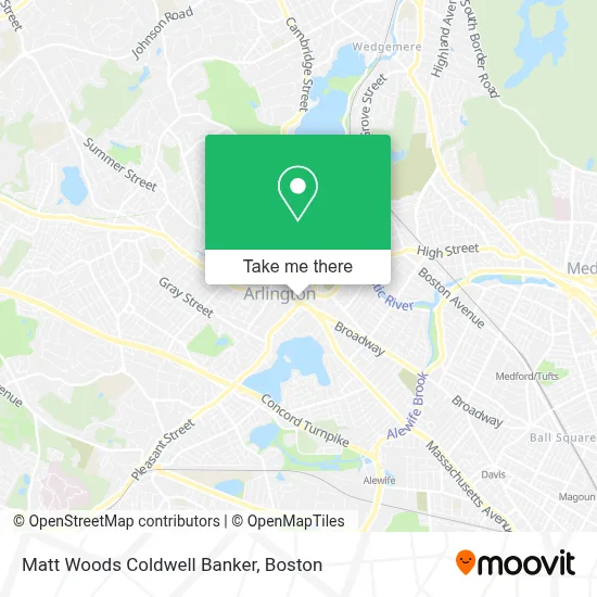
See Matt Woods Coldwell Banker, Arlington, on the map
Public Transit to Matt Woods Coldwell Banker in Arlington
Wondering how to get to Matt Woods Coldwell Banker in Arlington? Moovit helps you find the best way to get to Matt Woods Coldwell Banker with step-by-step directions from the nearest public transit station.
Moovit provides free maps and live directions to help you navigate through your city. View schedules, routes, timetables, and find out how long does it take to get to Matt Woods Coldwell Banker in real time.
Looking for the nearest stop or station to Matt Woods Coldwell Banker? Check out this list of stops closest to your destination: Pleasant St @ Wellington St; Massachusetts Ave @ Mystic St; Massachusetts Ave @ Medford St; Medford St @ Massachusetts Ave; Broadway @ Massachusetts Ave; Belmont; Davis Sq.; Medford/Tufts Station; West Medford.
Bus: 67, 77, 80, 95.Train: FITCHBURG, LOWELL.Subway: RED LINE, GREEN LINE B, GREEN LINE C, GREEN LINE E.
Want to see if there’s another route that gets you there at an earlier time? Moovit helps you find alternative routes or times. Get directions from and directions to Matt Woods Coldwell Banker easily from the Moovit App or Website.
We make riding to Matt Woods Coldwell Banker easy, which is why over 1.7 million users, including users in Arlington, trust Moovit as the best app for public transit. You don’t need to download an individual bus app or train app, Moovit is your all-in-one transit app that helps you find the best bus time or train time available.
For information on prices of bus, subway and train, costs and ride fares to Matt Woods Coldwell Banker, please check the Moovit app.
Use the app to navigate to popular places including to the airport, hospital, stadium, grocery store, mall, coffee shop, school, college, and university.
Matt Woods Coldwell Banker Address: 637 Massachusetts Ave street in Arlington
- Law Offices of Susan D Stamps,
- Home Carpet Cleaning,
- Tatte Bakery & Cafe,
- Uncle Sam Memorial Statue,
- Bank of America,
- Suming Sullivan Licsw,
- Donahue Jonathan LMHC,
- Designer Carpet Cleaning,
- VCA,
- Integrative Psychology,
- Arlington Pediatric Associates,
- Visiting Nurse & Community Health,
- The Sagov Center for Family Medicine,
- Let's Learn Together Childcare,
- Common Sense Massage,
- Cutter Gallery Arlington,
- Easy Does It Movements,
- Vintage Tea & Cake,
- Center Psychotherapy,
- The Daily Bloom
Places Near Matt Woods Coldwell Banker (Arlington)
- Wang Theater, Boston,
- Museum Of Science, Boston,
- Massachusetts General Hospital, Boston,
- Isabella Stewart Gardner Museum, Boston,
- Seaport District, Boston,
- Boston Common, Boston,
- Wilbur Theatre, Boston,
- Boston Medical Center, Boston,
- Td Garden, Boston,
- House Of Blues, Boston,
- Boston Convention & Exhibition Center, Boston,
- Leader Bank Pavilion (Leader Bank Pavillion), Boston,
- North End, Boston,
- Castle Island, Boston,
- Cheers, Boston,
- Prudential Center, Boston,
- Mgm Music Hall, Boston,
- Faneuil Hall, Boston,
- Quincy Market, Boston,
- Boston Children's Hospital, Boston
How to get to popular places in Boston with public transit
Get around Arlington by public transit!
Traveling around Arlington has never been so easy. See step by step directions as you travel to any attraction, street or major public transit station. View bus and train schedules, arrival times, service alerts and detailed routes on a map, so you know exactly how to get to anywhere in Arlington.
When traveling to any destination around Arlington use Moovit's Live Directions with Get Off Notifications to know exactly where and how far to walk, how long to wait for your line, and how many stops are left. Moovit will alert you when it's time to get off — no need to constantly re-check whether yours is the next stop.
Wondering how to use public transit in Arlington or how to pay for public transit in Arlington? Moovit public transit app can help you navigate your way with public transit easily, and at minimum cost. It includes public transit fees, ticket prices, and costs. Looking for a map of Arlington public transit lines? Moovit public transit app shows all public transit maps in Arlington with all Bus, Train, Subway and Ferry routes and stops on an interactive map.
Boston has 4 transit type(s), including: Bus, Train, Subway and Ferry, operated by several transit agencies, including MBTA, Southeastern Regional Transit Authority, MetroWest Regional Transit Authority, Rhode Island Public Transit Authority, WRTA, Lowell Regional Transit Authority, Merrimack Valley Transit, Montachusett Regional Transit Authority, Cape Cod Regional Transit Authority, Brockton Area Transit Authority, Martha's Vineyard Transit Authority, the WAVE - Nantucket Regional Transit Authority, GATRA, Cape Ann Transportation Authority and Massport