Directions to Matthew Waterhouse, Financial Advisor (Wellesley) with public transportation
The following transit lines have routes that pass near Matthew Waterhouse, Financial Advisor
 Bus: 59.
- Train: FRAMINGHAM/WORCESTER.
- Subway: GREEN LINE D.
How to get to Matthew Waterhouse, Financial Advisor by bus?
Click on the bus route to see step by step directions with maps, line arrival times and updated time schedules.
From 1 Brookline Place, Brookline
89 minFrom The Monument, Boston
124 minFrom Regina Pizzeria, Boston
85 minFrom Massachusetts General Hospital, Waltham
111 minFrom Boston University Track and Tennis Center, Boston
83 minFrom Brighton Music Hall, Boston
77 minFrom Jamaica Plain, Boston
121 minFrom Beth Israel Deaconess Medical Center, Brookline
89 minFrom New Balance, Boston
82 minFrom Homewood Suites by Hilton Boston Brookline-Longwood Medical, Brookline
91 min
How to get to Matthew Waterhouse, Financial Advisor by train?
Click on the train route to see step by step directions with maps, line arrival times and updated time schedules.
How to get to Matthew Waterhouse, Financial Advisor by subway?
Click on the subway route to see step by step directions with maps, line arrival times and updated time schedules.
From 1 Brookline Place, Brookline
50 minFrom The Monument, Boston
96 minFrom Regina Pizzeria, Boston
74 minFrom Boston University Track and Tennis Center, Boston
84 minFrom Brighton Music Hall, Boston
70 minFrom Jamaica Plain, Boston
94 minFrom Beth Israel Deaconess Medical Center, Brookline
51 minFrom New Balance, Boston
81 minFrom Homewood Suites by Hilton Boston Brookline-Longwood Medical, Brookline
54 min
Subway station near Matthew Waterhouse, Financial Advisor in Wellesley
- Woodland, 29 min walk,VIEW
What are the closest stations to Matthew Waterhouse, Financial Advisor?
The closest stations to Matthew Waterhouse, Financial Advisor are:
- Woodland is 2454 yards away, 29 min walk.
Which bus line stops near Matthew Waterhouse, Financial Advisor?
59 (Needham Junction Via Needham St)
Which train line stops near Matthew Waterhouse, Financial Advisor?
FRAMINGHAM/WORCESTER (#525 | Worcester)
Which subway line stops near Matthew Waterhouse, Financial Advisor?
GREEN LINE D (Riverside)
What’s the nearest subway station to Matthew Waterhouse, Financial Advisor in Wellesley?
The nearest subway station to Matthew Waterhouse, Financial Advisor in Wellesley is Woodland. It’s a 29 min walk away.
What time is the first subway to Matthew Waterhouse, Financial Advisor in Wellesley?
The GREEN LINE D is the first subway that goes to Matthew Waterhouse, Financial Advisor in Wellesley. It stops nearby at 4:45 AM.
What time is the last subway to Matthew Waterhouse, Financial Advisor in Wellesley?
The GREEN LINE D is the last subway that goes to Matthew Waterhouse, Financial Advisor in Wellesley. It stops nearby at 2:48 AM.
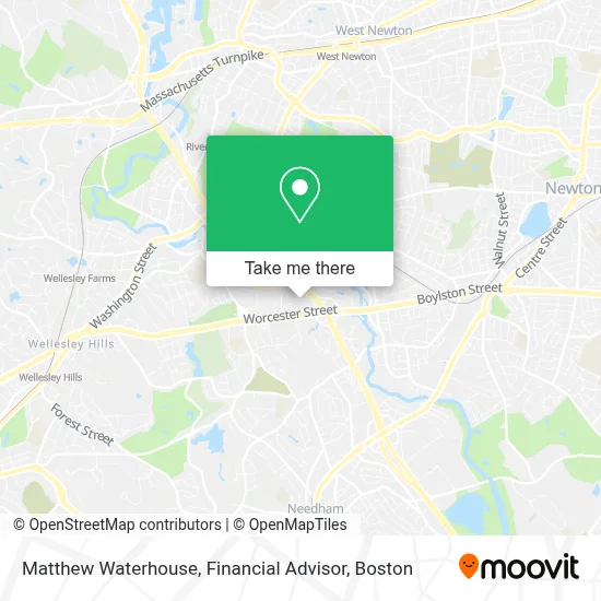
See Matthew Waterhouse, Financial Advisor, Wellesley, on the map
Public Transit to Matthew Waterhouse, Financial Advisor in Wellesley
Wondering how to get to Matthew Waterhouse, Financial Advisor in Wellesley? Moovit helps you find the best way to get to Matthew Waterhouse, Financial Advisor with step-by-step directions from the nearest public transit station.
Moovit provides free maps and live directions to help you navigate through your city. View schedules, routes, timetables, and find out how long does it take to get to Matthew Waterhouse, Financial Advisor in real time.
Looking for the nearest stop or station to Matthew Waterhouse, Financial Advisor? Check out this list of stops closest to your destination: Woodland.
Bus: 59.Train: FRAMINGHAM/WORCESTER.Subway: GREEN LINE D.
Want to see if there’s another route that gets you there at an earlier time? Moovit helps you find alternative routes or times. Get directions from and directions to Matthew Waterhouse, Financial Advisor easily from the Moovit App or Website.
We make riding to Matthew Waterhouse, Financial Advisor easy, which is why over 1.7 million users, including users in Wellesley, trust Moovit as the best app for public transit. You don’t need to download an individual bus app or train app, Moovit is your all-in-one transit app that helps you find the best bus time or train time available.
For information on prices of bus, subway and train, costs and ride fares to Matthew Waterhouse, Financial Advisor, please check the Moovit app.
Use the app to navigate to popular places including to the airport, hospital, stadium, grocery store, mall, coffee shop, school, college, and university.
Matthew Waterhouse, Financial Advisor Address: 93 Worcester St street in Wellesley
- Aetna,
- ADT 24 7 Alarm & Security,
- Gerald Bell at Guaranteed Rate (NMLS #1530076),
- The Mass Bar Association,
- Pierre Boursiquot at Guaranteed Rate ,
- Robert S Berman,
- Thomas E Ruggiero Clu CHFC and Albert Ruggiero,
- Grove Services,
- Tosti Crane Service,
- Sun Life Financial,
- The Health Insurance Exchange Marketplace,
- Dental Benefits,
- Medicaid de Virginia,
- Crystal Paving and Masonry,
- Unisys,
- Chiara U Laplume,
- Andrew Jurkunas - Financial Advisor, Ameriprise Financial Services,
- North Bridge Venture Partners,
- Blink Charging,
- Acer Therapeutics
Places Near Matthew Waterhouse, Financial Advisor (Wellesley)
- Museum Of Science, Boston,
- Leader Bank Pavilion (Leader Bank Pavillion), Boston,
- Faneuil Hall, Boston,
- Castle Island, Boston,
- Cheers, Boston,
- Boston Children's Hospital, Boston,
- Boston Medical Center, Boston,
- Boston Common, Boston,
- Wang Theater, Boston,
- House Of Blues, Boston,
- Boston Convention & Exhibition Center, Boston,
- Massachusetts General Hospital, Boston,
- Isabella Stewart Gardner Museum, Boston,
- Quincy Market, Boston,
- North End, Boston,
- Prudential Center, Boston,
- Mgm Music Hall, Boston,
- Wilbur Theatre, Boston,
- Td Garden, Boston,
- Seaport District, Boston
How to get to popular places in Boston with public transit
Get around Wellesley by public transit!
Traveling around Wellesley has never been so easy. See step by step directions as you travel to any attraction, street or major public transit station. View bus and train schedules, arrival times, service alerts and detailed routes on a map, so you know exactly how to get to anywhere in Wellesley.
When traveling to any destination around Wellesley use Moovit's Live Directions with Get Off Notifications to know exactly where and how far to walk, how long to wait for your line, and how many stops are left. Moovit will alert you when it's time to get off — no need to constantly re-check whether yours is the next stop.
Wondering how to use public transit in Wellesley or how to pay for public transit in Wellesley? Moovit public transit app can help you navigate your way with public transit easily, and at minimum cost. It includes public transit fees, ticket prices, and costs. Looking for a map of Wellesley public transit lines? Moovit public transit app shows all public transit maps in Wellesley with all Bus, Train, Subway and Ferry routes and stops on an interactive map.
Boston has 4 transit type(s), including: Bus, Train, Subway and Ferry, operated by several transit agencies, including MBTA, Southeastern Regional Transit Authority, MetroWest Regional Transit Authority, Rhode Island Public Transit Authority, WRTA, Lowell Regional Transit Authority, Merrimack Valley Transit, Montachusett Regional Transit Authority, Cape Cod Regional Transit Authority, Brockton Area Transit Authority, Martha's Vineyard Transit Authority, the WAVE - Nantucket Regional Transit Authority, GATRA, Cape Ann Transportation Authority and Massport