How to get to Maverick Mills by bus?
Click on the bus route to see step by step directions with maps, line arrival times and updated time schedules.
From James P. Kelleher Rose Garden, Boston
82 minFrom Studio Allston, Boston
99 minFrom VA Medical Center, Boston (Jamaica Plain), Boston
82 minFrom Harvard, Boston
94 minFrom Fresh Pond Mall, Cambridge
105 minFrom Massachusetts Eye And Ear, Boston
28 minFrom The 'Quin House, Boston
69 minFrom Boston Burger Company - Boston, Boston
79 minFrom Jamaica Plain VA Medical Center (VA Hospital), Boston
81 minFrom Astrazeneca Hope Lodge, Boston
80 min
How to get to Maverick Mills by train?
Click on the train route to see step by step directions with maps, line arrival times and updated time schedules.
How to get to Maverick Mills by subway?
Click on the subway route to see step by step directions with maps, line arrival times and updated time schedules.
From James P. Kelleher Rose Garden, Boston
55 minFrom VA Medical Center, Boston (Jamaica Plain), Boston
64 minFrom Harvard, Boston
53 minFrom Fresh Pond Mall, Cambridge
69 minFrom Massachusetts Eye And Ear, Boston
41 minFrom The 'Quin House, Boston
48 minFrom Boston Burger Company - Boston, Boston
46 minFrom Jamaica Plain VA Medical Center (VA Hospital), Boston
65 minFrom Astrazeneca Hope Lodge, Boston
64 min
Bus stops near Maverick Mills in Boston
Subway station near Maverick Mills in Boston
- Airport, 23 min walk,VIEW
Train station near Maverick Mills in Boston
- Chelsea, 37 min walk,VIEW
Bus lines to Maverick Mills in Boston
What are the closest stations to Maverick Mills?
The closest stations to Maverick Mills are:
- Mcclellan Highway @ Addison St is 23 yards away, 1 min walk.
- Chelsea St @ Curtis St is 544 yards away, 7 min walk.
- Bennington St @ Westbrook St is 577 yards away, 7 min walk.
- 270 Central Ave - Chelsea Garage is 1089 yards away, 13 min walk.
- 245 Central Ave is 1115 yards away, 14 min walk.
- Eastern Avenue is 1146 yards away, 14 min walk.
- Airport is 1921 yards away, 23 min walk.
- Chelsea is 3145 yards away, 37 min walk.
Which bus lines stop near Maverick Mills?
These bus lines stop near Maverick Mills: 104, 450, SL3.
Which train line stops near Maverick Mills?
NEWBURYPORT/ROCKPORT (#125 | Newburyport)
Which subway line stops near Maverick Mills?
BLUE LINE (Wonderland)
What’s the nearest subway station to Maverick Mills in Boston?
The nearest subway station to Maverick Mills in Boston is Airport. It’s a 23 min walk away.
What’s the nearest bus station to Maverick Mills in Boston?
The nearest bus station to Maverick Mills in Boston is Mcclellan Highway @ Addison St. It’s a 1 min walk away.
What time is the first subway to Maverick Mills in Boston?
The BLUE LINE is the first subway that goes to Maverick Mills in Boston. It stops nearby at 5:08 AM.
What time is the last subway to Maverick Mills in Boston?
The BLUE LINE is the last subway that goes to Maverick Mills in Boston. It stops nearby at 2:04 AM.
What time is the first train to Maverick Mills in Boston?
The NEWBURYPORT/ROCKPORT is the first train that goes to Maverick Mills in Boston. It stops nearby at 5:40 AM.
What time is the last train to Maverick Mills in Boston?
The NEWBURYPORT/ROCKPORT is the last train that goes to Maverick Mills in Boston. It stops nearby at 11:26 PM.
What time is the first bus to Maverick Mills in Boston?
The 771 is the first bus that goes to Maverick Mills in Boston. It stops nearby at 3:00 AM.
What time is the last bus to Maverick Mills in Boston?
The 771 is the last bus that goes to Maverick Mills in Boston. It stops nearby at 3:20 AM.
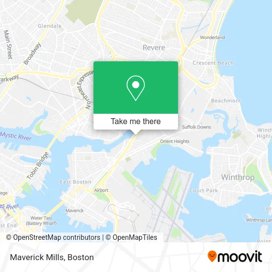
See Maverick Mills, Boston, on the map
Public Transit to Maverick Mills in Boston
Wondering how to get to Maverick Mills in Boston? Moovit helps you find the best way to get to Maverick Mills with step-by-step directions from the nearest public transit station.
Moovit provides free maps and live directions to help you navigate through your city. View schedules, routes, timetables, and find out how long does it take to get to Maverick Mills in real time.
Looking for the nearest stop or station to Maverick Mills? Check out this list of stops closest to your destination: Mcclellan Highway @ Addison St; Chelsea St @ Curtis St; Bennington St @ Westbrook St; 270 Central Ave - Chelsea Garage; 245 Central Ave; Eastern Avenue; Airport; Chelsea.
Bus: 104, 450, SL3, 112, 120, 771, 772, 773.Train: NEWBURYPORT/ROCKPORT.Subway: BLUE LINE.
Want to see if there’s another route that gets you there at an earlier time? Moovit helps you find alternative routes or times. Get directions from and directions to Maverick Mills easily from the Moovit App or Website.
We make riding to Maverick Mills easy, which is why over 1.7 million users, including users in Boston, trust Moovit as the best app for public transit. You don’t need to download an individual bus app or train app, Moovit is your all-in-one transit app that helps you find the best bus time or train time available.
For information on prices of subway, bus and train, costs and ride fares to Maverick Mills, please check the Moovit app.
Use the app to navigate to popular places including to the airport, hospital, stadium, grocery store, mall, coffee shop, school, college, and university.
Maverick Mills Address: 175 McClennan Hwy street in Boston
- Fastest Labs Boston,
- Carnaval Salvadoreno,
- Blue Nile Livery,
- American Expediting,
- Ansi 107 Class 3,
- Clothes Encounters,
- Bright Home Solutions,
- Eduardos Auto Body,
- Massport Employee Chelsea Garage Shuttle,
- Courtyard by Marriott Boston Logan Airport,
- Happy Valley - Boston,
- Enterprise,
- Dartmouth College,
- East Boston Neighborhood Health Center Education & Training Institute,
- Bunker Hill Community College,
- Cheverus School Apts,
- PreFlight Airport Parking,
- Edward Brooke Charter School - East Boston,
- Salesian Boys & Girls Club Of East Boston,
- Marriott Town Place Suites
Places Near Maverick Mills (Boston)
- Td Garden, Boston,
- House Of Blues, Boston,
- Museum Of Science, Boston,
- Castle Island, Boston,
- Boston Children's Hospital, Boston,
- Quincy Market, Boston,
- Faneuil Hall, Boston,
- Mgm Music Hall, Boston,
- Boston Common, Boston,
- Seaport District, Boston,
- Wilbur Theatre, Boston,
- North End, Boston,
- Boston Medical Center, Boston,
- Leader Bank Pavilion (Leader Bank Pavillion), Boston,
- Massachusetts General Hospital, Boston,
- Cheers, Boston,
- Wang Theater, Boston,
- Prudential Center, Boston,
- Boston Convention & Exhibition Center, Boston,
- Isabella Stewart Gardner Museum, Boston
How to get to popular places in Boston with public transit
Get around Boston by public transit!
Traveling around Boston has never been so easy. See step by step directions as you travel to any attraction, street or major public transit station. View bus and train schedules, arrival times, service alerts and detailed routes on a map, so you know exactly how to get to anywhere in Boston.
When traveling to any destination around Boston use Moovit's Live Directions with Get Off Notifications to know exactly where and how far to walk, how long to wait for your line, and how many stops are left. Moovit will alert you when it's time to get off — no need to constantly re-check whether yours is the next stop.
Wondering how to use public transit in Boston or how to pay for public transit in Boston? Moovit public transit app can help you navigate your way with public transit easily, and at minimum cost. It includes public transit fees, ticket prices, and costs. Looking for a map of Boston public transit lines? Moovit public transit app shows all public transit maps in Boston with all Bus, Train, Subway and Ferry routes and stops on an interactive map.
Boston has 4 transit type(s), including: Bus, Train, Subway and Ferry, operated by several transit agencies, including MBTA, Southeastern Regional Transit Authority, MetroWest Regional Transit Authority, Rhode Island Public Transit Authority, WRTA, Lowell Regional Transit Authority, Merrimack Valley Transit, Montachusett Regional Transit Authority, Cape Cod Regional Transit Authority, Brockton Area Transit Authority, Martha's Vineyard Transit Authority, the WAVE - Nantucket Regional Transit Authority, GATRA, Cape Ann Transportation Authority and Massport