Directions to Mayer + Associates Architects (Newton) with public transportation
The following transit lines have routes that pass near Mayer + Associates Architects
 Bus: 505, 52, 59, GREEN LINE D SHUTTLE, GREEN LINE D SHUTTLE.
- Train: FRAMINGHAM/WORCESTER.
- Subway: GREEN LINE D.
How to get to Mayer + Associates Architects by bus?
Click on the bus route to see step by step directions with maps, line arrival times and updated time schedules.
From Mission Hill, Boston
82 minFrom Faulkner Hospital, Boston
98 minFrom Raising Cane's, Boston
77 minFrom Forest Hills Station MBTA, Boston
83 minFrom Mount Auburn Hospital, Cambridge
65 minFrom Jamaica Plain VA Medical Center (VA Hospital), Boston
88 minFrom DoubleTree Suites by Hilton Hotel Boston - Cambridge, Boston
74 minFrom 110 Francis Street Garage, Boston
84 minFrom Christian A Herter Park, Boston
69 minFrom Scullers Jazz Club, Boston
74 min
How to get to Mayer + Associates Architects by train?
Click on the train route to see step by step directions with maps, line arrival times and updated time schedules.
How to get to Mayer + Associates Architects by subway?
Click on the subway route to see step by step directions with maps, line arrival times and updated time schedules.
From Mission Hill, Boston
35 minFrom Faulkner Hospital, Boston
83 minFrom Raising Cane's, Boston
55 minFrom Forest Hills Station MBTA, Boston
62 minFrom Mount Auburn Hospital, Cambridge
80 minFrom Jamaica Plain VA Medical Center (VA Hospital), Boston
40 minFrom DoubleTree Suites by Hilton Hotel Boston - Cambridge, Boston
77 minFrom 110 Francis Street Garage, Boston
37 minFrom Scullers Jazz Club, Boston
78 min
Bus stop near Mayer + Associates Architects in Newton
- Waban - Beacon St @ Waban, 16 min walk,VIEW
Subway station near Mayer + Associates Architects in Newton
- Riverside, 29 min walk,VIEW
Bus lines to Mayer + Associates Architects in Newton
- GREEN LINE D SHUTTLE, Riverside - Newton Highlands,VIEW
- GREEN LINE D SHUTTLE, Riverside - Brookline Village,VIEW
- GREEN LINE D SHUTTLE, Riverside - Copley (Shuttle),VIEW
- GREEN LINE D SHUTTLE, Riverside - Brookline Hills,VIEW
- GREEN LINE D SHUTTLE, Riverside - Reservoir,VIEW
- GREEN LINE D SHUTTLE, Riverside - Kenmore,VIEW
- GREEN LINE D SHUTTLE, Riverside - Fenway,VIEW
- GREEN LINE D SHUTTLE, Riverside - Kenmore via Saint Mary's Street,VIEW
- GREEN LINE D SHUTTLE, Riverside - Kenmore (Shuttle),VIEW
What are the closest stations to Mayer + Associates Architects?
The closest stations to Mayer + Associates Architects are:
- Waban - Beacon St @ Waban is 1298 yards away, 16 min walk.
- Riverside is 2372 yards away, 29 min walk.
Which bus lines stop near Mayer + Associates Architects?
These bus lines stop near Mayer + Associates Architects: 505, 52, 59.
Which train line stops near Mayer + Associates Architects?
FRAMINGHAM/WORCESTER (#525 | Worcester)
Which subway line stops near Mayer + Associates Architects?
GREEN LINE D (Riverside)
What’s the nearest subway station to Mayer + Associates Architects in Newton?
The nearest subway station to Mayer + Associates Architects in Newton is Riverside. It’s a 29 min walk away.
What time is the first subway to Mayer + Associates Architects in Newton?
The GREEN LINE D is the first subway that goes to Mayer + Associates Architects in Newton. It stops nearby at 4:45 AM.
What time is the last subway to Mayer + Associates Architects in Newton?
The GREEN LINE D is the last subway that goes to Mayer + Associates Architects in Newton. It stops nearby at 2:48 AM.
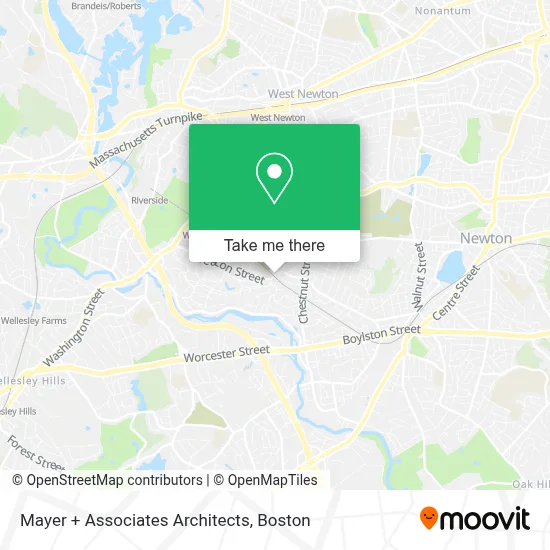
See Mayer + Associates Architects, Newton, on the map
Public Transit to Mayer + Associates Architects in Newton
Wondering how to get to Mayer + Associates Architects in Newton? Moovit helps you find the best way to get to Mayer + Associates Architects with step-by-step directions from the nearest public transit station.
Moovit provides free maps and live directions to help you navigate through your city. View schedules, routes, timetables, and find out how long does it take to get to Mayer + Associates Architects in real time.
Looking for the nearest stop or station to Mayer + Associates Architects? Check out this list of stops closest to your destination: Waban - Beacon St @ Waban; Riverside.
Bus: 505, 52, 59, GREEN LINE D SHUTTLE, GREEN LINE D SHUTTLE, GREEN LINE D SHUTTLE, GREEN LINE D SHUTTLE, GREEN LINE D SHUTTLE.Train: FRAMINGHAM/WORCESTER.Subway: GREEN LINE D.
Want to see if there’s another route that gets you there at an earlier time? Moovit helps you find alternative routes or times. Get directions from and directions to Mayer + Associates Architects easily from the Moovit App or Website.
We make riding to Mayer + Associates Architects easy, which is why over 1.7 million users, including users in Newton, trust Moovit as the best app for public transit. You don’t need to download an individual bus app or train app, Moovit is your all-in-one transit app that helps you find the best bus time or train time available.
For information on prices of bus, subway and train, costs and ride fares to Mayer + Associates Architects, please check the Moovit app.
Use the app to navigate to popular places including to the airport, hospital, stadium, grocery store, mall, coffee shop, school, college, and university.
Mayer + Associates Architects Address: 1647 Beacon St street in Newton
- Waban T - MBTA station,
- Starbucks,
- Waban, MA,
- Angier Elementary School,
- Locksmith A1,
- Chiropractors Accept Aetna,
- Rick?S Unlock Service,
- Beacon Hill,
- Cafe Services - W,
- Ubs AG,
- Northwestern Mutl Financial Network,
- Staubach Co.,
- NM,
- Equity Office Fitness Center,
- Equity Office Properties,
- Acer Therapeutics,
- Vaccine Technologies,
- Curtin Financial Management,
- Stanzler Levine,
- Wellesley Office Park
Places Near Mayer + Associates Architects (Newton)
- Isabella Stewart Gardner Museum, Boston,
- House Of Blues, Boston,
- Boston Common, Boston,
- Cheers, Boston,
- Leader Bank Pavilion (Leader Bank Pavillion), Boston,
- Wang Theater, Boston,
- Quincy Market, Boston,
- Boston Convention & Exhibition Center, Boston,
- Massachusetts General Hospital, Boston,
- Mgm Music Hall, Boston,
- Seaport District, Boston,
- Wilbur Theatre, Boston,
- Castle Island, Boston,
- Boston Medical Center, Boston,
- Prudential Center, Boston,
- North End, Boston,
- Museum Of Science, Boston,
- Boston Children's Hospital, Boston,
- Td Garden, Boston,
- Faneuil Hall, Boston
How to get to popular places in Boston with public transit
Get around Newton by public transit!
Traveling around Newton has never been so easy. See step by step directions as you travel to any attraction, street or major public transit station. View bus and train schedules, arrival times, service alerts and detailed routes on a map, so you know exactly how to get to anywhere in Newton.
When traveling to any destination around Newton use Moovit's Live Directions with Get Off Notifications to know exactly where and how far to walk, how long to wait for your line, and how many stops are left. Moovit will alert you when it's time to get off — no need to constantly re-check whether yours is the next stop.
Wondering how to use public transit in Newton or how to pay for public transit in Newton? Moovit public transit app can help you navigate your way with public transit easily, and at minimum cost. It includes public transit fees, ticket prices, and costs. Looking for a map of Newton public transit lines? Moovit public transit app shows all public transit maps in Newton with all Bus, Train, Subway and Ferry routes and stops on an interactive map.
Boston has 4 transit type(s), including: Bus, Train, Subway and Ferry, operated by several transit agencies, including MBTA, Southeastern Regional Transit Authority, MetroWest Regional Transit Authority, Rhode Island Public Transit Authority, WRTA, Lowell Regional Transit Authority, Merrimack Valley Transit, Montachusett Regional Transit Authority, Cape Cod Regional Transit Authority, Brockton Area Transit Authority, Martha's Vineyard Transit Authority, the WAVE - Nantucket Regional Transit Authority, GATRA, Cape Ann Transportation Authority and Massport