Directions to Maynard Buehler House (Orinda) with public transportation
The following transit lines have routes that pass near Maynard Buehler House
How to get to Maynard Buehler House by BART?
Click on the BART route to see step by step directions with maps, line arrival times and updated time schedules.
Bus stops near Maynard Buehler House in Orinda
- Moraga Way and Casa Vieja, 4 min walk,
Bart stations near Maynard Buehler House in Orinda
- Orinda, 32 min walk,
Bus lines to Maynard Buehler House in Orinda
- 6, Lafayette BART via St Marys College,
- 606, Orinda/Miner Rd,
What are the closest stations to Maynard Buehler House?
The closest stations to Maynard Buehler House are:
- Moraga Way and Casa Vieja is 288 yards away, 4 min walk.
- Orinda is 2717 yards away, 32 min walk.
Which bus line stops near Maynard Buehler House?
6
Which BART line stops near Maynard Buehler House?
YELLOW
What’s the nearest bus stop to Maynard Buehler House in Orinda?
The nearest bus stop to Maynard Buehler House in Orinda is Moraga Way and Casa Vieja. It’s a 4 min walk away.
What time is the first BART to Maynard Buehler House in Orinda?
The YELLOW is the first BART that goes to Maynard Buehler House in Orinda. It stops nearby at 4:58 AM.
What time is the last BART to Maynard Buehler House in Orinda?
The YELLOW is the last BART that goes to Maynard Buehler House in Orinda. It stops nearby at 1:01 AM.
What time is the first bus to Maynard Buehler House in Orinda?
The 6 is the first bus that goes to Maynard Buehler House in Orinda. It stops nearby at 6:18 AM.
What time is the last bus to Maynard Buehler House in Orinda?
The 6 is the last bus that goes to Maynard Buehler House in Orinda. It stops nearby at 7:32 PM.
How much is the BART fare to Maynard Buehler House?
The BART fare to Maynard Buehler House costs about $2.15 - $14.35.
See Maynard Buehler House, Orinda, on the map
Public Transit to Maynard Buehler House in Orinda
Wondering how to get to Maynard Buehler House in Orinda, United States? Moovit helps you find the best way to get to Maynard Buehler House with step-by-step directions from the nearest public transit station.
Moovit provides free maps and live directions to help you navigate through your city. View schedules, routes, timetables, and find out how long does it take to get to Maynard Buehler House in real time.
Looking for the nearest stop or station to Maynard Buehler House? Check out this list of stops closest to your destination: Moraga Way and Casa Vieja; Orinda.
Bus: 6, 606.BART: YELLOW.
Want to see if there’s another route that gets you there at an earlier time? Moovit helps you find alternative routes or times. Get directions from and directions to Maynard Buehler House easily from the Moovit App or Website.
We make riding to Maynard Buehler House easy, which is why over 1.5 million users, including users in Orinda, trust Moovit as the best app for public transit. You don’t need to download an individual bus app or train app, Moovit is your all-in-one transit app that helps you find the best bus time or train time available.
For information on prices of bus and BART, costs and ride fares to Maynard Buehler House, please check the Moovit app.
Use the app to navigate to popular places including to the airport, hospital, stadium, grocery store, mall, coffee shop, school, college, and university.
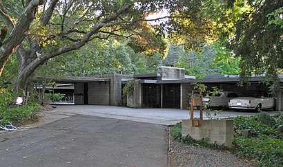
Maynard Buehler House Address: 6 Great Oaks Cir Orinda, CA 94563 street in Orinda
Attractions near Maynard Buehler House
Frank Lloyd Wright Buehler Estate,Jo Ann Sherwood Design,9 Moraga Ct,Moraga Way & Glorietta Boulevard,Zigenis & Sons Painting,Renova Builders,Net Zero Homes,CR Gutters,Financiometrics,Site Solutions,Larc,Lamorinda Adult Respite Center,Moraga Way & Los Cerros,Christina Linezo Village Associates,Moraga Way & Holy Shepherd Lutheran Church,Jbalducci,Moraga Way & McDonnell Nursery,Moraga Way & Brookside Road,Advantage Point Technologies,Moraga Way & Orchard RoadHow to get to popular attractions in Orinda with public transit
City of Fremont, Fremont,Town & Country Village, Palo Alto,City of Redwood City, Redwood City,Pacific Commons, Fremont,Safeway, San Jose,City of Milpitas, Milpitas,Costco Wholesale, Vallejo,24 Hour Fitness Super Sport Club, Fremont,Whole Foods Market, San Ramon,PayPal, San Jose,Apple Valley Fair, San Jose,Stanford Dish Trail,Genentech Inc, South San Francisco,Jelly Belly Factory, Fairfield,Downtown San Jose, San Jose,Googleplex - 43,Town of Los Gatos, Los Gatos,Costco Wholesale, Sunnyvale,Lake Elizabeth, Fremont,De Anza College, CupertinoGet around San Francisco - San Jose, CA by public transit!
Traveling around San Francisco - San Jose, CA has never been so easy. See step by step directions as you travel to any attraction, street or major public transit station. View bus and train schedules, arrival times, service alerts and detailed routes on a map, so you know exactly how to get to anywhere in San Francisco - San Jose, CA.
When traveling to any destination around San Francisco - San Jose, CA use Moovit's Live Directions with Get Off Notifications to know exactly where and how far to walk, how long to wait for your line, and how many stops are left. Moovit will alert you when it's time to get off — no need to constantly re-check whether yours is the next stop.
Wondering how to use public transit in San Francisco - San Jose, CA or how to pay for public transit in San Francisco - San Jose, CA? Moovit public transit app can help you navigate your way with public transit easily, and at minimum cost. It includes public transit fees, ticket prices, and costs. Looking for a map of San Francisco - San Jose, CA public transit lines? Moovit public transit app shows all public transit maps in San Francisco - San Jose, CA with all Bus, Train, BART, Light Rail, Ferry and Cable Car routes and stops on an interactive map.
San Francisco - San Jose, CA has 6 transit type(s), including: Bus, Train, BART, Light Rail, Ferry and Cable Car, operated by several transit agencies, including BART, Bay Area Rapid Transit, Muni Metro, Caltrain, VTA, Capitol Corridor, Sonoma Marin Area Rail Transit, MUNI, SF Cable Car, AC Transit, Dumbarton Express, Golden Gate Transit, County Connection, SamTrans, SamTrans / City of Menlo Park