See Mayo Clinic Square, Minneapolis, on the map
Directions to Mayo Clinic Square (Minneapolis) with public transportation
The following transit lines have routes that pass near Mayo Clinic Square
 Bus:
Bus: - Train:
- Light Rail:
How to get to Mayo Clinic Square by bus?
Click on the bus route to see step by step directions with maps, line arrival times and updated time schedules.
Bus stations near Mayo Clinic Square in Minneapolis
- Minneapolis Bus Station,5 min walk,
- 5th St Transit Center Gate A,5 min walk,
- 5th St Transit Center Gate C,7 min walk,
- 5th St Transit Center Gate D,7 min walk,
- Ramp A/7th St Transit Center,7 min walk,
- Nicollet Mall & 7th St S,8 min walk,
- 7th St S & Nicollet Mall,9 min walk,
- 6th St S & Hennepin Ave S,10 min walk,
- Hennepin Ave & 5th St S,10 min walk,
Train stations near Mayo Clinic Square in Minneapolis
- Target Field,7 min walk,
Light Rail stations near Mayo Clinic Square in Minneapolis
- Nicollet Mall,16 min walk,
Bus lines to Mayo Clinic Square in Minneapolis
- GREYHOUND US0150,Chicago - Milwakuee - Madison - Minneapolis,
- FLIXBUS 2548,Chicago - Milwaukee - Minneapolis,
- 14,Broadway / Robbinsdale / Via France,
- 94,Express / Mpls-Via Snell / Downtown,
- GREEN LINE BUS,Shuttle / Us Bank / Stadium Village,
- 355,Express / Woodbury,
- 363,Express / St Paul / Minneapolis,
- METRO C LINE,Brklyn Ctr Tc / Penn / Rapid,
- METRO D LINE,Brklyn Ctr Tc / Chi-Fremont / Rapid,
- 5,Chicago - 56st,
- 9,E 25st - 36av / 46st Station,
- 22,Brklyn Ctr Tc / N Lyndale / Via Penn Av,
- 61,Henn-Larp / Dwtn Mpls / Via Arcade,
- 755,Ltd Stop / Downtown / Gold Vall Rd,
- 784,Trip 1 / Maple Grove / Transit Sta,
- 10,Downtown / Via Central / Convention Ctr,
- 11,4av S / To 46st-Nic,
- 17,24st-Uptown / Mtka Blvd / Blake Rd,
- 18,Nicollet Av / 104-Humboldt,
- 25,Kenwood / Cedar Trail,
What are the closest stations to Mayo Clinic Square?
The closest stations to Mayo Clinic Square are:
- Minneapolis Bus Station is 350 yards away, 5 min walk.
- 5th St Transit Center Gate A is 370 yards away, 5 min walk.
- 5th St Transit Center Gate C is 515 yards away, 7 min walk.
- 5th St Transit Center Gate D is 515 yards away, 7 min walk.
- Ramp A/7th St Transit Center is 547 yards away, 7 min walk.
- Target Field is 582 yards away, 7 min walk.
- Nicollet Mall & 7th St S is 633 yards away, 8 min walk.
- 7th St S & Nicollet Mall is 708 yards away, 9 min walk.
- 6th St S & Hennepin Ave S is 770 yards away, 10 min walk.
- Hennepin Ave & 5th St S is 796 yards away, 10 min walk.
- Nicollet Mall is 1281 yards away, 16 min walk.
Which bus lines stop near Mayo Clinic Square?
These bus lines stop near Mayo Clinic Square: 10, 17, 22, 3, 61, 790, 94, METRO C LINE.
Which light rail line stops near Mayo Clinic Square?
METRO BLUE LINE
What’s the nearest light rail station to Mayo Clinic Square in Minneapolis?
The nearest light rail station to Mayo Clinic Square in Minneapolis is Nicollet Mall. It’s a 16 min walk away.
What’s the nearest train station to Mayo Clinic Square in Minneapolis?
The nearest train station to Mayo Clinic Square in Minneapolis is Target Field. It’s a 7 min walk away.
What’s the nearest bus stop to Mayo Clinic Square in Minneapolis?
The nearest bus stops to Mayo Clinic Square in Minneapolis are Minneapolis Bus Station and 5th St Transit Center Gate A. The closest one is a 5 min walk away.
What time is the first light rail to Mayo Clinic Square in Minneapolis?
The METRO BLUE LINE is the first light rail that goes to Mayo Clinic Square in Minneapolis. It stops nearby at 4:28 AM.
What time is the last light rail to Mayo Clinic Square in Minneapolis?
The METRO BLUE LINE is the last light rail that goes to Mayo Clinic Square in Minneapolis. It stops nearby at 12:49 AM.
What time is the first train to Mayo Clinic Square in Minneapolis?
The NORTHSTAR COMMUTER RAIL is the first train that goes to Mayo Clinic Square in Minneapolis. It stops nearby at 6:22 AM.
What time is the last train to Mayo Clinic Square in Minneapolis?
The NORTHSTAR COMMUTER RAIL is the last train that goes to Mayo Clinic Square in Minneapolis. It stops nearby at 5:50 PM.
What time is the first bus to Mayo Clinic Square in Minneapolis?
The 18 is the first bus that goes to Mayo Clinic Square in Minneapolis. It stops nearby at 4:12 AM.
What time is the last bus to Mayo Clinic Square in Minneapolis?
The GREYHOUND US0150 is the last bus that goes to Mayo Clinic Square in Minneapolis. It stops nearby at 9:55 AM.
How much is the light rail fare to Mayo Clinic Square?
The light rail fare to Mayo Clinic Square costs about $2.00.
How much is the bus fare to Mayo Clinic Square?
The bus fare to Mayo Clinic Square costs about $0.50 - $2.50.
See Mayo Clinic Square, Minneapolis, on the map
Public Transit to Mayo Clinic Square in Minneapolis
Wondering how to get to Mayo Clinic Square in Minneapolis, United States? Moovit helps you find the best way to get to Mayo Clinic Square with step-by-step directions from the nearest public transit station.
Moovit provides free maps and live directions to help you navigate through your city. View schedules, routes, timetables, and find out how long does it take to get to Mayo Clinic Square in real time.
Looking for the nearest stop or station to Mayo Clinic Square? Check out this list of stops closest to your destination: Minneapolis Bus Station; 5th St Transit Center Gate A; 5th St Transit Center Gate C; 5th St Transit Center Gate D; Ramp A/7th St Transit Center; Target Field; Nicollet Mall & 7th St S; 7th St S & Nicollet Mall; 6th St S & Hennepin Ave S; Hennepin Ave & 5th St S; Nicollet Mall.
Bus:Train:Light Rail:
Want to see if there’s another route that gets you there at an earlier time? Moovit helps you find alternative routes or times. Get directions from and directions to Mayo Clinic Square easily from the Moovit App or Website.
We make riding to Mayo Clinic Square easy, which is why over 1.5 million users, including users in Minneapolis, trust Moovit as the best app for public transit. You don’t need to download an individual bus app or train app, Moovit is your all-in-one transit app that helps you find the best bus time or train time available.
For information on prices of bus and light rail, costs and ride fares to Mayo Clinic Square, please check the Moovit app.
Use the app to navigate to popular places including to the airport, hospital, stadium, grocery store, mall, coffee shop, school, college, and university.
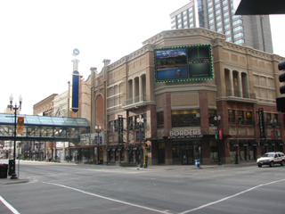
Mayo Clinic Square Address: Hennepin Avenue street in Minneapolis
Attractions near Mayo Clinic Square
Loews Hotel,Amy Beacom, M.D.,Shelby Johnson, M.D.,Nba League Pass,Elena (Ellie) Jelsing, M.D.,Kelechi Okoroha, M.D.,Christopher Camp, M.D.,Jeffrey Payne, M.D.,Mayo Clinic Square Parking Garage,Loews Minneapolis Hotel,Fogo de Chão Brazilian Steakhouse,Reckitt Benckiser,Fogo De Chao,First Avenue & 7th St Entry,Tom's Watch Bar,Rosa Mexicano Restaurant Valet,Fogo de Chão,Pantages Theater,Impark,First AvenueHow to get to popular attractions in Minneapolis with public transit
Aveda Institute, Minneapolis,Southdale Transit Center, Edina,Pollo Campero, West St. Paul,Midtown Global Market, Minneapolis,Pooja Grocers, Hilltop,Walter F. Mondale Hall, Minneapolis,Medtronic - Rice Creek East, Fridley,Xcel Energy Center, St. Paul,Target Photo Studio Royalston, Minneapolis,Gluek's Restaurant & Bar, Minneapolis,Robbinsdale Armstrong High School, Plymouth,Delta Building C,US 169 and Valley View Rd, Edina,Northtown Mall, Blaine,Hyatt Place Minneapolis / Downtown, Minneapolis,Walmart Supercenter, Brooklyn Center,North Minneapolis, Minneapolis,City of Crystal, Crystal,Mounds View, Mounds View,Valley View Apartments, Golden ValleyGet around Minneapolis by public transit!
Traveling around Minneapolis has never been so easy. See step by step directions as you travel to any attraction, street or major public transit station. View bus and train schedules, arrival times, service alerts and detailed routes on a map, so you know exactly how to get to anywhere in Minneapolis.
When traveling to any destination around Minneapolis use Moovit's Live Directions with Get Off Notifications to know exactly where and how far to walk, how long to wait for your line, and how many stops are left. Moovit will alert you when it's time to get off — no need to constantly re-check whether yours is the next stop.
Wondering how to use public transit in Minneapolis or how to pay for public transit in Minneapolis? Moovit public transit app can help you navigate your way with public transit easily, and at minimum cost. It includes public transit fees, ticket prices, and costs. Looking for a map of Minneapolis public transit lines? Moovit public transit app shows all public transit maps in Minneapolis with all bus or light rail routes and stops on an interactive map.
Minneapolis has 2 transit type(s), including: bus or light rail, operated by several transit agencies, including Metro Transit , Metro Transit, Metro Transit, MVTA, Plymouth Metrolink, SouthWest Transit, Maple Grove, University of Minnesota, Airport (MAC), Amtrak, Mankato Transit System, SMART, Megabus, FlixBus-us and Greyhound-us