See Maywood Academy High School, Huntington Park, on the map
Directions to Maywood Academy High School (Huntington Park) with public transportation
The following transit lines have routes that pass near Maywood Academy High School
 Bus:
Bus:
How to get to Maywood Academy High School by bus?
Click on the bus route to see step by step directions with maps, line arrival times and updated time schedules.
Bus stations near Maywood Academy High School in Huntington Park
- Atlantic / Randolph,7 min walk,
- Slauson / Pine,8 min walk,
- Randolph & Gifford,9 min walk,
- Randolph Street and Otis Avenue,9 min walk,
- Gage / Atlantic,12 min walk,
Bus lines to Maywood Academy High School in Huntington Park
- 260,M.L. King - Atlantic,
- 108,Pico Rivera - Slauson / Passons,
- HUNTINGTON PARK EXPRESS,Huntington Park Express,
- LA CAMPANA BUS,Loop,
- 110,Playa Vista,
What are the closest stations to Maywood Academy High School?
The closest stations to Maywood Academy High School are:
- Atlantic / Randolph is 483 yards away, 7 min walk.
- Slauson / Pine is 552 yards away, 8 min walk.
- Randolph & Gifford is 619 yards away, 9 min walk.
- Randolph Street and Otis Avenue is 669 yards away, 9 min walk.
- Gage / Atlantic is 893 yards away, 12 min walk.
Which bus lines stop near Maywood Academy High School?
These bus lines stop near Maywood Academy High School: 108, 260.
What’s the nearest bus stop to Maywood Academy High School in Huntington Park?
The nearest bus stop to Maywood Academy High School in Huntington Park is Atlantic / Randolph. It’s a 7 min walk away.
What time is the first bus to Maywood Academy High School in Huntington Park?
The 110 is the first bus that goes to Maywood Academy High School in Huntington Park. It stops nearby at 4:39 AM.
What time is the last bus to Maywood Academy High School in Huntington Park?
The 108 is the last bus that goes to Maywood Academy High School in Huntington Park. It stops nearby at 11:20 PM.
How much is the bus fare to Maywood Academy High School?
The bus fare to Maywood Academy High School costs about $0.35 - $1.75.
How much is the light rail fare to Maywood Academy High School?
The light rail fare to Maywood Academy High School costs about $1.75.
See Maywood Academy High School, Huntington Park, on the map
Public Transit to Maywood Academy High School in Huntington Park
Wondering how to get to Maywood Academy High School in Huntington Park, United States? Moovit helps you find the best way to get to Maywood Academy High School with step-by-step directions from the nearest public transit station.
Moovit provides free maps and live directions to help you navigate through your city. View schedules, routes, timetables, and find out how long does it take to get to Maywood Academy High School in real time.
Looking for the nearest stop or station to Maywood Academy High School? Check out this list of stops closest to your destination: Atlantic / Randolph; Slauson / Pine; Randolph & Gifford; Randolph Street and Otis Avenue; Gage / Atlantic.
Bus:
Want to see if there’s another route that gets you there at an earlier time? Moovit helps you find alternative routes or times. Get directions from and directions to Maywood Academy High School easily from the Moovit App or Website.
We make riding to Maywood Academy High School easy, which is why over 1.5 million users, including users in Huntington Park, trust Moovit as the best app for public transit. You don’t need to download an individual bus app or train app, Moovit is your all-in-one transit app that helps you find the best bus time or train time available.
For information on prices of bus and light rail, costs and ride fares to Maywood Academy High School, please check the Moovit app.
Use the app to navigate to popular places including to the airport, hospital, stadium, grocery store, mall, coffee shop, school, college, and university.
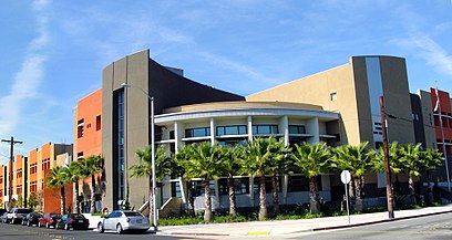
Maywood Academy High School Address: Fishburn Avenue street in Huntington Park
Attractions near Maywood Academy High School
HG Graphic & Printing,99 Cents Only Stores,Tri-City Painting,Mini Coach,St. Rose of Lima Church,McDonald's,Fashion TU,Atlatis Beauty Beauty Salon,RB Outlet,Don Pollon,WESTERN UNION,Botanica Omi-Oni,Post-Surgical Rehabilitation,Tasty King,Las Islas Marias Maywood,Calicanto US,OEM Auto Paint Supplies,Ernys Computers,98cent More Gift,Pro-CutsHow to get to popular attractions in Huntington Park with public transit
Costco Wholesale, Tustin,California Screamin', Anaheim,Matterhorn Bobsleds, Anaheim,Disney California Adventure Park, Anaheim,City of Rancho Cucamonga, Rancho Cucamonga,Corona del Mar State Beach, Newport Beach,Disneyland Monorail, Anaheim,AMC Promenade 16, Woodland Hills, La,Ball Cast Member Parking Lot (BCML), Anaheim,Anaheim Packing House, Anaheim,IKEA, Costa Mesa,85°C Bakery Cafe, Irvine,East Shuttle Area, Anaheim,Torrance, CA, Torrance,Hollywood, Hollywood, La,Main Street, U.S.A., Anaheim,City of Los Angeles, Downtown, La,The Ritz-Carlton Laguna Niguel, Dana Point,Indiana Jones Adventure, Anaheim,City of Irvine, IrvineGet around Huntington Park by public transit!
Traveling around Huntington Park has never been so easy. See step by step directions as you travel to any attraction, street or major public transit station. View bus and train schedules, arrival times, service alerts and detailed routes on a map, so you know exactly how to get to anywhere in Huntington Park.
When traveling to any destination around Huntington Park use Moovit's Live Directions with Get Off Notifications to know exactly where and how far to walk, how long to wait for your line, and how many stops are left. Moovit will alert you when it's time to get off — no need to constantly re-check whether yours is the next stop.
Wondering how to use public transit in Huntington Park or how to pay for public transit in Huntington Park? Moovit public transit app can help you navigate your way with public transit easily, and at minimum cost. It includes public transit fees, ticket prices, and costs. Looking for a map of Huntington Park public transit lines? Moovit public transit app shows all public transit maps in Huntington Park with all bus or light rail routes and stops on an interactive map.
Huntington Park has 2 transit type(s), including: bus or light rail, operated by several transit agencies, including Metro - Los Angeles, Metro - Los Angeles, Metrolink Trains, METRO, Long Beach Transit, LADOT, OCTA, Foothill Transit, Big Blue Bus, Riverside Transit Agency, LAX FlyAway, Airporter Shuttle, Playa Vista Shuttle, Amtrak and OMNITRANS