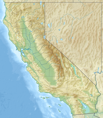
See McGrath State Beach, Los Angeles, on the map
- ETOPO1 for relief and bathymetry using GMT package
- File:USA California location map.svg for borders, rivers, lakes, coastline
- Own work using
Directions to McGrath State Beach (Los Angeles) with public transportation
The following transit lines have routes that pass near McGrath State Beach
 Bus:
Bus:
How to get to McGrath State Beach by bus?
Click on the bus route to see step by step directions with maps, line arrival times and updated time schedules.
Which bus lines stop near McGrath State Beach?
These bus lines stop near McGrath State Beach: 19, 21.
See McGrath State Beach, Los Angeles, on the map
- ETOPO1 for relief and bathymetry using GMT package
- File:USA California location map.svg for borders, rivers, lakes, coastline
- Own work using
Public Transit to McGrath State Beach in Los Angeles
Wondering how to get to McGrath State Beach in Los Angeles, United States? Moovit helps you find the best way to get to McGrath State Beach with step-by-step directions from the nearest public transit station.
Moovit provides free maps and live directions to help you navigate through your city. View schedules, routes, timetables, and find out how long does it take to get to McGrath State Beach in real time.
Bus:
Want to see if there’s another route that gets you there at an earlier time? Moovit helps you find alternative routes or times. Get directions from and directions to McGrath State Beach easily from the Moovit App or Website.
We make riding to McGrath State Beach easy, which is why over 1.5 million users, including users in Los Angeles, trust Moovit as the best app for public transit. You don’t need to download an individual bus app or train app, Moovit is your all-in-one transit app that helps you find the best bus time or train time available.
For information on prices of bus and train, costs and ride fares to McGrath State Beach, please check the Moovit app.
Use the app to navigate to popular places including to the airport, hospital, stadium, grocery store, mall, coffee shop, school, college, and university.
McGrath State Beach Address: Harbor Blvd street in Los Angeles
- ETOPO1 for relief and bathymetry using GMT package
- File:USA California location map.svg for borders, rivers, lakes, coastline
- Own work using
Attractions near McGrath State Beach
1900 N Harbor Blvd,N Harbor Blvd / W Gonzales Rd,Holiday Inn Express & Suites-Ventura,1867 Spinnaker Dr,FOUR POINTS BY SHERATON-Ventura,2v,Top Star Nursery,Lil Tommy's Pumpkin Patch,Pemko,Msi Construction,Telephone Road Self Storage,Hillcrest Electrical,Double Dragon Tae Kwon do,Wood Pl,Otis Bradley Company,Sampson Racing,Demo Deluxe,Downstar,Current Systems,Metro-MedHow to get to popular attractions in Los Angeles with public transit
Whole Foods Market, Tustin,Indiana Jones Adventure, Anaheim,Galleria at Tyler, Riverside,Pomona, CA, Pomona,Sawtelle / Little Japantown, Sawtelle, La,Apple South Coast Plaza, Costa Mesa,Monsters, Inc. Mike & Sulley to the Rescue!, Anaheim,Radiator Springs Racers, Anaheim,Disneyland Monorail, Anaheim,Honda Center, Anaheim,Finding Nemo Submarine Voyage, Anaheim,East Shuttle Area, Anaheim,85°C Bakery Cafe, Irvine,Los Olivos Apartment Village, Irvine,Muvico Theaters, Thousand Oaks,Disneyland Park, Anaheim,Blu Jam Café, Fairfax, La,24 Hour Fitness, Industry,City of Los Angeles, Downtown, La,City of Rancho Cucamonga, Rancho CucamongaGet around Los Angeles by public transit!
Traveling around Los Angeles has never been so easy. See step by step directions as you travel to any attraction, street or major public transit station. View bus and train schedules, arrival times, service alerts and detailed routes on a map, so you know exactly how to get to anywhere in Los Angeles.
When traveling to any destination around Los Angeles use Moovit's Live Directions with Get Off Notifications to know exactly where and how far to walk, how long to wait for your line, and how many stops are left. Moovit will alert you when it's time to get off — no need to constantly re-check whether yours is the next stop.
Wondering how to use public transit in Los Angeles or how to pay for public transit in Los Angeles? Moovit public transit app can help you navigate your way with public transit easily, and at minimum cost. It includes public transit fees, ticket prices, and costs. Looking for a map of Los Angeles public transit lines? Moovit public transit app shows all public transit maps in Los Angeles with all bus or train routes and stops on an interactive map.
Los Angeles has 2 transit type(s), including: bus or train, operated by several transit agencies, including Metro - Los Angeles, Metro - Los Angeles, Metrolink Trains, METRO, Long Beach Transit, LADOT, OCTA, Foothill Transit, Big Blue Bus, Riverside Transit Agency, LAX FlyAway, Airporter Shuttle, Playa Vista Shuttle, Amtrak and OMNITRANS