Directions to McPherson Square Station (Washington) with public transportation
The following transit lines have routes that pass near McPherson Square Station
How to get to McPherson Square Station by bus?
Click on the bus route to see step by step directions with maps, line arrival times and updated time schedules.
How to get to McPherson Square Station by train?
Click on the train route to see step by step directions with maps, line arrival times and updated time schedules.
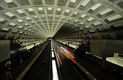
How to get to McPherson Square Station by metro?
Click on the metro route to see step by step directions with maps, line arrival times and updated time schedules.
Bus stops near McPherson Square Station in Washington
- 14th St NW + I St NW, 2 min walk,
- I (Eye) Street And 14th Street Nw, 2 min walk,
- K St & 15th St NW Eb, 3 min walk,
- K St & 15th St, 3 min walk,
- K St NW + 15th St NW, 3 min walk,
- K St NW & 14th St NW (Main), 3 min walk,
- I St NW + 15th St NW, 5 min walk,
- I St NW @ 15th St NW, 5 min walk,
Metro stations near McPherson Square Station in Washington
- Federal Triangle Metro Station, 7 min walk,
- Farragut North, 13 min walk,
Bus lines to McPherson Square Station in Washington
- 16E, East To Franklin Square,
- 52, South To L'Enfant Plaza,
- 54, North To Takoma,
- 59, North To Takoma,
- WP-AM, Mcpherson Square Metro,
- 3F, West To East Falls Church,
- 715, 715/10 Golden Beach Park & Ride,
- 725, 725/4 California,
- 810, 810/5 Pindell,
- 820, 820/15 Pg Equestrian Center,
- 830, 830/14 Sunderland / Dunkirk,
- 840, 840/10 Prince Frederick / St Leonard,
- 281, H ST & 4TH ST - Stone Ridge II,
- 481, H ST & 4TH ST - Leesburg P&R,
- 483, H ST & 4TH ST - Harmony Park and Ride,
- 484, H ST & 4TH ST - Harmony Park and Ride,
- 486, Brambleton - H ST & 4TH ST,
- 3Y, East To Mcpherson Sq,
- D6, West To Sibley Hospital,
- 16Y, West To Barcroft,
What are the closest stations to McPherson Square Station?
The closest stations to McPherson Square Station are:
- 14th St NW + I St NW is 152 yards away, 2 min walk.
- I (Eye) Street And 14th Street Nw is 159 yards away, 2 min walk.
- K St & 15th St NW Eb is 179 yards away, 3 min walk.
- K St & 15th St is 185 yards away, 3 min walk.
- K St NW + 15th St NW is 189 yards away, 3 min walk.
- K St NW & 14th St NW (Main) is 222 yards away, 3 min walk.
- I St NW + 15th St NW is 352 yards away, 5 min walk.
- I St NW @ 15th St NW is 354 yards away, 5 min walk.
- Federal Triangle Metro Station is 528 yards away, 7 min walk.
- Farragut North is 1042 yards away, 13 min walk.
Which bus lines stop near McPherson Square Station?
These bus lines stop near McPherson Square Station: 32, 33, 38B, 52, DC3, G8.
Which train lines stop near McPherson Square Station?
These train lines stop near McPherson Square Station: FREDERICKSBURG LINE, MARC.
Which metro lines stop near McPherson Square Station?
These metro lines stop near McPherson Square Station: METRORAIL BLUE LINE, METRORAIL ORANGE LINE, METRORAIL SILVER LINE.
What’s the nearest metro station to McPherson Square Station in Washington?
The nearest metro station to McPherson Square Station in Washington is Federal Triangle Metro Station. It’s a 7 min walk away.
What’s the nearest bus stop to McPherson Square Station in Washington?
The nearest bus stops to McPherson Square Station in Washington are 14th St NW + I St NW and I (Eye) Street And 14th Street Nw. The closest one is a 2 min walk away.
What time is the first metro to McPherson Square Station in Washington?
The METRORAIL BLUE LINE is the first metro that goes to McPherson Square Station in Washington. It stops nearby at 5:23 AM.
What time is the last metro to McPherson Square Station in Washington?
The METRORAIL RED LINE is the last metro that goes to McPherson Square Station in Washington. It stops nearby at 12:08 AM.
What time is the first bus to McPherson Square Station in Washington?
The 52 is the first bus that goes to McPherson Square Station in Washington. It stops nearby at 4:22 AM.
What time is the last bus to McPherson Square Station in Washington?
The 16E is the last bus that goes to McPherson Square Station in Washington. It stops nearby at 2:43 AM.
How much is the bus fare to McPherson Square Station?
The bus fare to McPherson Square Station costs about $2.00.
How much is the metro fare to McPherson Square Station?
The metro fare to McPherson Square Station costs about $2.00 - $6.00.
See McPherson Square Station, Washington, on the map
Public Transit to McPherson Square Station in Washington
Wondering how to get to McPherson Square Station in Washington, United States? Moovit helps you find the best way to get to McPherson Square Station with step-by-step directions from the nearest public transit station.
Moovit provides free maps and live directions to help you navigate through your city. View schedules, routes, timetables, and find out how long does it take to get to McPherson Square Station in real time.
Looking for the nearest stop or station to McPherson Square Station? Check out this list of stops closest to your destination: 14th St NW + I St NW; I (Eye) Street And 14th Street Nw; K St & 15th St NW Eb; K St & 15th St; K St NW + 15th St NW; K St NW & 14th St NW (Main); I St NW + 15th St NW; I St NW @ 15th St NW; Federal Triangle Metro Station; Farragut North.
Bus: 32, 33, 38B, 52, DC3, G8, WP-AM, 3F, 16E, 54, 59, 281, 481, 483, 484, 486.Train: FREDERICKSBURG LINE, MARC.Metro: METRORAIL BLUE LINE, METRORAIL ORANGE LINE, METRORAIL SILVER LINE, METRORAIL RED LINE.
Want to see if there’s another route that gets you there at an earlier time? Moovit helps you find alternative routes or times. Get directions from and directions to McPherson Square Station easily from the Moovit App or Website.
We make riding to McPherson Square Station easy, which is why over 1.5 million users, including users in Washington, trust Moovit as the best app for public transit. You don’t need to download an individual bus app or train app, Moovit is your all-in-one transit app that helps you find the best bus time or train time available.
For information on prices of metro, bus and train, costs and ride fares to McPherson Square Station, please check the Moovit app.
Use the app to navigate to popular places including to the airport, hospital, stadium, grocery store, mall, coffee shop, school, college, and university.
Location: Washington, Washington, D.C. - Baltimore, MD
Attractions near McPherson Square Station
How to get to popular places in Washington, D.C. - Baltimore, MD with public transit
Get around Washington by public transit!
Traveling around Washington has never been so easy. See step by step directions as you travel to any attraction, street or major public transit station. View bus and train schedules, arrival times, service alerts and detailed routes on a map, so you know exactly how to get to anywhere in Washington.
When traveling to any destination around Washington use Moovit's Live Directions with Get Off Notifications to know exactly where and how far to walk, how long to wait for your line, and how many stops are left. Moovit will alert you when it's time to get off — no need to constantly re-check whether yours is the next stop.
Wondering how to use public transit in Washington or how to pay for public transit in Washington? Moovit public transit app can help you navigate your way with public transit easily, and at minimum cost. It includes public transit fees, ticket prices, and costs. Looking for a map of Washington public transit lines? Moovit public transit app shows all public transit maps in Washington with all metro, bus or train routes and stops on an interactive map.
Washington has 3 transit type(s), including: metro, bus or train, operated by several transit agencies, including WMATA, WMATA, Montgomery County Ride On, Montgomery County MD Ride On, Fairfax Connector, TheBus, PRTC, DC Circulator, DASH - Alexandria, Arlington Transit (ART), DC Streetcar, RTA of Central Maryland, FRED, MDOT MTA and Marc