Directions to Mcclure Engineering Co. (Boston) with public transportation
The following transit lines have routes that pass near Mcclure Engineering Co.
 Bus: 111, 43, 504, 93, SL3.
- Train: FITCHBURG, NEEDHAM, NEWBURYPORT/ROCKPORT.
- Subway: BLUE LINE, GREEN LINE D, GREEN LINE E, ORANGE LINE, RED LINE.
How to get to Mcclure Engineering Co. by bus?
Click on the bus route to see step by step directions with maps, line arrival times and updated time schedules.
From MSPCA Angell Animal Medical Center, Boston
53 minFrom Qea, Quincy
114 minFrom Newton, MA, Newton
52 minFrom Heartbreak Hill, Newton
51 minFrom Jamaica Pond, Boston
51 minFrom The Burren, Somerville
57 minFrom Arsenal Mall, Watertown Town
68 minFrom Revere Beach, Revere
73 minFrom DoubleTree by Hilton Boston Logan Airport Chelsea, Chelsea
51 minFrom Arlington, MA, Arlington
86 min
How to get to Mcclure Engineering Co. by train?
Click on the train route to see step by step directions with maps, line arrival times and updated time schedules.
How to get to Mcclure Engineering Co. by subway?
Click on the subway route to see step by step directions with maps, line arrival times and updated time schedules.
Bus stops near Mcclure Engineering Co. in Boston
- Tremont St @ Beacon St, 4 min walk,VIEW
- Park Street - Tremont St Opp Hamilton Pl, 4 min walk,VIEW
- Cambridge St @ Government Ctr Sta, 4 min walk,VIEW
- Park Street - Tremont St @ Winter St, 4 min walk,VIEW
- Beacon St Opp Walnut St, 4 min walk,VIEW
- Tremont St @ Boylston Station, 5 min walk,VIEW
- Tremont St Opp Temple Pl, 5 min walk,VIEW
- Government Center - Cambridge St @ Sudbury St, 5 min walk,VIEW
- Charles/Mgh - Cambridge St @ Lindall Pl, 6 min walk,VIEW
Subway stations near Mcclure Engineering Co. in Boston
Bus lines to Mcclure Engineering Co. in Boston
- 15, Mattapan Via Nubian & Fields Corner,VIEW
- 39, Forest Hills,VIEW
- 57, Watertown Via Kenmore,VIEW
- RED LINE SHUTTLE, Alewife - Park Street,VIEW
- RED LINE SHUTTLE, JFK/UMass - Park Street,VIEW
- RED LINE SHUTTLE, Harvard - Park Street,VIEW
- 116, Wonderland Via Maverick,VIEW
- 354, Burlington (Express) Via Woburn,VIEW
- BLUE LINE SHUTTLE, Orient Heights (Local Shuttle),VIEW
- BLUE LINE SHUTTLE, Government Center (Express Shuttle),VIEW
- BLUE LINE SHUTTLE, Orient Heights (Express Shuttle),VIEW
- BLUE LINE SHUTTLE, Wonderland (Shuttle),VIEW
- GREEN LINE E SHUTTLE, Medford/Tufts (Shuttle),VIEW
- GREEN LINE SHUTTLE, Medford/Tufts Via Union Square (Shuttle),VIEW
- GREEN LINE SHUTTLE, North Station (Shuttle),VIEW
- GREEN LINE SHUTTLE, Union Square (Shuttle),VIEW
- RED LINE SHUTTLE, Kendall/MIT (Shuttle),VIEW
- RED LINE SHUTTLE, Harvard (Shuttle),VIEW
- RED LINE SHUTTLE, Broadway (Shuttle),VIEW
- RED LINE SHUTTLE, Jfk/Umass (Shuttle),VIEW
What are the closest stations to Mcclure Engineering Co.?
The closest stations to Mcclure Engineering Co. are:
- Tremont St @ Beacon St is 240 yards away, 4 min walk.
- Park Street - Tremont St Opp Hamilton Pl is 258 yards away, 4 min walk.
- Boylston is 259 yards away, 4 min walk.
- Cambridge St @ Government Ctr Sta is 290 yards away, 4 min walk.
- Park Street - Tremont St @ Winter St is 304 yards away, 4 min walk.
- Beacon St Opp Walnut St is 316 yards away, 4 min walk.
- Tremont St @ Boylston Station is 342 yards away, 5 min walk.
- Tremont St Opp Temple Pl is 348 yards away, 5 min walk.
- Government Center - Cambridge St @ Sudbury St is 405 yards away, 5 min walk.
- Downtown Crossing is 410 yards away, 6 min walk.
- Charles/Mgh - Cambridge St @ Lindall Pl is 446 yards away, 6 min walk.
- Bowdoin is 553 yards away, 7 min walk.
Which bus lines stop near Mcclure Engineering Co.?
These bus lines stop near Mcclure Engineering Co.: 111, 43, 504, 93, SL3.
Which train lines stop near Mcclure Engineering Co.?
These train lines stop near Mcclure Engineering Co.: FITCHBURG, NEEDHAM, NEWBURYPORT/ROCKPORT.
Which subway lines stop near Mcclure Engineering Co.?
These subway lines stop near Mcclure Engineering Co.: BLUE LINE, GREEN LINE D, GREEN LINE E, ORANGE LINE, RED LINE.
What’s the nearest subway station to Mcclure Engineering Co. in Boston?
The nearest subway station to Mcclure Engineering Co. in Boston is Boylston. It’s a 4 min walk away.
What’s the nearest bus station to Mcclure Engineering Co. in Boston?
The nearest bus stations to Mcclure Engineering Co. in Boston are Tremont St @ Beacon St, Park Street - Tremont St Opp Hamilton Pl, Cambridge St @ Government Ctr Sta, Park Street - Tremont St @ Winter St and Beacon St Opp Walnut St. The closest one is a 4 min walk away.
What time is the first subway to Mcclure Engineering Co. in Boston?
The GREEN LINE E is the first subway that goes to Mcclure Engineering Co. in Boston. It stops nearby at 5:07 AM.
What time is the last subway to Mcclure Engineering Co. in Boston?
The GREEN LINE E is the last subway that goes to Mcclure Engineering Co. in Boston. It stops nearby at 2:18 AM.
What time is the first bus to Mcclure Engineering Co. in Boston?
The 57 is the first bus that goes to Mcclure Engineering Co. in Boston. It stops nearby at 5:07 AM.
What time is the last bus to Mcclure Engineering Co. in Boston?
The 116 is the last bus that goes to Mcclure Engineering Co. in Boston. It stops nearby at 1:58 AM.
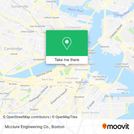
See Mcclure Engineering Co., Boston, on the map
Public Transit to Mcclure Engineering Co. in Boston
Wondering how to get to Mcclure Engineering Co. in Boston? Moovit helps you find the best way to get to Mcclure Engineering Co. with step-by-step directions from the nearest public transit station.
Moovit provides free maps and live directions to help you navigate through your city. View schedules, routes, timetables, and find out how long does it take to get to Mcclure Engineering Co. in real time.
Looking for the nearest stop or station to Mcclure Engineering Co.? Check out this list of stops closest to your destination: Tremont St @ Beacon St; Park Street - Tremont St Opp Hamilton Pl; Boylston; Cambridge St @ Government Ctr Sta; Park Street - Tremont St @ Winter St; Beacon St Opp Walnut St; Tremont St @ Boylston Station; Tremont St Opp Temple Pl; Government Center - Cambridge St @ Sudbury St; Downtown Crossing; Charles/Mgh - Cambridge St @ Lindall Pl; Bowdoin.
Bus: 111, 43, 504, 93, SL3, RED LINE SHUTTLE, RED LINE SHUTTLE, RED LINE SHUTTLE, 15, 39, 57, RED LINE SHUTTLE.Train: FITCHBURG, NEEDHAM, NEWBURYPORT/ROCKPORT.Subway: BLUE LINE, GREEN LINE D, GREEN LINE E, ORANGE LINE, RED LINE, GREEN LINE B, GREEN LINE C.
Want to see if there’s another route that gets you there at an earlier time? Moovit helps you find alternative routes or times. Get directions from and directions to Mcclure Engineering Co. easily from the Moovit App or Website.
We make riding to Mcclure Engineering Co. easy, which is why over 1.7 million users, including users in Boston, trust Moovit as the best app for public transit. You don’t need to download an individual bus app or train app, Moovit is your all-in-one transit app that helps you find the best bus time or train time available.
For information on prices of bus, subway and train, costs and ride fares to Mcclure Engineering Co., please check the Moovit app.
Use the app to navigate to popular places including to the airport, hospital, stadium, grocery store, mall, coffee shop, school, college, and university.
Mcclure Engineering Co. Address: 1 Walnut St street in Boston
- Alcohol Treatment Center 24 Hour Help Line,
- Somerset Club,
- Masonry Guys Boston,
- Psychic Readings by Lolita,
- Fran's Cleaning,
- Hub Town Tours,
- Block Renovation,
- Frog Pond,
- Frog Pond (The Boston Common Frog Pond),
- Delightful Pleasures,
- Maid in Boston,
- Joy St & Mount Vernon St,
- The Tadpole Playground and the Frog Pond,
- John F. Kennedy Statue,
- Owen Rooney Square,
- Odyssey Journey,
- Massachusetts State House,
- Boston Common,
- Primo Pizza (Primo's Restaurant),
- Back Bay
Places Near Mcclure Engineering Co. (Boston)
- Boston Convention & Exhibition Center, Boston,
- Cheers, Boston,
- Museum Of Science, Boston,
- Castle Island, Boston,
- Quincy Market, Boston,
- Boston Medical Center, Boston,
- Isabella Stewart Gardner Museum, Boston,
- Mgm Music Hall, Boston,
- Boston Children's Hospital, Boston,
- Faneuil Hall, Boston,
- Td Garden, Boston,
- Wang Theater, Boston,
- Seaport District, Boston,
- House Of Blues, Boston,
- Wilbur Theatre, Boston,
- Leader Bank Pavilion (Leader Bank Pavillion), Boston,
- Prudential Center, Boston,
- Boston Common, Boston,
- North End, Boston,
- Massachusetts General Hospital, Boston
How to get to popular places in Boston with public transit
Get around Boston by public transit!
Traveling around Boston has never been so easy. See step by step directions as you travel to any attraction, street or major public transit station. View bus and train schedules, arrival times, service alerts and detailed routes on a map, so you know exactly how to get to anywhere in Boston.
When traveling to any destination around Boston use Moovit's Live Directions with Get Off Notifications to know exactly where and how far to walk, how long to wait for your line, and how many stops are left. Moovit will alert you when it's time to get off — no need to constantly re-check whether yours is the next stop.
Wondering how to use public transit in Boston or how to pay for public transit in Boston? Moovit public transit app can help you navigate your way with public transit easily, and at minimum cost. It includes public transit fees, ticket prices, and costs. Looking for a map of Boston public transit lines? Moovit public transit app shows all public transit maps in Boston with all Bus, Train, Subway and Ferry routes and stops on an interactive map.
Boston has 4 transit type(s), including: Bus, Train, Subway and Ferry, operated by several transit agencies, including MBTA, Southeastern Regional Transit Authority, MetroWest Regional Transit Authority, Rhode Island Public Transit Authority, WRTA, Lowell Regional Transit Authority, Merrimack Valley Transit, Montachusett Regional Transit Authority, Cape Cod Regional Transit Authority, Brockton Area Transit Authority, Martha's Vineyard Transit Authority, the WAVE - Nantucket Regional Transit Authority, GATRA, Cape Ann Transportation Authority and Massport