Directions to Mccluskey Builders (Boston) with public transportation
The following transit lines have routes that pass near Mccluskey Builders
 Bus: 10, 7, 9.
- Train: FRAMINGHAM/WORCESTER, KINGSTON.
- Subway: RED LINE.
- Ferry: LOVEJOY - FAN PIER - PIER 10, FAST FERRY, QUINCY FERRY, WINTHROP FERRY, WINTHROP/QUINCY FERRY.
How to get to Mccluskey Builders by bus?
Click on the bus route to see step by step directions with maps, line arrival times and updated time schedules.
From Malden Catholic High School, Malden
100 minFrom Saltie Girl, Boston
61 minFrom Belle Isle Lobster & Seafood, Winthrop Town
72 minFrom Sommerville Theatre, Somerville
81 minFrom Quincy Market, Quincy
108 minFrom Danehy Park, Cambridge
88 minFrom Malden, MA, Malden
67 minFrom 110 Francis Street Garage, Boston
49 minFrom The Garment District, Cambridge
60 minFrom Medford, MA, Medford
81 min
How to get to Mccluskey Builders by train?
Click on the train route to see step by step directions with maps, line arrival times and updated time schedules.
How to get to Mccluskey Builders by subway?
Click on the subway route to see step by step directions with maps, line arrival times and updated time schedules.
From Saltie Girl, Boston
57 minFrom Belle Isle Lobster & Seafood, Winthrop Town
67 minFrom Sommerville Theatre, Somerville
49 minFrom Quincy Market, Quincy
48 minFrom Danehy Park, Cambridge
63 minFrom Malden, MA, Malden
59 minFrom 110 Francis Street Garage, Boston
65 minFrom The Garment District, Cambridge
48 minFrom Medford, MA, Medford
77 min
Bus stops near Mccluskey Builders in Boston
Subway station near Mccluskey Builders in Boston
- Broadway, 6 min walk,VIEW
Ferry stations near Mccluskey Builders in Boston
Bus lines to Mccluskey Builders in Boston
What are the closest stations to Mccluskey Builders?
The closest stations to Mccluskey Builders are:
- E Broadway @ H St is 248 yards away, 3 min walk.
- Broadway is 418 yards away, 6 min walk.
- Pier 10 is 582 yards away, 7 min walk.
- E 1st St @ City Point Bus Terminal is 601 yards away, 8 min walk.
- World Trade Center Pier, Boston, MA is 1276 yards away, 16 min walk.
- Seaport (Fan Pier) is 1776 yards away, 21 min walk.
Which bus lines stop near Mccluskey Builders?
These bus lines stop near Mccluskey Builders: 10, 7, 9.
Which train lines stop near Mccluskey Builders?
These train lines stop near Mccluskey Builders: FRAMINGHAM/WORCESTER, KINGSTON.
Which subway line stops near Mccluskey Builders?
RED LINE (Ashmont/Braintree)
What’s the nearest subway station to Mccluskey Builders in Boston?
The nearest subway station to Mccluskey Builders in Boston is Broadway. It’s a 6 min walk away.
What’s the nearest bus station to Mccluskey Builders in Boston?
The nearest bus station to Mccluskey Builders in Boston is E Broadway @ H St. It’s a 3 min walk away.
What’s the nearest ferry station to Mccluskey Builders in Boston?
The nearest ferry station to Mccluskey Builders in Boston is Pier 10. It’s a 7 min walk away.
What time is the first subway to Mccluskey Builders in Boston?
The RED LINE is the first subway that goes to Mccluskey Builders in Boston. It stops nearby at 5:28 AM.
What time is the last subway to Mccluskey Builders in Boston?
The RED LINE is the last subway that goes to Mccluskey Builders in Boston. It stops nearby at 1:51 AM.
What time is the first bus to Mccluskey Builders in Boston?
The 10 is the first bus that goes to Mccluskey Builders in Boston. It stops nearby at 4:53 AM.
What time is the last bus to Mccluskey Builders in Boston?
The 10 is the last bus that goes to Mccluskey Builders in Boston. It stops nearby at 1:38 AM.
What time is the first ferry to Mccluskey Builders in Boston?
The EAST is the first ferry that goes to Mccluskey Builders in Boston. It stops nearby at 6:01 AM.
What time is the last ferry to Mccluskey Builders in Boston?
The FAST FERRY is the last ferry that goes to Mccluskey Builders in Boston. It stops nearby at 9:05 PM.
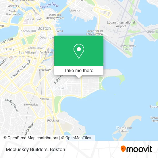
See Mccluskey Builders, Boston, on the map
Public Transit to Mccluskey Builders in Boston
Wondering how to get to Mccluskey Builders in Boston? Moovit helps you find the best way to get to Mccluskey Builders with step-by-step directions from the nearest public transit station.
Moovit provides free maps and live directions to help you navigate through your city. View schedules, routes, timetables, and find out how long does it take to get to Mccluskey Builders in real time.
Looking for the nearest stop or station to Mccluskey Builders? Check out this list of stops closest to your destination: E Broadway @ H St; Broadway; Pier 10; E 1st St @ City Point Bus Terminal; World Trade Center Pier; Seaport (Fan Pier).
Bus: 10, 7, 9.Train: FRAMINGHAM/WORCESTER, KINGSTON.Subway: RED LINE.Ferry: LOVEJOY - FAN PIER - PIER 10, FAST FERRY, QUINCY FERRY, WINTHROP FERRY, WINTHROP/QUINCY FERRY, EAST.
Want to see if there’s another route that gets you there at an earlier time? Moovit helps you find alternative routes or times. Get directions from and directions to Mccluskey Builders easily from the Moovit App or Website.
We make riding to Mccluskey Builders easy, which is why over 1.7 million users, including users in Boston, trust Moovit as the best app for public transit. You don’t need to download an individual bus app or train app, Moovit is your all-in-one transit app that helps you find the best bus time or train time available.
For information on prices of bus, subway and train, costs and ride fares to Mccluskey Builders, please check the Moovit app.
Use the app to navigate to popular places including to the airport, hospital, stadium, grocery store, mall, coffee shop, school, college, and university.
Mccluskey Builders Address: 656-1/2 E 2nd St street in Boston
- Greyhound Bus Garage,
- Ethel and Andy's Sandwich Shop (Ethel & Andy's Sub Shop),
- Murphy's Law,
- Kim Davidson,
- BSC Group (BSC Companies),
- Babe Cave,
- The Hub,
- CM Masonry and Construction,
- Flaherty Demolition,
- 775 Summer Street,
- South Boston, Massachusetts,
- The Distillery Gallery,
- Spencer Funeral Home,
- FedEx,
- All American Party Bus Tours,
- World Courier Ground,
- Precious M Cleaners & Laundromat,
- McDonough Gym/ Walsh Community Center,
- South Boston Municipal Court (Boston Southpaws),
- 647 Summer Street
Places Near Mccluskey Builders (Boston)
- North End, Boston,
- Boston Common, Boston,
- Museum Of Science, Boston,
- Boston Convention & Exhibition Center, Boston,
- Mgm Music Hall, Boston,
- Leader Bank Pavilion (Leader Bank Pavillion), Boston,
- Faneuil Hall, Boston,
- Prudential Center, Boston,
- Quincy Market, Boston,
- Seaport District, Boston,
- Massachusetts General Hospital, Boston,
- Cheers, Boston,
- Boston Medical Center, Boston,
- Boston Children's Hospital, Boston,
- Castle Island, Boston,
- House Of Blues, Boston,
- Td Garden, Boston,
- Isabella Stewart Gardner Museum, Boston,
- Wang Theater, Boston,
- Wilbur Theatre, Boston
How to get to popular places in Boston with public transit
Get around Boston by public transit!
Traveling around Boston has never been so easy. See step by step directions as you travel to any attraction, street or major public transit station. View bus and train schedules, arrival times, service alerts and detailed routes on a map, so you know exactly how to get to anywhere in Boston.
When traveling to any destination around Boston use Moovit's Live Directions with Get Off Notifications to know exactly where and how far to walk, how long to wait for your line, and how many stops are left. Moovit will alert you when it's time to get off — no need to constantly re-check whether yours is the next stop.
Wondering how to use public transit in Boston or how to pay for public transit in Boston? Moovit public transit app can help you navigate your way with public transit easily, and at minimum cost. It includes public transit fees, ticket prices, and costs. Looking for a map of Boston public transit lines? Moovit public transit app shows all public transit maps in Boston with all Bus, Train, Subway and Ferry routes and stops on an interactive map.
Boston has 4 transit type(s), including: Bus, Train, Subway and Ferry, operated by several transit agencies, including MBTA, Southeastern Regional Transit Authority, MetroWest Regional Transit Authority, Rhode Island Public Transit Authority, WRTA, Lowell Regional Transit Authority, Merrimack Valley Transit, Montachusett Regional Transit Authority, Cape Cod Regional Transit Authority, Brockton Area Transit Authority, Martha's Vineyard Transit Authority, the WAVE - Nantucket Regional Transit Authority, GATRA, Cape Ann Transportation Authority and Massport