Directions to Mcelhinney Plastering (Milton) with public transportation
The following transit lines have routes that pass near Mcelhinney Plastering
 Bus: 12, 240, 245.
- Subway: MATTAPAN LINE.
How to get to Mcelhinney Plastering by bus?
Click on the bus route to see step by step directions with maps, line arrival times and updated time schedules.
From Mass Eye & Ear, Boston
62 minFrom Brigham & Women's Hospital, Boston
83 minFrom The Monument, Boston
45 minFrom Roxbury, Boston
64 minFrom Dedham, MA, Dedham
85 minFrom John F. Kennedy Presidential Library And Museum, Boston
77 minFrom Andrew Square, Boston
60 minFrom Massachusetts College Of Pharmacy And Health Science, Boston
64 minFrom Ruggles Station, Boston
58 minFrom Mission Hill, Boston
60 min
How to get to Mcelhinney Plastering by subway?
Click on the subway route to see step by step directions with maps, line arrival times and updated time schedules.
From Mass Eye & Ear, Boston
91 minFrom Brigham & Women's Hospital, Boston
89 minFrom The Monument, Boston
93 minFrom Roxbury, Boston
87 minFrom John F. Kennedy Presidential Library And Museum, Boston
82 minFrom Andrew Square, Boston
62 minFrom Massachusetts College Of Pharmacy And Health Science, Boston
89 minFrom Ruggles Station, Boston
78 minFrom Mission Hill, Boston
90 min
Bus stops near Mcelhinney Plastering in Milton
Subway station near Mcelhinney Plastering in Milton
- Central Avenue, 9 min walk,VIEW
Bus lines to Mcelhinney Plastering in Milton
What are the closest stations to Mcelhinney Plastering?
The closest stations to Mcelhinney Plastering are:
- Pleasant St @ Horton Pl is 25 yards away, 1 min walk.
- Central Avenue is 678 yards away, 9 min walk.
- Randolph Ave @ Reedsdale Rd is 902 yards away, 11 min walk.
Which bus lines stop near Mcelhinney Plastering?
These bus lines stop near Mcelhinney Plastering: 12, 240, 245.
Which subway line stops near Mcelhinney Plastering?
MATTAPAN LINE (Mattapan)
What’s the nearest subway station to Mcelhinney Plastering in Milton?
The nearest subway station to Mcelhinney Plastering in Milton is Central Avenue. It’s a 9 min walk away.
What’s the nearest bus station to Mcelhinney Plastering in Milton?
The nearest bus station to Mcelhinney Plastering in Milton is Pleasant St @ Horton Pl. It’s a 1 min walk away.
What time is the first subway to Mcelhinney Plastering in Milton?
The MATTAPAN LINE is the first subway that goes to Mcelhinney Plastering in Milton. It stops nearby at 5:01 AM.
What time is the last subway to Mcelhinney Plastering in Milton?
The MATTAPAN LINE is the last subway that goes to Mcelhinney Plastering in Milton. It stops nearby at 2:39 AM.
What time is the first bus to Mcelhinney Plastering in Milton?
The 240 is the first bus that goes to Mcelhinney Plastering in Milton. It stops nearby at 4:54 AM.
What time is the last bus to Mcelhinney Plastering in Milton?
The 240 is the last bus that goes to Mcelhinney Plastering in Milton. It stops nearby at 1:04 AM.
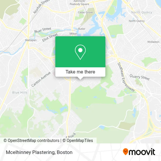
See Mcelhinney Plastering, Milton, on the map
Public Transit to Mcelhinney Plastering in Milton
Wondering how to get to Mcelhinney Plastering in Milton? Moovit helps you find the best way to get to Mcelhinney Plastering with step-by-step directions from the nearest public transit station.
Moovit provides free maps and live directions to help you navigate through your city. View schedules, routes, timetables, and find out how long does it take to get to Mcelhinney Plastering in real time.
Looking for the nearest stop or station to Mcelhinney Plastering? Check out this list of stops closest to your destination: Pleasant St @ Horton Pl; Central Avenue; Randolph Ave @ Reedsdale Rd.
Bus: 12, 240, 245.Subway: MATTAPAN LINE.
Want to see if there’s another route that gets you there at an earlier time? Moovit helps you find alternative routes or times. Get directions from and directions to Mcelhinney Plastering easily from the Moovit App or Website.
We make riding to Mcelhinney Plastering easy, which is why over 1.7 million users, including users in Milton, trust Moovit as the best app for public transit. You don’t need to download an individual bus app or train app, Moovit is your all-in-one transit app that helps you find the best bus time or train time available.
For information on prices of bus and subway, costs and ride fares to Mcelhinney Plastering, please check the Moovit app.
Use the app to navigate to popular places including to the airport, hospital, stadium, grocery store, mall, coffee shop, school, college, and university.
Mcelhinney Plastering Address: 15 Mathaurs St street in Milton
- Rick Baker, Realtor - Compass,
- Revive,
- Grand Circle Travel,
- Conklin Electric,
- Logan Car Airport Service,
- USPS Collection Box - Blue Box,
- Cunningham Park,
- Milton Cemetery (Town of Milton),
- Town of Milton,
- Barnes & Noble Booksellers,
- Hansen Wells,
- ChargePoint,
- Brook Rd @ Centre St,
- Bright Horizons,
- The Randolph,
- Maize Restoration and Remodeling,
- Meea,
- Apranta D Patel MD,
- CWB Foundation,
- Beth Israel Deaconess Healthcare - Milton Group
Places Near Mcelhinney Plastering (Milton)
- Boston Medical Center, Boston,
- Wilbur Theatre, Boston,
- House Of Blues, Boston,
- North End, Boston,
- Faneuil Hall, Boston,
- Museum Of Science, Boston,
- Td Garden, Boston,
- Leader Bank Pavilion (Leader Bank Pavillion), Boston,
- Wang Theater, Boston,
- Seaport District, Boston,
- Boston Common, Boston,
- Cheers, Boston,
- Prudential Center, Boston,
- Massachusetts General Hospital, Boston,
- Mgm Music Hall, Boston,
- Castle Island, Boston,
- Quincy Market, Boston,
- Boston Children's Hospital, Boston,
- Boston Convention & Exhibition Center, Boston,
- Isabella Stewart Gardner Museum, Boston
How to get to popular places in Boston with public transit
Get around Milton by public transit!
Traveling around Milton has never been so easy. See step by step directions as you travel to any attraction, street or major public transit station. View bus and train schedules, arrival times, service alerts and detailed routes on a map, so you know exactly how to get to anywhere in Milton.
When traveling to any destination around Milton use Moovit's Live Directions with Get Off Notifications to know exactly where and how far to walk, how long to wait for your line, and how many stops are left. Moovit will alert you when it's time to get off — no need to constantly re-check whether yours is the next stop.
Wondering how to use public transit in Milton or how to pay for public transit in Milton? Moovit public transit app can help you navigate your way with public transit easily, and at minimum cost. It includes public transit fees, ticket prices, and costs. Looking for a map of Milton public transit lines? Moovit public transit app shows all public transit maps in Milton with all Bus, Train, Subway and Ferry routes and stops on an interactive map.
Boston has 4 transit type(s), including: Bus, Train, Subway and Ferry, operated by several transit agencies, including MBTA, Southeastern Regional Transit Authority, MetroWest Regional Transit Authority, Rhode Island Public Transit Authority, WRTA, Lowell Regional Transit Authority, Merrimack Valley Transit, Montachusett Regional Transit Authority, Cape Cod Regional Transit Authority, Brockton Area Transit Authority, Martha's Vineyard Transit Authority, the WAVE - Nantucket Regional Transit Authority, GATRA, Cape Ann Transportation Authority and Massport