Directions to Mcelroy & Donaldson (Boston) with public transportation
The following transit lines have routes that pass near Mcelroy & Donaldson
 Bus: 1, 54, R, 51, 55.
- Train: PROVIDENCE/STOUGHTON, FOXBORO EVENT SERVICE, ACELA, NORTHEAST REGIONAL, PROVIDENCE LINE SHUTTLE.
How to get to Mcelroy & Donaldson by bus?
Click on the bus route to see step by step directions with maps, line arrival times and updated time schedules.
How to get to Mcelroy & Donaldson by train?
Click on the train route to see step by step directions with maps, line arrival times and updated time schedules.
Bus stops near Mcelroy & Donaldson in Boston
Train stations near Mcelroy & Donaldson in Boston
Bus lines to Mcelroy & Donaldson in Boston
What are the closest stations to Mcelroy & Donaldson?
The closest stations to Mcelroy & Donaldson are:
- Charles Before W River is 125 yards away, 2 min walk.
- Post Office at Corliss St is 410 yards away, 6 min walk.
- Rochambeau Avenue is 557 yards away, 7 min walk.
- Pawtucket/Central Falls is 996 yards away, 13 min walk.
- Providence is 1286 yards away, 16 min walk.
Which bus lines stop near Mcelroy & Donaldson?
These bus lines stop near Mcelroy & Donaldson: 1, 54, R.
Which train line stops near Mcelroy & Donaldson?
PROVIDENCE/STOUGHTON (#819 | Providence)
What’s the nearest train station to Mcelroy & Donaldson in Boston?
The nearest train station to Mcelroy & Donaldson in Boston is Pawtucket/Central Falls. It’s a 13 min walk away.
What’s the nearest bus station to Mcelroy & Donaldson in Boston?
The nearest bus station to Mcelroy & Donaldson in Boston is Charles Before W River. It’s a 2 min walk away.
What time is the first train to Mcelroy & Donaldson in Boston?
The PROVIDENCE/STOUGHTON is the first train that goes to Mcelroy & Donaldson in Boston. It stops nearby at 4:10 AM.
What time is the last train to Mcelroy & Donaldson in Boston?
The NORTHEAST REGIONAL is the last train that goes to Mcelroy & Donaldson in Boston. It stops nearby at 9:17 AM.
What time is the first bus to Mcelroy & Donaldson in Boston?
The 54 is the first bus that goes to Mcelroy & Donaldson in Boston. It stops nearby at 5:18 AM.
What time is the last bus to Mcelroy & Donaldson in Boston?
The R is the last bus that goes to Mcelroy & Donaldson in Boston. It stops nearby at 12:48 AM.
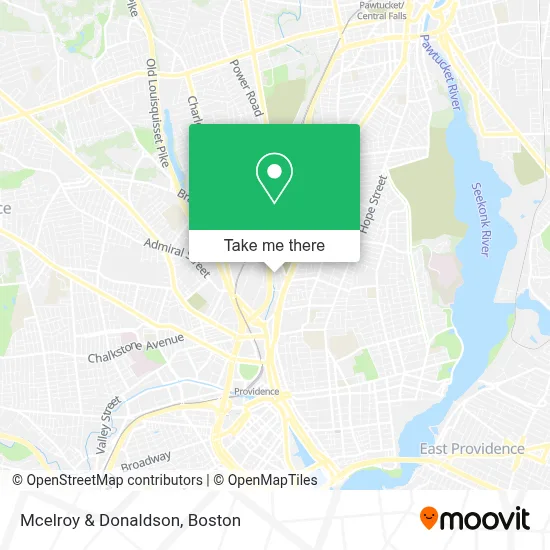
See Mcelroy & Donaldson, Boston, on the map
Public Transit to Mcelroy & Donaldson in Boston
Wondering how to get to Mcelroy & Donaldson in Boston? Moovit helps you find the best way to get to Mcelroy & Donaldson with step-by-step directions from the nearest public transit station.
Moovit provides free maps and live directions to help you navigate through your city. View schedules, routes, timetables, and find out how long does it take to get to Mcelroy & Donaldson in real time.
Looking for the nearest stop or station to Mcelroy & Donaldson? Check out this list of stops closest to your destination: Charles Before W River; Post Office at Corliss St; Rochambeau Avenue; Pawtucket/Central Falls; Providence.
Bus: 1, 54, R, 51, 55, 72, 58.Train: PROVIDENCE/STOUGHTON, FOXBORO EVENT SERVICE, ACELA, NORTHEAST REGIONAL, PROVIDENCE LINE SHUTTLE, PROVIDENCE LINE SHUTTLE, PROVIDENCE LINE SHUTTLE.
Want to see if there’s another route that gets you there at an earlier time? Moovit helps you find alternative routes or times. Get directions from and directions to Mcelroy & Donaldson easily from the Moovit App or Website.
We make riding to Mcelroy & Donaldson easy, which is why over 1.7 million users, including users in Boston, trust Moovit as the best app for public transit. You don’t need to download an individual bus app or train app, Moovit is your all-in-one transit app that helps you find the best bus time or train time available.
For information on prices of bus and train, costs and ride fares to Mcelroy & Donaldson, please check the Moovit app.
Use the app to navigate to popular places including to the airport, hospital, stadium, grocery store, mall, coffee shop, school, college, and university.
Mcelroy & Donaldson Address: 21 Dryden Ln street in Boston
- Dryden Mill,
- Mobile Auto Glass,
- Weiss Realty,
- Branch Station,
- Providence Fire Department Engine Company 2 Ladder Company 7 Rescue 3,
- City of Providence Parks Dept,
- Corrow, John D, Od - Advanced Eye Care Assoc,
- Extended Stay America,
- Fresenius Kidney Care,
- Ryder Truck Rental and Leasing,
- Thriveworks,
- Sheldon D Kaplan MD,
- Mike Slavit,
- Gracia Channel,
- Cse*Wilkinson Fuels,
- Harmony Women's Care,
- Lifespan Corporation,
- Revive Therapeutic Services,
- Children's Healthcare,
- Coinstar
Places Near Mcelroy & Donaldson (Boston)
- Castle Island, Boston,
- Boston Common, Boston,
- North End, Boston,
- Massachusetts General Hospital, Boston,
- Seaport District, Boston,
- Leader Bank Pavilion (Leader Bank Pavillion), Boston,
- House Of Blues, Boston,
- Isabella Stewart Gardner Museum, Boston,
- Wang Theater, Boston,
- Museum Of Science, Boston,
- Boston Children's Hospital, Boston,
- Quincy Market, Boston,
- Cheers, Boston,
- Faneuil Hall, Boston,
- Wilbur Theatre, Boston,
- Mgm Music Hall, Boston,
- Boston Convention & Exhibition Center, Boston,
- Boston Medical Center, Boston,
- Prudential Center, Boston,
- Td Garden, Boston
How to get to popular places in Boston with public transit
Get around Boston by public transit!
Traveling around Boston has never been so easy. See step by step directions as you travel to any attraction, street or major public transit station. View bus and train schedules, arrival times, service alerts and detailed routes on a map, so you know exactly how to get to anywhere in Boston.
When traveling to any destination around Boston use Moovit's Live Directions with Get Off Notifications to know exactly where and how far to walk, how long to wait for your line, and how many stops are left. Moovit will alert you when it's time to get off — no need to constantly re-check whether yours is the next stop.
Wondering how to use public transit in Boston or how to pay for public transit in Boston? Moovit public transit app can help you navigate your way with public transit easily, and at minimum cost. It includes public transit fees, ticket prices, and costs. Looking for a map of Boston public transit lines? Moovit public transit app shows all public transit maps in Boston with all Bus, Train, Subway and Ferry routes and stops on an interactive map.
Boston has 4 transit type(s), including: Bus, Train, Subway and Ferry, operated by several transit agencies, including MBTA, Southeastern Regional Transit Authority, MetroWest Regional Transit Authority, Rhode Island Public Transit Authority, WRTA, Lowell Regional Transit Authority, Merrimack Valley Transit, Montachusett Regional Transit Authority, Cape Cod Regional Transit Authority, Brockton Area Transit Authority, Martha's Vineyard Transit Authority, the WAVE - Nantucket Regional Transit Authority, GATRA, Cape Ann Transportation Authority and Massport