See Mclachlen Building, Washington, on the map
Directions to Mclachlen Building (Washington) with public transportation
The following transit lines have routes that pass near Mclachlen Building
 Bus:
Bus: - Train:
- Metro:
How to get to Mclachlen Building by bus?
Click on the bus route to see step by step directions with maps, line arrival times and updated time schedules.
How to get to Mclachlen Building by train?
Click on the train route to see step by step directions with maps, line arrival times and updated time schedules.
How to get to Mclachlen Building by metro?
Click on the metro route to see step by step directions with maps, line arrival times and updated time schedules.
Metro stations near Mclachlen Building in Washington
- Metro Center,2 min walk,
What are the closest stations to Mclachlen Building?
The closest stations to Mclachlen Building are:
- Metro Center is 0 yards away, 2 min walk.
Which bus lines stop near Mclachlen Building?
These bus lines stop near Mclachlen Building: 11Y, 16C, A9, S2.
Which train lines stop near Mclachlen Building?
These train lines stop near Mclachlen Building: FREDERICKSBURG LINE, MARC.
Which metro lines stop near Mclachlen Building?
These metro lines stop near Mclachlen Building: METRORAIL BLUE LINE, METRORAIL GREEN LINE, METRORAIL ORANGE LINE, METRORAIL RED LINE, METRORAIL SILVER LINE, METRORAIL YELLOW LINE.
What’s the nearest metro station to Mclachlen Building in Washington?
The nearest metro station to Mclachlen Building in Washington is Metro Center. It’s a 2 min walk away.
See Mclachlen Building, Washington, on the map
Public Transit to Mclachlen Building in Washington
Wondering how to get to Mclachlen Building in Washington, United States? Moovit helps you find the best way to get to Mclachlen Building with step-by-step directions from the nearest public transit station.
Moovit provides free maps and live directions to help you navigate through your city. View schedules, routes, timetables, and find out how long does it take to get to Mclachlen Building in real time.
Looking for the nearest stop or station to Mclachlen Building? Check out this list of stops closest to your destination: Metro Center.
Bus:Train:Metro:
Want to see if there’s another route that gets you there at an earlier time? Moovit helps you find alternative routes or times. Get directions from and directions to Mclachlen Building easily from the Moovit App or Website.
We make riding to Mclachlen Building easy, which is why over 1.5 million users, including users in Washington, trust Moovit as the best app for public transit. You don’t need to download an individual bus app or train app, Moovit is your all-in-one transit app that helps you find the best bus time or train time available.
For information on prices of bus, metro and train, costs and ride fares to Mclachlen Building, please check the Moovit app.
Use the app to navigate to popular places including to the airport, hospital, stadium, grocery store, mall, coffee shop, school, college, and university.
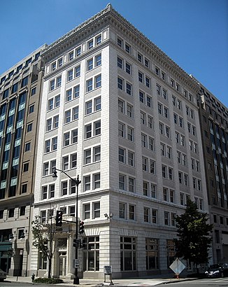
Mclachlen Building Address: G Street Northwest street in Washington
Attractions near Mclachlen Building
Application Developers Alliance,Metro Center (East Entrance),The Resolution Jam,Woodward And Lothrop Building,Forever 21,The Salvation Army,Democracy Resource Center,Woodies Holdings,,10th St,G / 10th St,10th St NW @ 1st,United Bank,St. Patrick's Catholic Church,Forever 21,One Medical Group,DC Wax Museum,Huber Lawrence & Abell,Jerome H Heckman Lawyer,Alexa B Barnett Lawyer,Klug Law OfficeHow to get to popular attractions in Washington with public transit
Glen Burnie, MD, Anne Arundel County,BWI Rental Car Facility, Anne Arundel County,Centreville, VA, Fairfax County,Bullfeathers, Washington,Canton, Baltimore,New Psalmist Baptist Church, Baltimore County,Teaism Penn Quarter, Washington,O'Sullivan's Irish Pub & Restaurant, Arlington County,Horseshoe Baltimore, Baltimore,Towson, MD, Baltimore County,Dumfries, VA, Prince William County,Bar Louie, Washington,Dundalk, Maryland, Baltimore County,Tunnicliff's Tavern, Washington,Anne Arundel Community College, Anne Arundel County,Hyatt Regency Baltimore Inner Harbor, Baltimore,Union Pub, Washington,P.J. Clarke's, Washington,Damascus, MD, Montgomery County,Pigtown / Washington Village, BaltimoreGet around Washington by public transit!
Traveling around Washington has never been so easy. See step by step directions as you travel to any attraction, street or major public transit station. View bus and train schedules, arrival times, service alerts and detailed routes on a map, so you know exactly how to get to anywhere in Washington.
When traveling to any destination around Washington use Moovit's Live Directions with Get Off Notifications to know exactly where and how far to walk, how long to wait for your line, and how many stops are left. Moovit will alert you when it's time to get off — no need to constantly re-check whether yours is the next stop.
Wondering how to use public transit in Washington or how to pay for public transit in Washington? Moovit public transit app can help you navigate your way with public transit easily, and at minimum cost. It includes public transit fees, ticket prices, and costs. Looking for a map of Washington public transit lines? Moovit public transit app shows all public transit maps in Washington with all bus, metro or train routes and stops on an interactive map.
Washington has 3 transit type(s), including: bus, metro or train, operated by several transit agencies, including WMATA, WMATA, Montgomery County Ride On, Fairfax Connector, TheBus, DC Circulator, MDOT MTA, Marc, MDOT MTA, MDOT MTA, Virginia Railway Express (VRE), PRTC, DASH - Alexandria, Arlington Transit (ART) and DC Streetcar