How to get to Mclean Imaging Center by bus?
Click on the bus route to see step by step directions with maps, line arrival times and updated time schedules.
From Woburn, MA, Woburn
89 minFrom Sanofi-aventis, Cambridge
69 minFrom MBTA-Museum of Fine Arts, Boston
84 minFrom Cambridgeside Galleria Shuttle Stop, Cambridge
75 minFrom Massachusetts Institute of Technology (MIT), Cambridge
57 minFrom Royal Sonesta, Cambridge
75 minFrom Museum Of Fine Arts MBTA Station, Boston
84 minFrom Bunker Hill Community College, Boston
87 minFrom Beth Israel Deaconess Medical Center West Campus, Boston
85 minFrom Encore Boston Harbor, Everett
81 min
How to get to Mclean Imaging Center by train?
Click on the train route to see step by step directions with maps, line arrival times and updated time schedules.
Bus stops near Mclean Imaging Center in Belmont
Train station near Mclean Imaging Center in Belmont
- Waverley, 3 min walk,VIEW
Subway station near Mclean Imaging Center in Belmont
- Alewife, 33 min walk,VIEW
Bus lines to Mclean Imaging Center in Belmont
What are the closest stations to Mclean Imaging Center?
The closest stations to Mclean Imaging Center are:
- Trapelo Rd @ Waverley St is 104 yards away, 2 min walk.
- Trapelo Rd @ Church St is 131 yards away, 2 min walk.
- Waverley is 161 yards away, 3 min walk.
- Alewife is 2831 yards away, 33 min walk.
Which bus lines stop near Mclean Imaging Center?
These bus lines stop near Mclean Imaging Center: 67, 73.
Which train line stops near Mclean Imaging Center?
FITCHBURG (#409 | Wachusett)
What’s the nearest train station to Mclean Imaging Center in Belmont?
The nearest train station to Mclean Imaging Center in Belmont is Waverley. It’s a 3 min walk away.
What’s the nearest bus station to Mclean Imaging Center in Belmont?
The nearest bus stations to Mclean Imaging Center in Belmont are Trapelo Rd @ Waverley St and Trapelo Rd @ Church St. The closest one is a 2 min walk away.
What time is the first subway to Mclean Imaging Center in Belmont?
The RED LINE is the first subway that goes to Mclean Imaging Center in Belmont. It stops nearby at 5:15 AM.
What time is the last subway to Mclean Imaging Center in Belmont?
The RED LINE is the last subway that goes to Mclean Imaging Center in Belmont. It stops nearby at 2:06 AM.
What time is the first train to Mclean Imaging Center in Belmont?
The FITCHBURG is the first train that goes to Mclean Imaging Center in Belmont. It stops nearby at 5:39 AM.
What time is the last train to Mclean Imaging Center in Belmont?
The FITCHBURG is the last train that goes to Mclean Imaging Center in Belmont. It stops nearby at 12:11 AM.
What time is the first bus to Mclean Imaging Center in Belmont?
The 73 is the first bus that goes to Mclean Imaging Center in Belmont. It stops nearby at 5:01 AM.
What time is the last bus to Mclean Imaging Center in Belmont?
The 73 is the last bus that goes to Mclean Imaging Center in Belmont. It stops nearby at 1:23 AM.
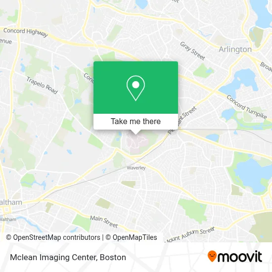
See Mclean Imaging Center, Belmont, on the map
Public Transit to Mclean Imaging Center in Belmont
Wondering how to get to Mclean Imaging Center in Belmont? Moovit helps you find the best way to get to Mclean Imaging Center with step-by-step directions from the nearest public transit station.
Moovit provides free maps and live directions to help you navigate through your city. View schedules, routes, timetables, and find out how long does it take to get to Mclean Imaging Center in real time.
Looking for the nearest stop or station to Mclean Imaging Center? Check out this list of stops closest to your destination: Trapelo Rd @ Waverley St; Trapelo Rd @ Church St; Waverley; Alewife.
Bus: 67, 73, 554, FITCHBURG LINE SHUTTLE.Train: FITCHBURG.Subway: RED LINE.
Want to see if there’s another route that gets you there at an earlier time? Moovit helps you find alternative routes or times. Get directions from and directions to Mclean Imaging Center easily from the Moovit App or Website.
We make riding to Mclean Imaging Center easy, which is why over 1.7 million users, including users in Belmont, trust Moovit as the best app for public transit. You don’t need to download an individual bus app or train app, Moovit is your all-in-one transit app that helps you find the best bus time or train time available.
For information on prices of bus, subway and train, costs and ride fares to Mclean Imaging Center, please check the Moovit app.
Use the app to navigate to popular places including to the airport, hospital, stadium, grocery store, mall, coffee shop, school, college, and university.
Mclean Imaging Center Address: 115 Mill St street in Belmont
- McLean Hospital,
- Arlington School,
- Mcclean Psychiatric Hospital,
- Adlab - Mclean Hospital / Harvard Medical School,
- Dr. Tolats,
- Brain Mri Studies In Boston Area,
- Mclean Child Care Center,
- Mclean Imaging Center,
- Arlington School,
- Cns/Pathways Academy,
- The Mclean Imaging Center,
- Chris Palmer, Md,
- Mclean Cbd Studies,
- Ocd Massachusetts,
- Laboratory For Affective And Translational Neuroscience,
- Dr. Tola Aestheticsmd - Belmont,
- Gunderson Personality Disorders Institute,
- Fernando Rodriguez-Villa Md,
- Maddison Massey, Licsw,
- Klarman Eating Disorders Center
Places Near Mclean Imaging Center (Belmont)
- Wilbur Theatre, Boston,
- Prudential Center, Boston,
- Wang Theater, Boston,
- Faneuil Hall, Boston,
- Museum Of Science, Boston,
- Massachusetts General Hospital, Boston,
- Quincy Market, Boston,
- Mgm Music Hall, Boston,
- Boston Convention & Exhibition Center, Boston,
- Boston Children's Hospital, Boston,
- Boston Common, Boston,
- Seaport District, Boston,
- Boston Medical Center, Boston,
- Isabella Stewart Gardner Museum, Boston,
- Leader Bank Pavilion (Leader Bank Pavillion), Boston,
- Castle Island, Boston,
- North End, Boston,
- Td Garden, Boston,
- House Of Blues, Boston,
- Cheers, Boston
How to get to popular places in Boston with public transit
Get around Belmont by public transit!
Traveling around Belmont has never been so easy. See step by step directions as you travel to any attraction, street or major public transit station. View bus and train schedules, arrival times, service alerts and detailed routes on a map, so you know exactly how to get to anywhere in Belmont.
When traveling to any destination around Belmont use Moovit's Live Directions with Get Off Notifications to know exactly where and how far to walk, how long to wait for your line, and how many stops are left. Moovit will alert you when it's time to get off — no need to constantly re-check whether yours is the next stop.
Wondering how to use public transit in Belmont or how to pay for public transit in Belmont? Moovit public transit app can help you navigate your way with public transit easily, and at minimum cost. It includes public transit fees, ticket prices, and costs. Looking for a map of Belmont public transit lines? Moovit public transit app shows all public transit maps in Belmont with all Bus, Train, Subway and Ferry routes and stops on an interactive map.
Boston has 4 transit type(s), including: Bus, Train, Subway and Ferry, operated by several transit agencies, including MBTA, Southeastern Regional Transit Authority, MetroWest Regional Transit Authority, Rhode Island Public Transit Authority, WRTA, Lowell Regional Transit Authority, Merrimack Valley Transit, Montachusett Regional Transit Authority, Cape Cod Regional Transit Authority, Brockton Area Transit Authority, Martha's Vineyard Transit Authority, the WAVE - Nantucket Regional Transit Authority, GATRA, Cape Ann Transportation Authority and Massport