See Meadowlands Arena, East Rutherford, Nj, on the map
Directions to Meadowlands Arena (East Rutherford, Nj) with public transportation
The following transit lines have routes that pass near Meadowlands Arena
 Bus:
Bus: - Train:
How to get to Meadowlands Arena by bus?
Click on the bus route to see step by step directions with maps, line arrival times and updated time schedules.
Bus stations near Meadowlands Arena in East Rutherford, Nj
- Washington Ave at Road A,15 min walk,
Train stations near Meadowlands Arena in East Rutherford, Nj
- Wood- Ridge,63 min walk,
- Rutherford,64 min walk,
Bus lines to Meadowlands Arena in East Rutherford, Nj
- 161,New York,
- 772,American Dream,
What are the closest stations to Meadowlands Arena?
The closest stations to Meadowlands Arena are:
- Washington Ave at Road A is 1114 yards away, 15 min walk.
- Wood- Ridge is 5315 yards away, 63 min walk.
- Rutherford is 5364 yards away, 64 min walk.
Which bus line stops near Meadowlands Arena?
355
What’s the nearest bus stop to Meadowlands Arena in East Rutherford, Nj?
The nearest bus stop to Meadowlands Arena in East Rutherford, Nj is Washington Ave at Road A. It’s a 15 min walk away.
See Meadowlands Arena, East Rutherford, Nj, on the map
Public Transit to Meadowlands Arena in East Rutherford, Nj
Wondering how to get to Meadowlands Arena in East Rutherford, Nj, United States? Moovit helps you find the best way to get to Meadowlands Arena with step-by-step directions from the nearest public transit station.
Moovit provides free maps and live directions to help you navigate through your city. View schedules, routes, timetables, and find out how long does it take to get to Meadowlands Arena in real time.
Looking for the nearest stop or station to Meadowlands Arena? Check out this list of stops closest to your destination: Washington Ave at Road A; Wood- Ridge; Rutherford.
Bus:Train:
Want to see if there’s another route that gets you there at an earlier time? Moovit helps you find alternative routes or times. Get directions from and directions to Meadowlands Arena easily from the Moovit App or Website.
We make riding to Meadowlands Arena easy, which is why over 1.5 million users, including users in East Rutherford, Nj, trust Moovit as the best app for public transit. You don’t need to download an individual bus app or train app, Moovit is your all-in-one transit app that helps you find the best bus time or train time available.
For information on prices of bus and subway, costs and ride fares to Meadowlands Arena, please check the Moovit app.
Use the app to navigate to popular places including to the airport, hospital, stadium, grocery store, mall, coffee shop, school, college, and university.
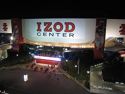
Meadowlands Arena Address: Arena Road street in East Rutherford, Nj
Attractions near Meadowlands Arena
IZOD Center (Meadowlands Arena),NJSEA EMS - Arena Medical,Brendan Byrne Arena,34 Arena Rd,Nuclear Cowboys Motocross,Deck E,Lot 26,Izod Center Parking Lot,Lot 27,Bang Cookies,MetLife Stadium Parking Lot B,Zales,Are E Peripheral Rd,American Dream Way,American Dream Peripheral Rd,Nike,Lot 26,Deck 23,The Dining Terrace,Munchies Food HallHow to get to popular attractions in East Rutherford, Nj with public transit
Woorijip, Manhattan,High Line, Manhattan,Central Park SummerStage, Manhattan,Joe's Shanghai 鹿嗚春, Manhattan,Freehold Raceway Mall, Freehold Township,I-80 (Interstate 80), Paterson, Nj,24 Hour Fitness, Manhattan,Dinosaur Bar-B-Que, Manhattan,The Meatball Shop,Peter Luger Steak House,The Plaza Hotel, Manhattan,Fette Sau,The Park, Manhattan,Stout, Manhattan,Stamford, CT, Stamford, Ct,Rubirosa Ristorante, Manhattan,Newark Liberty International Airport (EWR), Newark, Nj,Hotel Chantelle, Manhattan,The Grey Dog, Manhattan,MTA Subway - Coney Island / Stillwell Ave (D / F/N / Q)Get around East Rutherford, Nj by public transit!
Traveling around East Rutherford, Nj has never been so easy. See step by step directions as you travel to any attraction, street or major public transit station. View bus and train schedules, arrival times, service alerts and detailed routes on a map, so you know exactly how to get to anywhere in East Rutherford, Nj.
When traveling to any destination around East Rutherford, Nj use Moovit's Live Directions with Get Off Notifications to know exactly where and how far to walk, how long to wait for your line, and how many stops are left. Moovit will alert you when it's time to get off — no need to constantly re-check whether yours is the next stop.
Wondering how to use public transit in East Rutherford, Nj or how to pay for public transit in East Rutherford, Nj? Moovit public transit app can help you navigate your way with public transit easily, and at minimum cost. It includes public transit fees, ticket prices, and costs. Looking for a map of East Rutherford, Nj public transit lines? Moovit public transit app shows all public transit maps in East Rutherford, Nj with all bus or subway routes and stops on an interactive map.
East Rutherford, Nj has 2 transit type(s), including: bus or subway, operated by several transit agencies, including MTA Subway, Metro-North Railroad, LIRR, PATH, Shore Line East, MTA Bus Company, MTA New York City Transit - Express routes, MTA Bus, NJ Transit, NYC Ferry, NICE bus, Bee-Line Bus, NJ Transit Rail, NJ Transit Rail and Norwalk Transit District