Directions to Medford Ccsr with public transportation
The following transit lines have routes that pass near Medford Ccsr
 Bus: 134, 80, 95, 94, 101.
- Train: LOWELL.
- Subway: GREEN LINE E, GREEN LINE B, GREEN LINE C.
How to get to Medford Ccsr by bus?
Click on the bus route to see step by step directions with maps, line arrival times and updated time schedules.
From Citrus & Salt
72 minFrom Boston Marriott Copley Place
71 minFrom Royal Sonesta Hotel
62 minFrom New England Law | Boston
83 minFrom Salem St
57 minFrom Cheers Beacon Hill
55 minFrom New England Aquarium
50 minFrom The Cheesecake Factory
74 minFrom Hotel Aka Back Bay (Hotel Back Bay)
72 minFrom Boston Burger Company - Boston
70 min
How to get to Medford Ccsr by train?
Click on the train route to see step by step directions with maps, line arrival times and updated time schedules.
How to get to Medford Ccsr by subway?
Click on the subway route to see step by step directions with maps, line arrival times and updated time schedules.
From Citrus & Salt
79 minFrom Boston Marriott Copley Place
80 minFrom Royal Sonesta Hotel
65 minFrom New England Law | Boston
74 minFrom Salem St
68 minFrom Cheers Beacon Hill
80 minFrom New England Aquarium
73 minFrom The Cheesecake Factory
78 minFrom Hotel Aka Back Bay (Hotel Back Bay)
79 minFrom Boston Burger Company - Boston
80 min
Bus stops near Medford Ccsr
Subway station near Medford Ccsr
- Ball Square Station, 32 min walk,VIEW
Train station near Medford Ccsr
- West Medford, 34 min walk,VIEW
Bus lines to Medford Ccsr
What are the closest stations to Medford Ccsr?
The closest stations to Medford Ccsr are:
- Winthrop St Opp Smith Ln is 386 yards away, 5 min walk.
- Medford High School is 595 yards away, 8 min walk.
- Ball Square Station is 2694 yards away, 32 min walk.
- West Medford is 2881 yards away, 34 min walk.
Which bus lines stop near Medford Ccsr?
These bus lines stop near Medford Ccsr: 134, 80, 95.
Which train line stops near Medford Ccsr?
LOWELL (#323 | Lowell)
Which subway line stops near Medford Ccsr?
GREEN LINE E (Lechmere)
What’s the nearest bus station to Medford Ccsr?
The nearest bus station to Medford Ccsr is Winthrop St Opp Smith Ln. It’s a 5 min walk away.
What time is the first subway to Medford Ccsr?
The GREEN LINE E is the first subway that goes to Medford Ccsr. It stops nearby at 4:55 AM.
What time is the last subway to Medford Ccsr?
The GREEN LINE E is the last subway that goes to Medford Ccsr. It stops nearby at 2:41 AM.
What time is the first train to Medford Ccsr?
The LOWELL is the first train that goes to Medford Ccsr. It stops nearby at 5:27 AM.
What time is the last train to Medford Ccsr?
The LOWELL is the last train that goes to Medford Ccsr. It stops nearby at 12:20 AM.
What time is the first bus to Medford Ccsr?
The 95 is the first bus that goes to Medford Ccsr. It stops nearby at 5:24 AM.
What time is the last bus to Medford Ccsr?
The 95 is the last bus that goes to Medford Ccsr. It stops nearby at 1:39 AM.
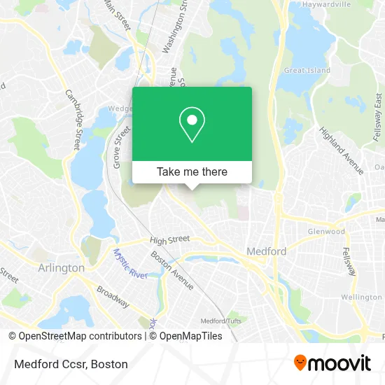
See Medford Ccsr on the map
Public Transportation to Medford Ccsr
Wondering how to get to Medford Ccsr? Moovit helps you find the best way to get to Medford Ccsr with step-by-step directions from the nearest public transit station.
Moovit provides free maps and live directions to help you navigate through your city. View schedules, routes, timetables, and find out how long does it take to get to Medford Ccsr in real time.
Looking for the nearest stop or station to Medford Ccsr? Check out this list of stops closest to your destination: Winthrop St Opp Smith Ln; Medford High School; Ball Square Station; West Medford.
Bus: 134, 80, 95, 94, 101.Train: LOWELL.Subway: GREEN LINE E, GREEN LINE B, GREEN LINE C.
Want to see if there’s another route that gets you there at an earlier time? Moovit helps you find alternative routes or times. Get directions from and directions to Medford Ccsr easily from the Moovit App or Website.
We make riding to Medford Ccsr easy, which is why over 1.7 million users, including users in Medford, trust Moovit as the best app for public transit. You don’t need to download an individual bus app or train app, Moovit is your all-in-one transit app that helps you find the best bus time or train time available.
For information on prices of bus, subway and train, costs and ride fares to Medford Ccsr, please check the Moovit app.
Use the app to navigate to popular places including to the airport, hospital, stadium, grocery store, mall, coffee shop, school, college, and university.
Medford Ccsr Address: 489 Winthrop St street in Medford
- Medford High,
- Medford High School (Medford Public Schools),
- Bistro 489,
- Medford Community Media,
- Friends of the Medford Family Network,
- Cunningham Super Steam Cleaning,
- Lad in A Battle,
- Kathryn I Vitiello DMD,
- John H. McGill House,
- TDM,
- Tony Woo, DDS,
- George Sousa,
- Premier Wood Flooring,
- Pierce Properties Real Estate,
- AAA Transcription Specialists,
- Riverside Motorsports,
- Jonathan Fletcher House,
- USPS Collection Box - Blue Box,
- Gilbert Carey Painting,
- Playstead Park
Places Near Medford Ccsr
- North End, Boston,
- Boston Common, Boston,
- Castle Island, Boston,
- Seaport District, Boston,
- Wang Theater, Boston,
- Faneuil Hall, Boston,
- Td Garden, Boston,
- Isabella Stewart Gardner Museum, Boston,
- House Of Blues, Boston,
- Boston Medical Center, Boston,
- Prudential Center, Boston,
- Cheers, Boston,
- Boston Convention & Exhibition Center, Boston,
- Museum Of Science, Boston,
- Massachusetts General Hospital, Boston,
- Mgm Music Hall, Boston,
- Leader Bank Pavilion (Leader Bank Pavillion), Boston,
- Boston Children's Hospital, Boston,
- Quincy Market, Boston,
- Wilbur Theatre, Boston
How to get to popular places in Boston with public transit
Get around Medford by public transit!
Traveling around Medford has never been so easy. See step by step directions as you travel to any attraction, street or major public transit station. View bus and train schedules, arrival times, service alerts and detailed routes on a map, so you know exactly how to get to anywhere in Medford.
When traveling to any destination around Medford use Moovit's Live Directions with Get Off Notifications to know exactly where and how far to walk, how long to wait for your line, and how many stops are left. Moovit will alert you when it's time to get off — no need to constantly re-check whether yours is the next stop.
Wondering how to use public transit in Medford or how to pay for public transit in Medford? Moovit public transit app can help you navigate your way with public transit easily, and at minimum cost. It includes public transit fees, ticket prices, and costs. Looking for a map of Medford public transit lines? Moovit public transit app shows all public transit maps in Medford with all Bus, Train, Subway and Ferry routes and stops on an interactive map.
Boston has 4 transit type(s), including: Bus, Train, Subway and Ferry, operated by several transit agencies, including MBTA, Southeastern Regional Transit Authority, MetroWest Regional Transit Authority, Rhode Island Public Transit Authority, WRTA, Lowell Regional Transit Authority, Merrimack Valley Transit, Montachusett Regional Transit Authority, Cape Cod Regional Transit Authority, Brockton Area Transit Authority, Martha's Vineyard Transit Authority, the WAVE - Nantucket Regional Transit Authority, GATRA, Cape Ann Transportation Authority and Massport