Directions to Medsav Solutions (Malden) with public transportation
The following transit lines have routes that pass near Medsav Solutions
 Bus: 101, 104, 105, 99, 106.
- Train: NEWBURYPORT/ROCKPORT, HAVERHILL, ORANGE LINE.
- Subway: ORANGE LINE.
How to get to Medsav Solutions by bus?
Click on the bus route to see step by step directions with maps, line arrival times and updated time schedules.
From Beth Israel Hospital, Boston
71 minFrom East Boston, Boston
42 minFrom The Beehive, Boston
86 minFrom MBTA-Museum of Fine Arts, Boston
93 minFrom Copley House, Boston
96 minFrom Rosie's Place, Boston
84 minFrom Museum Of Fine Arts MBTA Station, Boston
93 minFrom John Hancock Tower (200 Clarendon), Boston
82 minFrom Boston University Goldman School of Dental Medicine, Boston
87 minFrom Abe & Louie's, Boston
85 min
How to get to Medsav Solutions by subway?
Click on the subway route to see step by step directions with maps, line arrival times and updated time schedules.
From Beth Israel Hospital, Boston
58 minFrom East Boston, Boston
41 minFrom The Beehive, Boston
36 minFrom MBTA-Museum of Fine Arts, Boston
41 minFrom Copley House, Boston
37 minFrom Rosie's Place, Boston
41 minFrom Museum Of Fine Arts MBTA Station, Boston
41 minFrom John Hancock Tower (200 Clarendon), Boston
32 minFrom Boston University Goldman School of Dental Medicine, Boston
48 minFrom Abe & Louie's, Boston
37 min
Bus stops near Medsav Solutions in Malden
Bus lines to Medsav Solutions in Malden
- 99, Wellington - Woodland Rd,VIEW
- 105, Sullivan - Malden,VIEW
- 106, Wellington - Lebanon Loop,VIEW
- 108, Wellington - Linden Square,VIEW
- 131, Malden via Oak Grove - Melrose Highlands via Oak Grove,VIEW
- 137, Malden - Reading Depot,VIEW
- 411, Malden - Jack Satter House,VIEW
- 430, Malden via Square One Mall - Saugus Center via Square One Mall,VIEW
- 104, Malden,VIEW
What are the closest stations to Medsav Solutions?
The closest stations to Medsav Solutions are:
- Main St Opp Pleasant St is 168 yards away, 3 min walk.
- Centre St @ Main St is 343 yards away, 5 min walk.
- Chelsea is 351 yards away, 7 min walk.
- Oak Grove is 3397 yards away, 40 min walk.
Which bus lines stop near Medsav Solutions?
These bus lines stop near Medsav Solutions: 101, 104, 105.
Which subway line stops near Medsav Solutions?
ORANGE LINE (Oak Grove)
What’s the nearest train station to Medsav Solutions in Malden?
The nearest train station to Medsav Solutions in Malden is Chelsea. It’s a 7 min walk away.
What’s the nearest bus station to Medsav Solutions in Malden?
The nearest bus station to Medsav Solutions in Malden is Main St Opp Pleasant St. It’s a 3 min walk away.
What time is the first subway to Medsav Solutions in Malden?
The ORANGE LINE is the first subway that goes to Medsav Solutions in Malden. It stops nearby at 5:15 AM.
What time is the last subway to Medsav Solutions in Malden?
The ORANGE LINE is the last subway that goes to Medsav Solutions in Malden. It stops nearby at 1:59 AM.
What time is the first train to Medsav Solutions in Malden?
The HAVERHILL is the first train that goes to Medsav Solutions in Malden. It stops nearby at 5:35 AM.
What time is the last train to Medsav Solutions in Malden?
The NEWBURYPORT/ROCKPORT is the last train that goes to Medsav Solutions in Malden. It stops nearby at 12:06 AM.
What time is the first bus to Medsav Solutions in Malden?
The 104 is the first bus that goes to Medsav Solutions in Malden. It stops nearby at 4:27 AM.
What time is the last bus to Medsav Solutions in Malden?
The 104 is the last bus that goes to Medsav Solutions in Malden. It stops nearby at 1:38 AM.
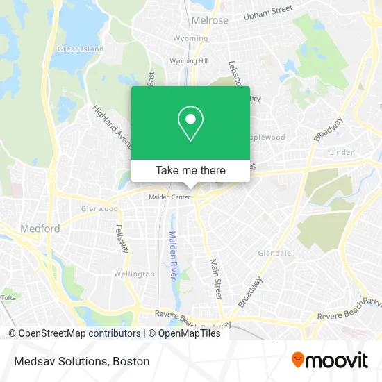
See Medsav Solutions, Malden, on the map
Public Transit to Medsav Solutions in Malden
Wondering how to get to Medsav Solutions in Malden? Moovit helps you find the best way to get to Medsav Solutions with step-by-step directions from the nearest public transit station.
Moovit provides free maps and live directions to help you navigate through your city. View schedules, routes, timetables, and find out how long does it take to get to Medsav Solutions in real time.
Looking for the nearest stop or station to Medsav Solutions? Check out this list of stops closest to your destination: Main St Opp Pleasant St; Centre St @ Main St; Chelsea; Oak Grove.
Bus: 101, 104, 105, 99, 106, 108, 131.Train: NEWBURYPORT/ROCKPORT, HAVERHILL, ORANGE LINE.Subway: ORANGE LINE.
Want to see if there’s another route that gets you there at an earlier time? Moovit helps you find alternative routes or times. Get directions from and directions to Medsav Solutions easily from the Moovit App or Website.
We make riding to Medsav Solutions easy, which is why over 1.7 million users, including users in Malden, trust Moovit as the best app for public transit. You don’t need to download an individual bus app or train app, Moovit is your all-in-one transit app that helps you find the best bus time or train time available.
For information on prices of bus and subway, costs and ride fares to Medsav Solutions, please check the Moovit app.
Use the app to navigate to popular places including to the airport, hospital, stadium, grocery store, mall, coffee shop, school, college, and university.
Medsav Solutions Address: 31 Pleasant St street in Malden
- Malden MA Locksmith Store,
- Bethel Church,
- Zuru Zuru Ramen & Donburi,
- Super 99 Century,
- Glenn Associates,
- Darlene Josephs,
- Carlson Management Consulting,
- Northeastern Remodeling,
- Ax Mortgage,
- Beck,
- Fairenity Management,
- Pepe's PPS,
- Boda Borg Boston,
- Boda Borg,
- Safy Halal Market,
- US Navy Recruiting Office,
- Tenoch,
- Salon Giavana,
- Wireless World Malden,
- Iglesia Cristiana Logos de Dios, Christian Church Logos of God
Places Near Medsav Solutions (Malden)
- Boston Children's Hospital, Boston,
- House Of Blues, Boston,
- Td Garden, Boston,
- Museum Of Science, Boston,
- Boston Medical Center, Boston,
- Massachusetts General Hospital, Boston,
- Mgm Music Hall, Boston,
- Cheers, Boston,
- Isabella Stewart Gardner Museum, Boston,
- Faneuil Hall, Boston,
- Quincy Market, Boston,
- Boston Common, Boston,
- North End, Boston,
- Castle Island, Boston,
- Seaport District, Boston,
- Boston Convention & Exhibition Center, Boston,
- Leader Bank Pavilion (Leader Bank Pavillion), Boston,
- Wang Theater, Boston,
- Wilbur Theatre, Boston,
- Prudential Center, Boston
How to get to popular places in Boston with public transit
Get around Malden by public transit!
Traveling around Malden has never been so easy. See step by step directions as you travel to any attraction, street or major public transit station. View bus and train schedules, arrival times, service alerts and detailed routes on a map, so you know exactly how to get to anywhere in Malden.
When traveling to any destination around Malden use Moovit's Live Directions with Get Off Notifications to know exactly where and how far to walk, how long to wait for your line, and how many stops are left. Moovit will alert you when it's time to get off — no need to constantly re-check whether yours is the next stop.
Wondering how to use public transit in Malden or how to pay for public transit in Malden? Moovit public transit app can help you navigate your way with public transit easily, and at minimum cost. It includes public transit fees, ticket prices, and costs. Looking for a map of Malden public transit lines? Moovit public transit app shows all public transit maps in Malden with all Bus, Train, Subway and Ferry routes and stops on an interactive map.
Boston has 4 transit type(s), including: Bus, Train, Subway and Ferry, operated by several transit agencies, including MBTA, Southeastern Regional Transit Authority, MetroWest Regional Transit Authority, Rhode Island Public Transit Authority, WRTA, Lowell Regional Transit Authority, Merrimack Valley Transit, Montachusett Regional Transit Authority, Cape Cod Regional Transit Authority, Brockton Area Transit Authority, Martha's Vineyard Transit Authority, the WAVE - Nantucket Regional Transit Authority, GATRA, Cape Ann Transportation Authority and Massport