Directions to Mega Way (Xaxim) with public transportation
The following transit lines have routes that pass near Mega Way
How to get to Mega Way by bus?
Click on the bus route to see step by step directions with maps, line arrival times and updated time schedules.
From Praça Do Expedicionario, Centro
54 minFrom Estação Tubo Constantino Marochi, Alto Da Glória
56 minFrom Jardim Botânico, Jardim Botânico
50 minFrom Parque Barigui, Mercês
75 minFrom Canal Da Música, Mercês
74 minFrom SENAC PR, Centro
56 minFrom Rua Padre Ladislau Kula, Santo Inácio
65 minFrom Avenida Marechal Humberto de Alencar Castelo Branco 230, Cristo Rei
46 minFrom Rua Padre Germano Mayer 840, Alto Da Rua XV
48 minFrom Centro Médico Hospital Pilar, Bom Retiro
51 min
Bus stops near Mega Way in Xaxim
Bus lines to Mega Way in Xaxim
- 525 HAUER / CAPÃO RASO, Terminal Capão Raso → Terminal Hauer,VIEW
- 689 MAD. SÃO PEDRO / RIO NEGRO, Praça Rui Barbosa ↺ São Pedro / Rio Negro (Circular),VIEW
- 526 ITAMARATI / VILA SÃO PEDRO, Terminal Hauer → Terminal Capão Raso ,VIEW
- 030 INTERBAIRROS III, Terminal Santa Cândida → Terminal Capão Raso,VIEW
- 625 GRAMADOS, Terminal Sítio Cercado → Terminal Capão Raso,VIEW
What are the closest stations to Mega Way?
The closest stations to Mega Way are:
- Rua Gabriel Frecceiro de Miranda 883 is 128 meters away, 2 min walk.
- R. Constantino José De Almeida, 125 is 818 meters away, 11 min walk.
- R. Omar Raymundo Picheth, 913 is 867 meters away, 12 min walk.
Which bus line stops near Mega Way?
525 HAUER / CAPÃO RASO (Terminal Capão Raso → Terminal Hauer)
What’s the nearest bus station to Mega Way in Xaxim?
The nearest bus station to Mega Way in Xaxim is Rua Gabriel Frecceiro de Miranda 883. It’s a 2 min walk away.
What time is the first bus to Mega Way in Xaxim?
The 689 MAD. SÃO PEDRO / RIO NEGRO is the first bus that goes to Mega Way in Xaxim. It stops nearby at 3:18 AM.
What time is the last bus to Mega Way in Xaxim?
The 689 MAD. SÃO PEDRO / RIO NEGRO is the last bus that goes to Mega Way in Xaxim. It stops nearby at 3:20 AM.
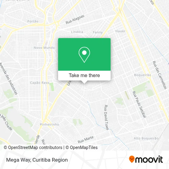
See Mega Way, Xaxim, on the map
Public Transit to Mega Way in Xaxim
Wondering how to get to Mega Way in Xaxim? Moovit helps you find the best way to get to Mega Way with step-by-step directions from the nearest public transit station.
Moovit provides free maps and live directions to help you navigate through your city. View schedules, routes, timetables, and find out how long does it take to get to Mega Way in real time.
Looking for the nearest stop or station to Mega Way? Check out this list of stops closest to your destination: Rua Gabriel Frecceiro de Miranda 883; R. Constantino José De Almeida; R. Omar Raymundo Picheth.
Bus: 525 HAUER / CAPÃO RASO, 689 MAD. SÃO PEDRO / RIO NEGRO, 526 ITAMARATI / VILA SÃO PEDRO, 030 INTERBAIRROS III, 625 GRAMADOS.
Want to see if there’s another route that gets you there at an earlier time? Moovit helps you find alternative routes or times. Get directions from and directions to Mega Way easily from the Moovit App or Website.
We make riding to Mega Way easy, which is why over 1.5 million users, including users in Xaxim, trust Moovit as the best app for public transit. You don’t need to download an individual bus app or train app, Moovit is your all-in-one transit app that helps you find the best bus time or train time available.
For information on prices of bus, costs and ride fares to Mega Way, please check the Moovit app.
Use the app to navigate to popular places including to the airport, hospital, stadium, grocery store, mall, coffee shop, school, college, and university.
Mega Way Address: Rua Gabriel Frecceiro de Miranda, 1005 Xaxim Curitiba-PR 81810-480 street in Xaxim
- 7 Seven Outlet & Outlet Kids,
- Embalar,
- Transoliva,
- Comercial Isa,
- Bigodon Barbearia,
- Auqemia,
- Reviver Igreja Em Células,
- Shekinah Artesanato,
- Sodirol Mercado de Rolamentos,
- Comunidade Do Jardim Esmeralda,
- Gb Refrigeracao,
- Comunidade N. Sra. Perpétuo Socorro,
- Recanto da Forta,
- Mica Lauz,
- Rua Euríco Fonseca dos Santos 914,
- Cmei Jardim Esmeralda,
- Msm Design - Comercio de Quadro de Formatura,
- R.M Systems Development,
- Colegio Senhora De Fatima - Terceirão,
- Colégio Senhora de Fátima
Places Near Mega Way (Xaxim)
- Parque Barigui, Mercês,
- Hospital Madalena Sofia, Bairro Alto,
- Hospital Angelina Caron, Campina Grande Do Sul,
- Rua Martim Afonso 558, Mercês,
- Hospital do Rocio, Campo,
- Shopping Estação, Rebouças,
- Hospital Da Cruz Vermelha, Batel,
- Hospital Nossa Senhora Das Graças, Mercês,
- Jockey Plaza Shopping Center, Tarumã,
- Hospital Universitário Evangélico de Curitiba, Bigorrilho,
- Hospital de Clínicas (HC - UFPR), Centro,
- Jardim Botânico de Curitiba PR, Centro,
- Park Shopping Barigüi, Mossunguê,
- Hhhhh, Fazendinha,
- Campo Largo, Campo,
- Pontifícia Universidade Católica do Paraná (PUCPR), Prado Velho,
- Hospital Erasto Gaertner, Jardim Das Américas,
- Shopping Palladium, Portão,
- Rua General Mário Tourinho, Campina Do Siqueira,
- Arena Da Baixada - Curitiba
How to get to popular places in Curitiba Region with public transit
Get around Xaxim by public transit!
Traveling around Xaxim has never been so easy. See step by step directions as you travel to any attraction, street or major public transit station. View bus and train schedules, arrival times, service alerts and detailed routes on a map, so you know exactly how to get to anywhere in Xaxim.
When traveling to any destination around Xaxim use Moovit's Live Directions with Get Off Notifications to know exactly where and how far to walk, how long to wait for your line, and how many stops are left. Moovit will alert you when it's time to get off — no need to constantly re-check whether yours is the next stop.
Wondering how to use public transit in Xaxim or how to pay for public transit in Xaxim? Moovit public transit app can help you navigate your way with public transit easily, and at minimum cost. It includes public transit fees, ticket prices, and costs. Looking for a map of Xaxim public transit lines? Moovit public transit app shows all public transit maps in Xaxim with all Bus and Cable Car routes and stops on an interactive map.
Curitiba Region has 2 transit type(s), including: Bus and Cable Car, operated by several transit agencies, including Sistema Integrado de Mobilidade (URBS), Sistema Integrado de Mobilidade (AMEP), URBS (Cartões bancários e Dinheiro), URBS (Cartões bancários / Cartão URBS), AMEP (Cartões bancários / Cartão MetroCard), AMEP (Cartões bancários / Cartão MetroCard / Dinheiro), Viação Colombo (Dinheiro), TRIAR (Cartão TRIAR / Dinheiro), Empresa Curitiba Cerro Azul (Dinheiro), Expresso Nossa Senhora da Penha (Dinheiro), Empresa Campo Alto Tijucas (Dinheiro), Auto Viação São José (Cartão VEM / Dinheiro), BRT S/A (Cartão VEM / Dinheiro), TransPiedade (Cartão Cidadão / Dinheiro) and Oceânica Sul (Cartão Transporte / Dinheiro)