Directions to Meghan Gange, Md (Newton) with public transportation
The following transit lines have routes that pass near Meghan Gange, Md
 Bus: 505, 553, 558, MBRS, GREEN LINE D SHUTTLE.
- Train: FRAMINGHAM/WORCESTER.
- Subway: GREEN LINE D.
How to get to Meghan Gange, Md by bus?
Click on the bus route to see step by step directions with maps, line arrival times and updated time schedules.
From Courtyard by Marriott Brookline, Brookline
85 minFrom VFW Parkway, Boston
99 minFrom The Track at New Balance, Boston
92 minFrom Thermo Fisher Scientific, Waltham
75 minFrom Brigham and Women's Faulkner Hospital, Boston
124 minFrom Hebrew Rehab Center, Boston
126 minFrom Arsenal Mall, Watertown Town
74 minFrom Brookline, MA, Brookline
87 minFrom Spaulding Rehab, Boston
157 min
How to get to Meghan Gange, Md by train?
Click on the train route to see step by step directions with maps, line arrival times and updated time schedules.
How to get to Meghan Gange, Md by subway?
Click on the subway route to see step by step directions with maps, line arrival times and updated time schedules.
Bus stops near Meghan Gange, Md in Newton
Subway station near Meghan Gange, Md in Newton
- Riverside, 5 min walk,VIEW
Train station near Meghan Gange, Md in Newton
- Wellesley Farms, 43 min walk,VIEW
Bus lines to Meghan Gange, Md in Newton
- MBRS, Riverside Station,VIEW
- GREEN LINE D SHUTTLE, Riverside (Shuttle),VIEW
- 558, Newton Corner - Riverside,VIEW
- GREEN LINE D SHUTTLE, Riverside - Copley (Express),VIEW
- GREEN LINE D SHUTTLE, Riverside - Copley (Shuttle),VIEW
- GREEN LINE D SHUTTLE, Riverside - Kenmore (Shuttle),VIEW
- GREEN LINE D SHUTTLE, Riverside - Reservoir,VIEW
- GREEN LINE D SHUTTLE, Riverside - Copley via Woodland (Express),VIEW
- GREEN LINE D SHUTTLE, Riverside - Fenway,VIEW
- GREEN LINE D SHUTTLE, Riverside - Newton Highlands,VIEW
- GREEN LINE D SHUTTLE, Woodland - Copley via Riverside (Express),VIEW
- GREEN LINE D SHUTTLE, Riverside - Kenmore via Saint Mary's Street,VIEW
- GREEN LINE D SHUTTLE, Riverside - Brookline Village,VIEW
- GREEN LINE D SHUTTLE, Riverside - Kenmore,VIEW
- 01, Natick Mall - Wegmans,VIEW
- MANSFIELD TO LOGAN AIRPORT, Terminal E - Arrivals,VIEW
What are the closest stations to Meghan Gange, Md?
The closest stations to Meghan Gange, Md are:
- Riverside Station is 231 yards away, 4 min walk.
- Riverside is 304 yards away, 5 min walk.
- Woodland Mbta Train Station is 553 yards away, 7 min walk.
- Riverside Mbta Station is 649 yards away, 9 min walk.
- Wellesley Farms is 3669 yards away, 43 min walk.
Which bus lines stop near Meghan Gange, Md?
These bus lines stop near Meghan Gange, Md: 505, 553, 558.
Which train line stops near Meghan Gange, Md?
FRAMINGHAM/WORCESTER (#525 | Worcester)
Which subway line stops near Meghan Gange, Md?
GREEN LINE D (Riverside)
What’s the nearest subway station to Meghan Gange, Md in Newton?
The nearest subway station to Meghan Gange, Md in Newton is Riverside. It’s a 5 min walk away.
What’s the nearest bus station to Meghan Gange, Md in Newton?
The nearest bus station to Meghan Gange, Md in Newton is Riverside Station. It’s a 4 min walk away.
What time is the first subway to Meghan Gange, Md in Newton?
The GREEN LINE D is the first subway that goes to Meghan Gange, Md in Newton. It stops nearby at 4:45 AM.
What time is the last subway to Meghan Gange, Md in Newton?
The GREEN LINE D is the last subway that goes to Meghan Gange, Md in Newton. It stops nearby at 2:48 AM.
What time is the first train to Meghan Gange, Md in Newton?
The FRAMINGHAM/WORCESTER is the first train that goes to Meghan Gange, Md in Newton. It stops nearby at 5:09 AM.
What time is the last train to Meghan Gange, Md in Newton?
The FRAMINGHAM/WORCESTER is the last train that goes to Meghan Gange, Md in Newton. It stops nearby at 12:26 AM.
What time is the first bus to Meghan Gange, Md in Newton?
The MANSFIELD TO LOGAN AIRPORT is the first bus that goes to Meghan Gange, Md in Newton. It stops nearby at 3:35 AM.
What time is the last bus to Meghan Gange, Md in Newton?
The MANSFIELD TO LOGAN AIRPORT is the last bus that goes to Meghan Gange, Md in Newton. It stops nearby at 1:50 AM.
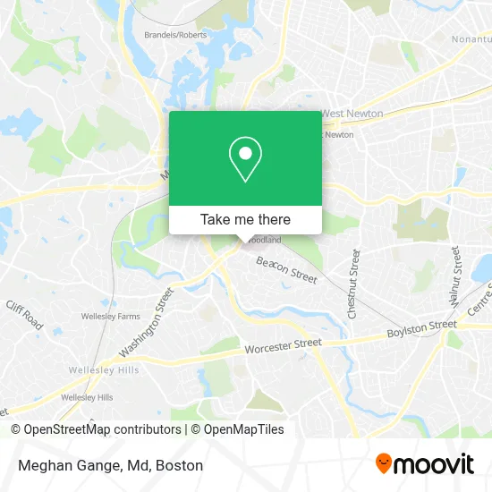
See Meghan Gange, Md, Newton, on the map
Public Transit to Meghan Gange, Md in Newton
Wondering how to get to Meghan Gange, Md in Newton? Moovit helps you find the best way to get to Meghan Gange, Md with step-by-step directions from the nearest public transit station.
Moovit provides free maps and live directions to help you navigate through your city. View schedules, routes, timetables, and find out how long does it take to get to Meghan Gange, Md in real time.
Looking for the nearest stop or station to Meghan Gange, Md? Check out this list of stops closest to your destination: Riverside Station; Riverside; Woodland Mbta Train Station; Riverside Mbta Station; Wellesley Farms.
Bus: 505, 553, 558, MBRS, GREEN LINE D SHUTTLE, GREEN LINE D SHUTTLE, GREEN LINE D SHUTTLE, GREEN LINE D SHUTTLE, GREEN LINE D SHUTTLE, 01.Train: FRAMINGHAM/WORCESTER.Subway: GREEN LINE D.
Want to see if there’s another route that gets you there at an earlier time? Moovit helps you find alternative routes or times. Get directions from and directions to Meghan Gange, Md easily from the Moovit App or Website.
We make riding to Meghan Gange, Md easy, which is why over 1.7 million users, including users in Newton, trust Moovit as the best app for public transit. You don’t need to download an individual bus app or train app, Moovit is your all-in-one transit app that helps you find the best bus time or train time available.
For information on prices of bus, subway and train, costs and ride fares to Meghan Gange, Md, please check the Moovit app.
Use the app to navigate to popular places including to the airport, hospital, stadium, grocery store, mall, coffee shop, school, college, and university.
Meghan Gange, Md Address: 2014 Washington St street in Newton
- Elizabeth Killmeyer, MD,
- Amy Comander, MD,
- Sharleen K Mulliken MD,
- Newton Wellesley Hospital Blood lab,
- Newton-Wellesley Hospital - Steven Pestka MD,
- Valentina Jalynytchev, MD,
- David Wolfe, MD, MPH,
- Spector, Carl C,
- Juliana Chen, MD,
- Newton-Wellesley Hospital, Emergency - Garage,
- Newton-Wellesley Hospital - West Entrance Valet,
- James Bartz, MD,
- Veterans Taxi,
- Allison Keel, MD,
- Christopher Melnic, MD,
- Partners Health,
- Dennis J. Beer, MD,
- Todd Francone, MD,
- Robert Friday, MD PHD,
- Pediatric Pediatrcian
Places Near Meghan Gange, Md (Newton)
- Wang Theater, Boston,
- Boston Medical Center, Boston,
- Mgm Music Hall, Boston,
- Museum Of Science, Boston,
- North End, Boston,
- Cheers, Boston,
- Wilbur Theatre, Boston,
- Prudential Center, Boston,
- Td Garden, Boston,
- Leader Bank Pavilion (Leader Bank Pavillion), Boston,
- Massachusetts General Hospital, Boston,
- House Of Blues, Boston,
- Castle Island, Boston,
- Seaport District, Boston,
- Faneuil Hall, Boston,
- Quincy Market, Boston,
- Isabella Stewart Gardner Museum, Boston,
- Boston Children's Hospital, Boston,
- Boston Common, Boston,
- Boston Convention & Exhibition Center, Boston
How to get to popular places in Boston with public transit
Get around Newton by public transit!
Traveling around Newton has never been so easy. See step by step directions as you travel to any attraction, street or major public transit station. View bus and train schedules, arrival times, service alerts and detailed routes on a map, so you know exactly how to get to anywhere in Newton.
When traveling to any destination around Newton use Moovit's Live Directions with Get Off Notifications to know exactly where and how far to walk, how long to wait for your line, and how many stops are left. Moovit will alert you when it's time to get off — no need to constantly re-check whether yours is the next stop.
Wondering how to use public transit in Newton or how to pay for public transit in Newton? Moovit public transit app can help you navigate your way with public transit easily, and at minimum cost. It includes public transit fees, ticket prices, and costs. Looking for a map of Newton public transit lines? Moovit public transit app shows all public transit maps in Newton with all Bus, Train, Subway and Ferry routes and stops on an interactive map.
Boston has 4 transit type(s), including: Bus, Train, Subway and Ferry, operated by several transit agencies, including MBTA, Southeastern Regional Transit Authority, MetroWest Regional Transit Authority, Rhode Island Public Transit Authority, WRTA, Lowell Regional Transit Authority, Merrimack Valley Transit, Montachusett Regional Transit Authority, Cape Cod Regional Transit Authority, Brockton Area Transit Authority, Martha's Vineyard Transit Authority, the WAVE - Nantucket Regional Transit Authority, GATRA, Cape Ann Transportation Authority and Massport