Directions to Mel/Wak Hospital (Melrose) with public transportation
The following transit lines have routes that pass near Mel/Wak Hospital
 Bus: 132, 137, 131.
- Train: HAVERHILL, ORANGE LINE.
- Subway: ORANGE LINE.
How to get to Mel/Wak Hospital by bus?
Click on the bus route to see step by step directions with maps, line arrival times and updated time schedules.
From Market Basket, Revere
58 minFrom Winter Hill, Somerville
68 minFrom TownePlace Suites Boston Logan Airport/Chelsea, Chelsea
64 minFrom Danehy Park, Cambridge
96 minFrom Inman Square, Cambridge
96 minFrom Harvard Museum Of Natural History, Cambridge
93 minFrom Bunker Hill Community College, Boston
72 minFrom Spaulding Hospital, Cambridge
93 minFrom Somerville, MA, Somerville
68 minFrom Cambridge Hospital, Cambridge
92 min
How to get to Mel/Wak Hospital by train?
Click on the train route to see step by step directions with maps, line arrival times and updated time schedules.
How to get to Mel/Wak Hospital by subway?
Click on the subway route to see step by step directions with maps, line arrival times and updated time schedules.
From Winter Hill, Somerville
85 minFrom TownePlace Suites Boston Logan Airport/Chelsea, Chelsea
84 minFrom Danehy Park, Cambridge
94 minFrom Inman Square, Cambridge
78 minFrom Harvard Museum Of Natural History, Cambridge
85 minFrom Bunker Hill Community College, Boston
58 minFrom Spaulding Hospital, Cambridge
92 minFrom Somerville, MA, Somerville
79 minFrom Cambridge Hospital, Cambridge
82 min
Bus stops near Mel/Wak Hospital in Melrose
Train station near Mel/Wak Hospital in Melrose
- Oak Grove, 46 min walk,VIEW
What are the closest stations to Mel/Wak Hospital?
The closest stations to Mel/Wak Hospital are:
- Upham St @ Bellevue Ave is 294 yards away, 4 min walk.
- Main St @ Emerson St is 296 yards away, 4 min walk.
- Oak Grove is 3886 yards away, 46 min walk.
Which bus lines stop near Mel/Wak Hospital?
These bus lines stop near Mel/Wak Hospital: 132, 137.
Which train line stops near Mel/Wak Hospital?
HAVERHILL (#229 | Haverhill)
Which subway line stops near Mel/Wak Hospital?
ORANGE LINE (Oak Grove)
What’s the nearest bus station to Mel/Wak Hospital in Melrose?
The nearest bus stations to Mel/Wak Hospital in Melrose are Upham St @ Bellevue Ave and Main St @ Emerson St. The closest one is a 4 min walk away.
What time is the first subway to Mel/Wak Hospital in Melrose?
The ORANGE LINE is the first subway that goes to Mel/Wak Hospital in Melrose. It stops nearby at 5:15 AM.
What time is the last subway to Mel/Wak Hospital in Melrose?
The ORANGE LINE is the last subway that goes to Mel/Wak Hospital in Melrose. It stops nearby at 1:59 AM.
What time is the first train to Mel/Wak Hospital in Melrose?
The HAVERHILL is the first train that goes to Mel/Wak Hospital in Melrose. It stops nearby at 5:35 AM.
What time is the last train to Mel/Wak Hospital in Melrose?
The HAVERHILL is the last train that goes to Mel/Wak Hospital in Melrose. It stops nearby at 11:53 PM.
What time is the first bus to Mel/Wak Hospital in Melrose?
The 137 is the first bus that goes to Mel/Wak Hospital in Melrose. It stops nearby at 5:01 AM.
What time is the last bus to Mel/Wak Hospital in Melrose?
The 137 is the last bus that goes to Mel/Wak Hospital in Melrose. It stops nearby at 10:54 PM.
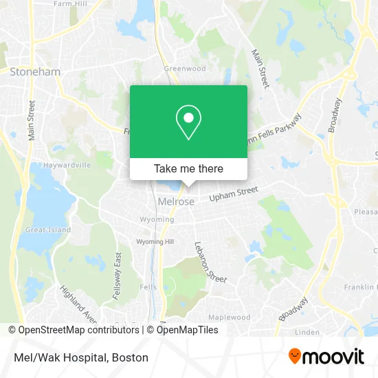
See Mel/Wak Hospital, Melrose, on the map
Public Transit to Mel/Wak Hospital in Melrose
Wondering how to get to Mel/Wak Hospital in Melrose? Moovit helps you find the best way to get to Mel/Wak Hospital with step-by-step directions from the nearest public transit station.
Moovit provides free maps and live directions to help you navigate through your city. View schedules, routes, timetables, and find out how long does it take to get to Mel/Wak Hospital in real time.
Looking for the nearest stop or station to Mel/Wak Hospital? Check out this list of stops closest to your destination: Upham St @ Bellevue Ave; Main St @ Emerson St; Oak Grove.
Bus: 132, 137, 131.Train: HAVERHILL, ORANGE LINE.Subway: ORANGE LINE.
Want to see if there’s another route that gets you there at an earlier time? Moovit helps you find alternative routes or times. Get directions from and directions to Mel/Wak Hospital easily from the Moovit App or Website.
We make riding to Mel/Wak Hospital easy, which is why over 1.7 million users, including users in Melrose, trust Moovit as the best app for public transit. You don’t need to download an individual bus app or train app, Moovit is your all-in-one transit app that helps you find the best bus time or train time available.
For information on prices of bus, subway and train, costs and ride fares to Mel/Wak Hospital, please check the Moovit app.
Use the app to navigate to popular places including to the airport, hospital, stadium, grocery store, mall, coffee shop, school, college, and university.
Location: Melrose, Boston
- Aarti Kakkar, MD,
- MelroseWakefield Hospital,
- Sewer Plumbers,
- Labcorp,
- Vo Hoai-NU-Thi MD,
- Access Orthopedics,
- Mark Berenson MD,
- Hallmark Health Diagnostic,
- Gloria Moussa-Gabour Dr,
- White's Plumbing & Heating,
- Smiley House,
- Red Cross,
- Latty Alexander B, MD,
- Eric S Schreiber, MD, PC,
- Cooperative for Human Services,
- Mollys Bookstore,
- Advanced Dermatology and Aesthetic Center,
- Follow Your Art Community Studios,
- Grace and Faith Christian Church,
- Southern Baptist Convention
Places Near Mel/Wak Hospital (Melrose)
- North End, Boston,
- Mgm Music Hall, Boston,
- Wilbur Theatre, Boston,
- Seaport District, Boston,
- Massachusetts General Hospital, Boston,
- Boston Convention & Exhibition Center, Boston,
- Museum Of Science, Boston,
- Boston Children's Hospital, Boston,
- Boston Common, Boston,
- Castle Island, Boston,
- Faneuil Hall, Boston,
- Leader Bank Pavilion (Leader Bank Pavillion), Boston,
- Td Garden, Boston,
- Cheers, Boston,
- Quincy Market, Boston,
- House Of Blues, Boston,
- Wang Theater, Boston,
- Isabella Stewart Gardner Museum, Boston,
- Boston Medical Center, Boston,
- Prudential Center, Boston
How to get to popular places in Boston with public transit
Get around Melrose by public transit!
Traveling around Melrose has never been so easy. See step by step directions as you travel to any attraction, street or major public transit station. View bus and train schedules, arrival times, service alerts and detailed routes on a map, so you know exactly how to get to anywhere in Melrose.
When traveling to any destination around Melrose use Moovit's Live Directions with Get Off Notifications to know exactly where and how far to walk, how long to wait for your line, and how many stops are left. Moovit will alert you when it's time to get off — no need to constantly re-check whether yours is the next stop.
Wondering how to use public transit in Melrose or how to pay for public transit in Melrose? Moovit public transit app can help you navigate your way with public transit easily, and at minimum cost. It includes public transit fees, ticket prices, and costs. Looking for a map of Melrose public transit lines? Moovit public transit app shows all public transit maps in Melrose with all Bus, Train, Subway and Ferry routes and stops on an interactive map.
Boston has 4 transit type(s), including: Bus, Train, Subway and Ferry, operated by several transit agencies, including MBTA, Southeastern Regional Transit Authority, MetroWest Regional Transit Authority, Rhode Island Public Transit Authority, WRTA, Lowell Regional Transit Authority, Merrimack Valley Transit, Montachusett Regional Transit Authority, Cape Cod Regional Transit Authority, Brockton Area Transit Authority, Martha's Vineyard Transit Authority, the WAVE - Nantucket Regional Transit Authority, GATRA, Cape Ann Transportation Authority and Massport