Directions to Memorial Field Medford MA with public transportation
The following transit lines have routes that pass near Memorial Field Medford MA
 Bus: 94, 95, 96, 134, 101.
- Train: LOWELL.
- Subway: GREEN LINE E, GREEN LINE B, GREEN LINE C, RED LINE.
How to get to Memorial Field Medford MA by bus?
Click on the bus route to see step by step directions with maps, line arrival times and updated time schedules.
From Pax East
51 minFrom New England Baptist Hospital
79 minFrom Mike's Pastry
37 minFrom new hampshire!
64 minFrom MCPHS University-Boston
80 minFrom Downtown Boston
37 minFrom Hampton Inn Boston Logan Airport Chelsea
52 minFrom Seaport Boston Hotel
55 minFrom Emerson Colonial Theatre (Colonial Theater)
44 minFrom Boston University Goldman School of Dental Medicine
68 min
How to get to Memorial Field Medford MA by train?
Click on the train route to see step by step directions with maps, line arrival times and updated time schedules.
How to get to Memorial Field Medford MA by subway?
Click on the subway route to see step by step directions with maps, line arrival times and updated time schedules.
From Pax East
69 minFrom New England Baptist Hospital
82 minFrom Mike's Pastry
50 minFrom new hampshire!
70 minFrom MCPHS University-Boston
70 minFrom Downtown Boston
54 minFrom Seaport Boston Hotel
74 minFrom Emerson Colonial Theatre (Colonial Theater)
53 minFrom Boston University Goldman School of Dental Medicine
77 min
Bus stops near Memorial Field Medford MA
Subway stations near Memorial Field Medford MA
Train station near Memorial Field Medford MA
- West Medford, 9 min walk,VIEW
Bus lines to Memorial Field Medford MA
What are the closest stations to Memorial Field Medford MA?
The closest stations to Memorial Field Medford MA are:
- High St Opp Governors Ave is 43 yards away, 1 min walk.
- George St @ Winthrop St is 168 yards away, 2 min walk.
- Ball Square Station is 569 yards away, 7 min walk.
- West Medford is 682 yards away, 9 min walk.
- Davis Sq. is 790 yards away, 10 min walk.
Which bus lines stop near Memorial Field Medford MA?
These bus lines stop near Memorial Field Medford MA: 94, 95, 96.
Which train line stops near Memorial Field Medford MA?
LOWELL (#323 | Lowell)
Which subway line stops near Memorial Field Medford MA?
GREEN LINE E (Lechmere)
What’s the nearest subway station to Memorial Field Medford MA?
The nearest subway station to Memorial Field Medford MA is Ball Square Station. It’s a 7 min walk away.
What’s the nearest train station to Memorial Field Medford MA?
The nearest train station to Memorial Field Medford MA is West Medford. It’s a 9 min walk away.
What’s the nearest bus station to Memorial Field Medford MA?
The nearest bus station to Memorial Field Medford MA is High St Opp Governors Ave. It’s a 1 min walk away.
What time is the first subway to Memorial Field Medford MA?
The GREEN LINE E is the first subway that goes to Memorial Field Medford MA. It stops nearby at 4:53 AM.
What time is the last subway to Memorial Field Medford MA?
The GREEN LINE E is the last subway that goes to Memorial Field Medford MA. It stops nearby at 2:41 AM.
What time is the first train to Memorial Field Medford MA?
The LOWELL is the first train that goes to Memorial Field Medford MA. It stops nearby at 5:31 AM.
What time is the last train to Memorial Field Medford MA?
The LOWELL is the last train that goes to Memorial Field Medford MA. It stops nearby at 12:20 AM.
What time is the first bus to Memorial Field Medford MA?
The 95 is the first bus that goes to Memorial Field Medford MA. It stops nearby at 4:54 AM.
What time is the last bus to Memorial Field Medford MA?
The 95 is the last bus that goes to Memorial Field Medford MA. It stops nearby at 1:34 AM.
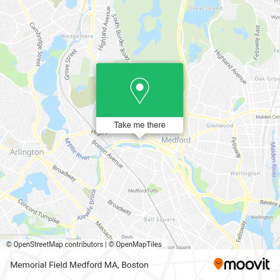
See Memorial Field Medford MA on the map
Public Transportation to Memorial Field Medford MA
Wondering how to get to Memorial Field Medford MA? Moovit helps you find the best way to get to Memorial Field Medford MA with step-by-step directions from the nearest public transit station.
Moovit provides free maps and live directions to help you navigate through your city. View schedules, routes, timetables, and find out how long does it take to get to Memorial Field Medford MA in real time.
Looking for the nearest stop or station to Memorial Field Medford MA? Check out this list of stops closest to your destination: High St Opp Governors Ave; George St @ Winthrop St; Ball Square Station; West Medford; Davis Sq..
Bus: 94, 95, 96, 134, 101.Train: LOWELL.Subway: GREEN LINE E, GREEN LINE B, GREEN LINE C, RED LINE.
Want to see if there’s another route that gets you there at an earlier time? Moovit helps you find alternative routes or times. Get directions from and directions to Memorial Field Medford MA easily from the Moovit App or Website.
We make riding to Memorial Field Medford MA easy, which is why over 1.7 million users, including users in Medford, trust Moovit as the best app for public transit. You don’t need to download an individual bus app or train app, Moovit is your all-in-one transit app that helps you find the best bus time or train time available.
For information on prices of bus, subway and train, costs and ride fares to Memorial Field Medford MA, please check the Moovit app.
Use the app to navigate to popular places including to the airport, hospital, stadium, grocery store, mall, coffee shop, school, college, and university.
Memorial Field Medford MA Address: 220 Winthrop St street in Medford
- Mystic Lakes,
- Jason A Pesaturo, Ea,
- Winyhrop Street Community Gardens,
- RT-16,
- Sila Transport,
- Burnout Brewing,
- John Wade House,
- Rich Jarvis Photog,
- Sabrina Salgado,
- Mary Queen of Peace Medford - St. Joseph & St. Francis of Assisi Churches,
- John B. Angier House,
- Saint Joseph School (St Joseph's School of Medford Basketball),
- SKL Fabricators,
- Knight Shift MFG,
- Curly Customs,
- Wilson House,
- A D T Security Services,
- Medford City Library (City of Medford),
- Charlotte And William Bloomberg Medford Public Library,
- Scky Photography
Places Near Memorial Field Medford MA
- House Of Blues, Boston,
- Boston Children's Hospital, Boston,
- Leader Bank Pavilion (Leader Bank Pavillion), Boston,
- Prudential Center, Boston,
- North End, Boston,
- Boston Common, Boston,
- Quincy Market, Boston,
- Faneuil Hall, Boston,
- Isabella Stewart Gardner Museum, Boston,
- Wang Theater, Boston,
- Mgm Music Hall, Boston,
- Wilbur Theatre, Boston,
- Cheers, Boston,
- Castle Island, Boston,
- Museum Of Science, Boston,
- Boston Medical Center, Boston,
- Seaport District, Boston,
- Boston Convention & Exhibition Center, Boston,
- Massachusetts General Hospital, Boston,
- Td Garden, Boston
How to get to popular places in Boston with public transit
Get around Medford by public transit!
Traveling around Medford has never been so easy. See step by step directions as you travel to any attraction, street or major public transit station. View bus and train schedules, arrival times, service alerts and detailed routes on a map, so you know exactly how to get to anywhere in Medford.
When traveling to any destination around Medford use Moovit's Live Directions with Get Off Notifications to know exactly where and how far to walk, how long to wait for your line, and how many stops are left. Moovit will alert you when it's time to get off — no need to constantly re-check whether yours is the next stop.
Wondering how to use public transit in Medford or how to pay for public transit in Medford? Moovit public transit app can help you navigate your way with public transit easily, and at minimum cost. It includes public transit fees, ticket prices, and costs. Looking for a map of Medford public transit lines? Moovit public transit app shows all public transit maps in Medford with all Bus, Train, Subway and Ferry routes and stops on an interactive map.
Boston has 4 transit type(s), including: Bus, Train, Subway and Ferry, operated by several transit agencies, including MBTA, Southeastern Regional Transit Authority, MetroWest Regional Transit Authority, Rhode Island Public Transit Authority, WRTA, Lowell Regional Transit Authority, Merrimack Valley Transit, Montachusett Regional Transit Authority, Cape Cod Regional Transit Authority, Brockton Area Transit Authority, Martha's Vineyard Transit Authority, the WAVE - Nantucket Regional Transit Authority, GATRA, Cape Ann Transportation Authority and Massport