Directions to Menya Jiro (Dedham) with public transportation
The following transit lines have routes that pass near Menya Jiro
How to get to Menya Jiro by bus?
Click on the bus route to see step by step directions with maps, line arrival times and updated time schedules.
From Arnold Arboretum, Boston
48 minFrom Washington St, Boston
64 minFrom Beth Israel Deaconess Hospital-Milton, Milton
75 minFrom The Monument, Boston
50 minFrom The Mall At Chestnut Hill, Newton
95 minFrom Jamaica Plain, Boston
51 minFrom Forest Hills Station MBTA, Boston
34 minFrom Lower Mills, Boston
75 minFrom Milton, MA, Milton
86 min
How to get to Menya Jiro by train?
Click on the train route to see step by step directions with maps, line arrival times and updated time schedules.
Bus stops near Menya Jiro in Dedham
Train stations near Menya Jiro in Dedham
Bus lines to Menya Jiro in Dedham
What are the closest stations to Menya Jiro?
The closest stations to Menya Jiro are:
- Washington St @ Harmony Hill Way is 752 yards away, 10 min walk.
- Dedham Corporate Center is 809 yards away, 10 min walk.
- Route 128 - Westwood is 4063 yards away, 48 min walk.
- Endicott is 4318 yards away, 51 min walk.
Which bus line stops near Menya Jiro?
34E (Walpole Center Via Washington St)
Which train line stops near Menya Jiro?
ACELA (Washington)
What’s the nearest bus station to Menya Jiro in Dedham?
The nearest bus stations to Menya Jiro in Dedham are Washington St @ Harmony Hill Way and Dedham Corporate Center. The closest one is a 10 min walk away.
What time is the first train to Menya Jiro in Dedham?
The PROVIDENCE/STOUGHTON is the first train that goes to Menya Jiro in Dedham. It stops nearby at 4:39 AM.
What time is the last train to Menya Jiro in Dedham?
The NORTHEAST REGIONAL is the last train that goes to Menya Jiro in Dedham. It stops nearby at 9:42 AM.
What time is the first bus to Menya Jiro in Dedham?
The 34E is the first bus that goes to Menya Jiro in Dedham. It stops nearby at 5:02 AM.
What time is the last bus to Menya Jiro in Dedham?
The 34E is the last bus that goes to Menya Jiro in Dedham. It stops nearby at 1:18 AM.
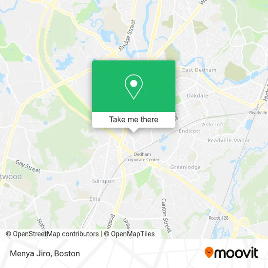
See Menya Jiro, Dedham, on the map
Public Transit to Menya Jiro in Dedham
Wondering how to get to Menya Jiro in Dedham? Moovit helps you find the best way to get to Menya Jiro with step-by-step directions from the nearest public transit station.
Moovit provides free maps and live directions to help you navigate through your city. View schedules, routes, timetables, and find out how long does it take to get to Menya Jiro in real time.
Looking for the nearest stop or station to Menya Jiro? Check out this list of stops closest to your destination: Washington St @ Harmony Hill Way; Dedham Corporate Center; Route 128 - Westwood; Endicott.
Bus: 34E, FRANKLIN LINE SHUTTLE, FRANKLIN LINE SHUTTLE.Train: ACELA, PROVIDENCE/STOUGHTON, NORTHEAST REGIONAL, FRANKLIN/FOXBORO, FOXBORO EVENT SERVICE.
Want to see if there’s another route that gets you there at an earlier time? Moovit helps you find alternative routes or times. Get directions from and directions to Menya Jiro easily from the Moovit App or Website.
We make riding to Menya Jiro easy, which is why over 1.7 million users, including users in Dedham, trust Moovit as the best app for public transit. You don’t need to download an individual bus app or train app, Moovit is your all-in-one transit app that helps you find the best bus time or train time available.
For information on prices of bus and train, costs and ride fares to Menya Jiro, please check the Moovit app.
Use the app to navigate to popular places including to the airport, hospital, stadium, grocery store, mall, coffee shop, school, college, and university.
Menya Jiro Address: Legacy Pl street in Dedham
- Same Day Auto Glass Service,
- Liberty & Main,
- Mix and Company,
- MANGO,
- Restore Hyper Wellness- Dedham, Massachusetts,
- Charlotte Tilbury,
- Dedham, MA,
- Apple Legacy Place,
- VICTORIA'S SECRET,
- Showcase Cinema de Lux Legacy Place,
- PANDORA,
- Legacy Place Movie Theater,
- Yardhouse Restaurants,
- Dedham Carpet Cleaning,
- Skin Laundry - Legacy Place,
- Uniclean Carpet & Upholstery Cleaning,
- Il Massimo,
- L.L. Bean (LL Bean),
- Legacy Place,
- WFXT-TV Fox 25 Boston
Places Near Menya Jiro (Dedham)
- Seaport District, Boston,
- Wang Theater, Boston,
- North End, Boston,
- Boston Medical Center, Boston,
- Quincy Market, Boston,
- Prudential Center, Boston,
- Leader Bank Pavilion (Leader Bank Pavillion), Boston,
- Museum Of Science, Boston,
- Cheers, Boston,
- Isabella Stewart Gardner Museum, Boston,
- Boston Convention & Exhibition Center, Boston,
- House Of Blues, Boston,
- Boston Common, Boston,
- Faneuil Hall, Boston,
- Boston Children's Hospital, Boston,
- Mgm Music Hall, Boston,
- Td Garden, Boston,
- Castle Island, Boston,
- Massachusetts General Hospital, Boston,
- Wilbur Theatre, Boston
How to get to popular places in Boston with public transit
Get around Dedham by public transit!
Traveling around Dedham has never been so easy. See step by step directions as you travel to any attraction, street or major public transit station. View bus and train schedules, arrival times, service alerts and detailed routes on a map, so you know exactly how to get to anywhere in Dedham.
When traveling to any destination around Dedham use Moovit's Live Directions with Get Off Notifications to know exactly where and how far to walk, how long to wait for your line, and how many stops are left. Moovit will alert you when it's time to get off — no need to constantly re-check whether yours is the next stop.
Wondering how to use public transit in Dedham or how to pay for public transit in Dedham? Moovit public transit app can help you navigate your way with public transit easily, and at minimum cost. It includes public transit fees, ticket prices, and costs. Looking for a map of Dedham public transit lines? Moovit public transit app shows all public transit maps in Dedham with all Bus, Train, Subway and Ferry routes and stops on an interactive map.
Boston has 4 transit type(s), including: Bus, Train, Subway and Ferry, operated by several transit agencies, including MBTA, Southeastern Regional Transit Authority, MetroWest Regional Transit Authority, Rhode Island Public Transit Authority, WRTA, Lowell Regional Transit Authority, Merrimack Valley Transit, Montachusett Regional Transit Authority, Cape Cod Regional Transit Authority, Brockton Area Transit Authority, Martha's Vineyard Transit Authority, the WAVE - Nantucket Regional Transit Authority, GATRA, Cape Ann Transportation Authority and Massport