Directions to Meowlounge (Boston) with public transportation
The following transit lines have routes that pass near Meowlounge
 Bus: 93, 89/93.
- Train: FRAMINGHAM/WORCESTER, LOWELL, NEEDHAM, FITCHBURG, HAVERHILL.
- Subway: GREEN LINE D, ORANGE LINE, HAVERHILL LINE SHUTTLE, HAVERHILL LINE SHUTTLE, LOWELL LINE SHUTTLE.
- Ferry: CHARLESTOWN FERRY, LOVEJOY - FAN PIER - PIER 10.
How to get to Meowlounge by bus?
Click on the bus route to see step by step directions with maps, line arrival times and updated time schedules.
From Hilton Garden Inn Boston Brookline, Brookline
61 minFrom Stone Zoo, Stoneham
86 minFrom Watertown, MA, Watertown Town
70 minFrom Jamaica Plain, Boston
80 minFrom Skating Club Of Boston, Boston
63 minFrom Regent Theatre, Arlington
64 minFrom Faulkner Hospital, Boston
114 minFrom Arnold Arboretum, Boston
109 minFrom Brigham and Women's Faulkner Hospital, Boston
113 minFrom 7F Everett Street, Revere
57 min
How to get to Meowlounge by train?
Click on the train route to see step by step directions with maps, line arrival times and updated time schedules.
How to get to Meowlounge by subway?
Click on the subway route to see step by step directions with maps, line arrival times and updated time schedules.
Bus stops near Meowlounge in Boston
Subway station near Meowlounge in Boston
- Causeway St (East), 8 min walk,VIEW
Ferry stations near Meowlounge in Boston
Train station near Meowlounge in Boston
- North Station, 24 min walk,VIEW
What are the closest stations to Meowlounge?
The closest stations to Meowlounge are:
- First Ave @ Terry Ring is 68 yards away, 1 min walk.
- Bunker Hill St @ Vine St is 467 yards away, 6 min walk.
- Causeway St (East) is 606 yards away, 8 min walk.
- Charlestown Navy Yard is 1142 yards away, 14 min walk.
- North Station (Lovejoy Wharf) is 1736 yards away, 21 min walk.
- North Station is 2012 yards away, 24 min walk.
Which bus line stops near Meowlounge?
93 (Sullivan)
Which train lines stop near Meowlounge?
These train lines stop near Meowlounge: FRAMINGHAM/WORCESTER, LOWELL, NEEDHAM.
Which subway lines stop near Meowlounge?
These subway lines stop near Meowlounge: GREEN LINE D, ORANGE LINE.
What’s the nearest subway station to Meowlounge in Boston?
The nearest subway station to Meowlounge in Boston is Causeway St (East). It’s a 8 min walk away.
What’s the nearest train station to Meowlounge in Boston?
The nearest train station to Meowlounge in Boston is North Station. It’s a 24 min walk away.
What’s the nearest bus station to Meowlounge in Boston?
The nearest bus station to Meowlounge in Boston is First Ave @ Terry Ring. It’s a 1 min walk away.
What’s the nearest ferry station to Meowlounge in Boston?
The nearest ferry station to Meowlounge in Boston is Charlestown Navy Yard. It’s a 14 min walk away.
What time is the first subway to Meowlounge in Boston?
The GREEN LINE E is the first subway that goes to Meowlounge in Boston. It stops nearby at 5:01 AM.
What time is the last subway to Meowlounge in Boston?
The GREEN LINE E is the last subway that goes to Meowlounge in Boston. It stops nearby at 2:24 AM.
What time is the first train to Meowlounge in Boston?
The LOWELL is the first train that goes to Meowlounge in Boston. It stops nearby at 5:20 AM.
What time is the last train to Meowlounge in Boston?
The LOWELL is the last train that goes to Meowlounge in Boston. It stops nearby at 12:34 AM.
What time is the first bus to Meowlounge in Boston?
The 89/93 is the first bus that goes to Meowlounge in Boston. It stops nearby at 4:50 AM.
What time is the last bus to Meowlounge in Boston?
The 93 is the last bus that goes to Meowlounge in Boston. It stops nearby at 1:44 AM.
What time is the first ferry to Meowlounge in Boston?
The LOVEJOY - FAN PIER - PIER 10 is the first ferry that goes to Meowlounge in Boston. It stops nearby at 6:20 AM.
What time is the last ferry to Meowlounge in Boston?
The CHARLESTOWN FERRY is the last ferry that goes to Meowlounge in Boston. It stops nearby at 8:15 PM.
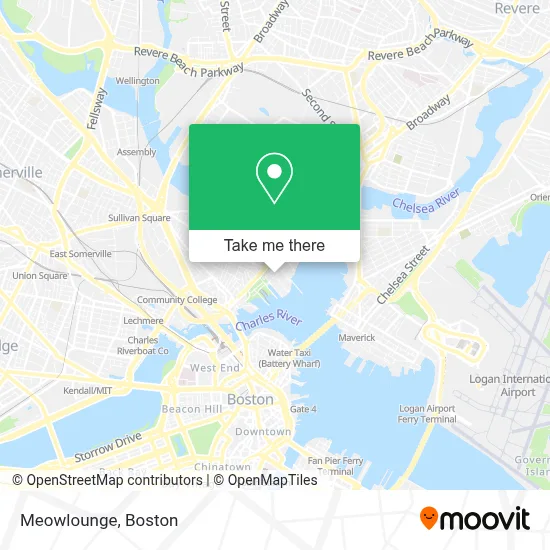
See Meowlounge, Boston, on the map
Public Transit to Meowlounge in Boston
Wondering how to get to Meowlounge in Boston? Moovit helps you find the best way to get to Meowlounge with step-by-step directions from the nearest public transit station.
Moovit provides free maps and live directions to help you navigate through your city. View schedules, routes, timetables, and find out how long does it take to get to Meowlounge in real time.
Looking for the nearest stop or station to Meowlounge? Check out this list of stops closest to your destination: First Ave @ Terry Ring; Bunker Hill St @ Vine St; Causeway St (East); Charlestown Navy Yard; North Station (Lovejoy Wharf); North Station.
Bus: 93, 89/93.Train: FRAMINGHAM/WORCESTER, LOWELL, NEEDHAM, FITCHBURG, HAVERHILL, NEWBURYPORT/ROCKPORT, DOWNEASTER.Subway: GREEN LINE D, ORANGE LINE, HAVERHILL LINE SHUTTLE, HAVERHILL LINE SHUTTLE, LOWELL LINE SHUTTLE, LOWELL LINE SHUTTLE, NEWBURYPORT/ROCKPORT LINE SHUTTLE.Ferry: CHARLESTOWN FERRY, LOVEJOY - FAN PIER - PIER 10.
Want to see if there’s another route that gets you there at an earlier time? Moovit helps you find alternative routes or times. Get directions from and directions to Meowlounge easily from the Moovit App or Website.
We make riding to Meowlounge easy, which is why over 1.7 million users, including users in Boston, trust Moovit as the best app for public transit. You don’t need to download an individual bus app or train app, Moovit is your all-in-one transit app that helps you find the best bus time or train time available.
For information on prices of bus, subway and train, costs and ride fares to Meowlounge, please check the Moovit app.
Use the app to navigate to popular places including to the airport, hospital, stadium, grocery store, mall, coffee shop, school, college, and university.
Meowlounge Address: 39 1st Ave street in Boston
- Cycleboat Boston,
- Pier 6 Boston Waterfront (Pier6 Boston Waterfront),
- 1st Ave & 7th St,
- Mgh Institute Of Heatlh Professions,
- Cny Building 199,
- Dovetail Restaurant & Shop,
- Charlestown Navy Yard,
- Dovetail,
- Boston Navy Yard,
- Charlestown Navy Yard Baby Pool,
- Partners HealthCare / MGH - Charlestown Navy Yard (CNY),
- TCQ,
- Mbta Bus 352,
- USS Constitution,
- 149 13th Street,
- Allo,
- John F. Kennedy Center,
- MGH at the Navy Yard,
- Solt Lab,
- MGH Cny Parking Garage
Places Near Meowlounge (Boston)
- North End, Boston,
- Quincy Market, Boston,
- Wilbur Theatre, Boston,
- Massachusetts General Hospital, Boston,
- Boston Convention & Exhibition Center, Boston,
- Wang Theater, Boston,
- Isabella Stewart Gardner Museum, Boston,
- Td Garden, Boston,
- Boston Medical Center, Boston,
- House Of Blues, Boston,
- Leader Bank Pavilion (Leader Bank Pavillion), Boston,
- Seaport District, Boston,
- Cheers, Boston,
- Boston Common, Boston,
- Faneuil Hall, Boston,
- Museum Of Science, Boston,
- Castle Island, Boston,
- Prudential Center, Boston,
- Boston Children's Hospital, Boston,
- Mgm Music Hall, Boston
How to get to popular places in Boston with public transit
Get around Boston by public transit!
Traveling around Boston has never been so easy. See step by step directions as you travel to any attraction, street or major public transit station. View bus and train schedules, arrival times, service alerts and detailed routes on a map, so you know exactly how to get to anywhere in Boston.
When traveling to any destination around Boston use Moovit's Live Directions with Get Off Notifications to know exactly where and how far to walk, how long to wait for your line, and how many stops are left. Moovit will alert you when it's time to get off — no need to constantly re-check whether yours is the next stop.
Wondering how to use public transit in Boston or how to pay for public transit in Boston? Moovit public transit app can help you navigate your way with public transit easily, and at minimum cost. It includes public transit fees, ticket prices, and costs. Looking for a map of Boston public transit lines? Moovit public transit app shows all public transit maps in Boston with all Bus, Train, Subway and Ferry routes and stops on an interactive map.
Boston has 4 transit type(s), including: Bus, Train, Subway and Ferry, operated by several transit agencies, including MBTA, Southeastern Regional Transit Authority, MetroWest Regional Transit Authority, Rhode Island Public Transit Authority, WRTA, Lowell Regional Transit Authority, Merrimack Valley Transit, Montachusett Regional Transit Authority, Cape Cod Regional Transit Authority, Brockton Area Transit Authority, Martha's Vineyard Transit Authority, the WAVE - Nantucket Regional Transit Authority, GATRA, Cape Ann Transportation Authority and Massport